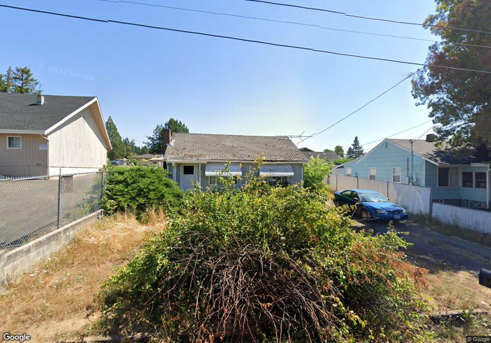
340 Robinson St Sutherlin, OR 97479
Estimated Value: $188,000 - $230,000
2
Beds
1
Bath
954
Sq Ft
$217/Sq Ft
Est. Value
About This Home
This home is located at 340 Robinson St, Sutherlin, OR 97479 and is currently estimated at $206,616, approximately $216 per square foot. 340 Robinson St is a home located in Douglas County with nearby schools including East Sutherlin Primary School, West Sutherlin Intermediate School, and Sutherlin Middle School.
Ownership History
Date
Name
Owned For
Owner Type
Purchase Details
Closed on
Jan 30, 2018
Sold by
Mudrow Virginia and Mudrow Family Trust Dated December 15 20
Bought by
Family Trust and Mckinney
Current Estimated Value
Home Financials for this Owner
Home Financials are based on the most recent Mortgage that was taken out on this home.
Original Mortgage
$80,756
Outstanding Balance
$988
Interest Rate
3.94%
Mortgage Type
New Conventional
Estimated Equity
$205,628
Purchase Details
Closed on
Dec 15, 2005
Sold by
Mudrow Gordon C and Mudrow Virginia
Bought by
Mudrow Gordon C and Mudrow Virginia
Create a Home Valuation Report for This Property
The Home Valuation Report is an in-depth analysis detailing your home's value as well as a comparison with similar homes in the area
Home Values in the Area
Average Home Value in this Area
Purchase History
| Date | Buyer | Sale Price | Title Company |
|---|---|---|---|
| Family Trust | $90,756 | First American Title | |
| Mudrow Gordon C | -- | -- |
Source: Public Records
Mortgage History
| Date | Status | Borrower | Loan Amount |
|---|---|---|---|
| Open | Family Trust | $80,756 |
Source: Public Records
Tax History Compared to Growth
Tax History
| Year | Tax Paid | Tax Assessment Tax Assessment Total Assessment is a certain percentage of the fair market value that is determined by local assessors to be the total taxable value of land and additions on the property. | Land | Improvement |
|---|---|---|---|---|
| 2025 | $1,203 | $97,134 | -- | -- |
| 2024 | $1,176 | $94,305 | -- | -- |
| 2023 | $1,142 | $91,559 | $0 | $0 |
| 2022 | $1,109 | $88,893 | $0 | $0 |
| 2021 | $1,078 | $86,304 | $0 | $0 |
| 2020 | $1,046 | $83,791 | $0 | $0 |
| 2019 | $1,016 | $81,351 | $0 | $0 |
| 2018 | $986 | $78,982 | $0 | $0 |
| 2017 | $1,008 | $76,682 | $0 | $0 |
| 2016 | $979 | $74,449 | $0 | $0 |
| 2015 | $953 | $72,281 | $0 | $0 |
| 2014 | $925 | $70,176 | $0 | $0 |
| 2013 | -- | $68,133 | $0 | $0 |
Source: Public Records
Map
Nearby Homes
- 165 Robinson St
- 401 N Comstock Ave
- 142 S Comstock Ave
- 226 Miller St
- 220 Miller St
- 324 Dakota St
- 1660 Scardi Blvd
- 181 SW Hutchins St
- 1688 W Central Ave
- 1716 Scardi Blvd Unit 174
- 575 Cedar St
- 0 N Fourth St Unit 24557651
- 1907 W Duke Rd
- 702 Divot Loop
- 135 Elkton St
- 126 Coles Valley St
- 154 Coles Valley St
- 881 Medina Ave
- 409 S State St
- 149 Coles Valley St
- 328 Robinson St
- 360 Robinson St
- 339 Kruse St
- 351 Kruse St
- 307 Robinson St
- 352 N Comstock Ave
- 338 N Comstock Ave
- 327 Kruse St
- 248 Robinson St
- 375 Kruse St
- 305 Kruse St
- 271 Kruse St
- 261 Robinson St
- 261 N Robinson
- 314 N Comstock Ave
- 249 Robinson St
- 1156 W Sixth Ave
- 388 Robinson St
- 226 Robinson St
- 237 Kruse St Unit 1