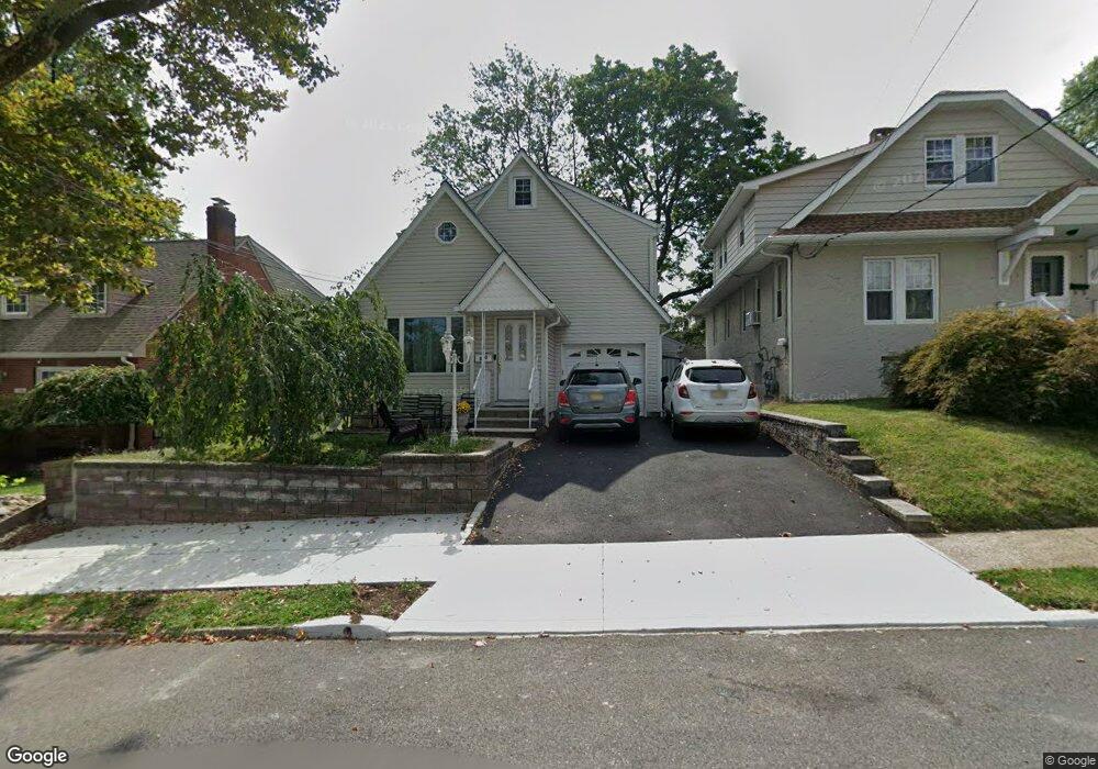
340 Roosevelt Ave Hasbrouck Heights, NJ 07604
Estimated Value: $552,530 - $621,000
--
Bed
--
Bath
1,372
Sq Ft
$430/Sq Ft
Est. Value
About This Home
This home is located at 340 Roosevelt Ave, Hasbrouck Heights, NJ 07604 and is currently estimated at $589,633, approximately $429 per square foot. 340 Roosevelt Ave is a home located in Bergen County with nearby schools including Hasbrouck Heights High School and Corpus Christi School.
Ownership History
Date
Name
Owned For
Owner Type
Purchase Details
Closed on
Oct 5, 2000
Bought by
Auriemma John
Current Estimated Value
Home Financials for this Owner
Home Financials are based on the most recent Mortgage that was taken out on this home.
Original Mortgage
$65,000
Outstanding Balance
$23,773
Interest Rate
7.96%
Estimated Equity
$565,860
Purchase Details
Closed on
Feb 2, 1998
Sold by
Murgia Robert and Murgia Louise
Bought by
Auriemma John and Auriemma Kathleen
Home Financials for this Owner
Home Financials are based on the most recent Mortgage that was taken out on this home.
Original Mortgage
$156,750
Interest Rate
6.95%
Create a Home Valuation Report for This Property
The Home Valuation Report is an in-depth analysis detailing your home's value as well as a comparison with similar homes in the area
Home Values in the Area
Average Home Value in this Area
Purchase History
| Date | Buyer | Sale Price | Title Company |
|---|---|---|---|
| Auriemma John | -- | -- | |
| Auriemma John | -- | -- | |
| Auriemma John | $165,000 | -- |
Source: Public Records
Mortgage History
| Date | Status | Borrower | Loan Amount |
|---|---|---|---|
| Open | Auriemma John | $65,000 | |
| Closed | Auriemma John | $65,000 | |
| Previous Owner | Auriemma John | $156,750 |
Source: Public Records
Tax History Compared to Growth
Tax History
| Year | Tax Paid | Tax Assessment Tax Assessment Total Assessment is a certain percentage of the fair market value that is determined by local assessors to be the total taxable value of land and additions on the property. | Land | Improvement |
|---|---|---|---|---|
| 2025 | $9,602 | $375,800 | $215,000 | $160,800 |
| 2024 | $9,135 | $375,800 | $215,000 | $160,800 |
| 2023 | $8,989 | $354,500 | $200,000 | $154,500 |
| 2022 | $8,989 | $333,900 | $187,500 | $146,400 |
| 2021 | $8,721 | $308,800 | $175,000 | $133,800 |
| 2020 | $8,967 | $311,800 | $172,500 | $139,300 |
| 2019 | $8,720 | $306,500 | $170,000 | $136,500 |
| 2018 | $8,587 | $301,100 | $167,500 | $133,600 |
| 2017 | $8,445 | $295,700 | $165,000 | $130,700 |
| 2016 | $8,316 | $274,000 | $150,000 | $124,000 |
| 2015 | $8,182 | $274,000 | $150,000 | $124,000 |
| 2014 | $7,957 | $274,000 | $150,000 | $124,000 |
Source: Public Records
Map
Nearby Homes
- 311 Harrison Ave
- 476 Innes Rd
- 432 Innes Rd
- 420 Innes Rd
- 243 Cleveland Ave
- 289 Valley Blvd Unit 1D
- 289 Valley Blvd Unit 1A
- 245 Cliff St
- 560 Ryerson Ave
- 110 Harrison Ave
- 206 Columbia St
- 176 Hackensack St Unit 6
- 288 Sussex Rd
- 165 Madison St
- 167 Columbia St
- 148 Hackensack St
- 364 Wood Ridge Ave
- 573 Anderson Ave
- 38 Springfield Ave
- 417 Franklin Ave
- 336 Roosevelt Ave
- 346 Roosevelt Ave
- 332 Roosevelt Ave
- 337 Lincoln Ave
- 333 Lincoln Ave
- 341 Lincoln Ave
- 328 Roosevelt Ave
- 348 Roosevelt Ave
- 325 Lincoln Ave
- 341 Roosevelt Ave
- 345 Lincoln Ave
- 347 Roosevelt Ave
- 326 Roosevelt Ave
- 335 Roosevelt Ave
- 349 Roosevelt Ave
- 331 Roosevelt Ave
- 363 Lincoln Ave
- 353 Lincoln Ave
- 322 Roosevelt Ave
- 321 Lincoln Ave