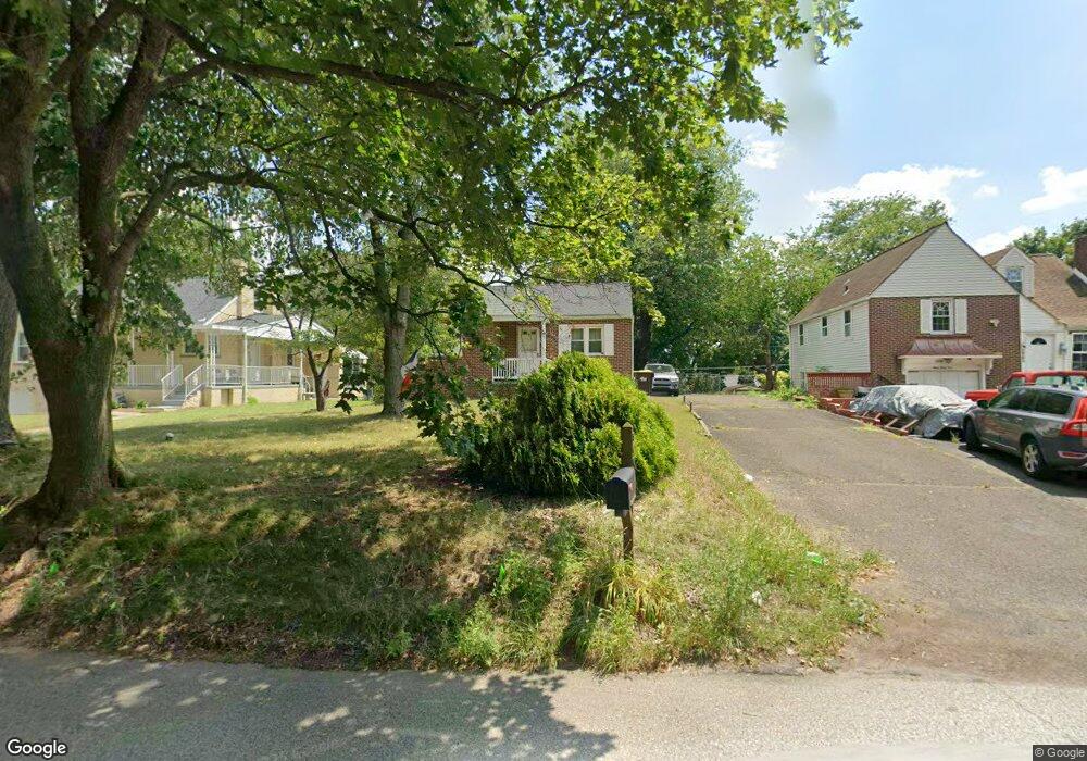
340 S Trooper Rd Norristown, PA 19403
West Norriton Township NeighborhoodEstimated Value: $330,000 - $365,607
2
Beds
1
Bath
952
Sq Ft
$359/Sq Ft
Est. Value
About This Home
This home is located at 340 S Trooper Rd, Norristown, PA 19403 and is currently estimated at $341,902, approximately $359 per square foot. 340 S Trooper Rd is a home located in Montgomery County with nearby schools including Charles Blockson Middle School, Paul V Fly Elementary School, and East Norriton Middle School.
Ownership History
Date
Name
Owned For
Owner Type
Purchase Details
Closed on
Mar 22, 2023
Sold by
Watkins Karl A
Bought by
Watkins Brady
Current Estimated Value
Home Financials for this Owner
Home Financials are based on the most recent Mortgage that was taken out on this home.
Original Mortgage
$150,000
Interest Rate
6.32%
Mortgage Type
Seller Take Back
Purchase Details
Closed on
Feb 3, 2009
Sold by
Watkins Karl A and Watkins Lisa D
Bought by
Watkins Karl A and Watkins Lisa D
Create a Home Valuation Report for This Property
The Home Valuation Report is an in-depth analysis detailing your home's value as well as a comparison with similar homes in the area
Home Values in the Area
Average Home Value in this Area
Purchase History
| Date | Buyer | Sale Price | Title Company |
|---|---|---|---|
| Watkins Brady | -- | None Listed On Document | |
| Watkins Brady | -- | None Listed On Document | |
| Watkins Karl A | -- | None Available |
Source: Public Records
Mortgage History
| Date | Status | Borrower | Loan Amount |
|---|---|---|---|
| Previous Owner | Watkins Brady | $150,000 |
Source: Public Records
Tax History Compared to Growth
Tax History
| Year | Tax Paid | Tax Assessment Tax Assessment Total Assessment is a certain percentage of the fair market value that is determined by local assessors to be the total taxable value of land and additions on the property. | Land | Improvement |
|---|---|---|---|---|
| 2025 | $4,898 | $100,240 | $44,800 | $55,440 |
| 2024 | $4,898 | $100,240 | $44,800 | $55,440 |
| 2023 | $4,843 | $100,240 | $44,800 | $55,440 |
| 2022 | $4,811 | $100,240 | $44,800 | $55,440 |
| 2021 | $4,782 | $100,240 | $44,800 | $55,440 |
| 2020 | $4,639 | $100,240 | $44,800 | $55,440 |
| 2019 | $4,535 | $100,240 | $44,800 | $55,440 |
| 2018 | $3,454 | $100,240 | $44,800 | $55,440 |
| 2017 | $4,282 | $100,240 | $44,800 | $55,440 |
| 2016 | $4,243 | $100,240 | $44,800 | $55,440 |
| 2015 | $3,931 | $100,240 | $44,800 | $55,440 |
| 2014 | $3,931 | $100,240 | $44,800 | $55,440 |
Source: Public Records
Map
Nearby Homes
- 2044 Mill Rd
- 123 Glenwood Ave
- 0 Roosevelt Blvd
- 365 Norris Hall Ln
- 37 Burnside Ave
- 2017 Yorktown S
- 1503 Reagan Ct
- 526 Bassett Ln
- 2012 Yorktown S
- 2504 Grant Ct
- 109 N Park Ave
- 1914 Yorktown S
- 636 Hillside Ave
- 1924 Juniata Rd
- 1905 Yorktown N
- 308 Hillside Ave
- 617 Meadowlark Rd
- 143 Riversedge Dr Unit CONDO 143
- 307 Brandon Rd
- 402 Brandon Rd
- 336 S Trooper Rd
- 344 S Trooper Rd Unit 12
- 348 S Trooper Rd
- 337 Heston Ave
- 335 Heston Ave
- 330 S Trooper Rd
- 401 Heston Ave
- 329 Heston Ave
- 400 S Trooper Rd
- 325 S Trooper Rd
- 327 S Trooper Rd
- 319 S Trooper Rd
- 403 Heston Ave
- 2601 Woodland Ave
- 317 S Trooper Rd
- 321 Heston Ave
- 406 S Trooper Rd
- 407 Heston Ave
- 403 S Trooper Rd
- 315 S Trooper Rd