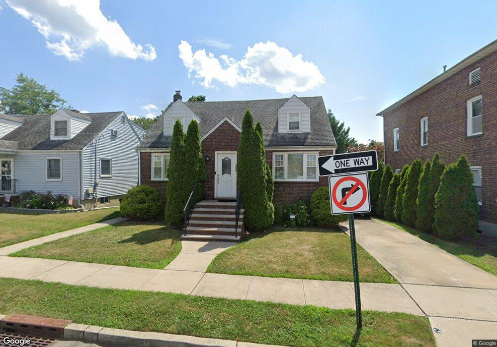
340 Thomas Ave Lyndhurst, NJ 07071
Estimated Value: $651,000
--
Bed
--
Bath
1,523
Sq Ft
$427/Sq Ft
Est. Value
About This Home
This home is located at 340 Thomas Ave, Lyndhurst, NJ 07071 and is currently estimated at $651,000, approximately $427 per square foot. 340 Thomas Ave is a home located in Bergen County with nearby schools including Lyndhurst High School and Sacred Heart School.
Ownership History
Date
Name
Owned For
Owner Type
Purchase Details
Closed on
Jan 27, 2016
Sold by
Harvey Kate E and Warner Kate E
Bought by
Curci Deanna
Current Estimated Value
Home Financials for this Owner
Home Financials are based on the most recent Mortgage that was taken out on this home.
Original Mortgage
$378,510
Outstanding Balance
$301,937
Interest Rate
3.97%
Mortgage Type
FHA
Estimated Equity
$349,063
Purchase Details
Closed on
Oct 21, 2011
Sold by
Redner William
Bought by
Warner Thomas P and Warner Kate E
Home Financials for this Owner
Home Financials are based on the most recent Mortgage that was taken out on this home.
Original Mortgage
$286,335
Interest Rate
4.25%
Mortgage Type
FHA
Create a Home Valuation Report for This Property
The Home Valuation Report is an in-depth analysis detailing your home's value as well as a comparison with similar homes in the area
Home Values in the Area
Average Home Value in this Area
Purchase History
| Date | Buyer | Sale Price | Title Company |
|---|---|---|---|
| Curci Deanna | $390,000 | Attorney | |
| Warner Thomas P | $315,000 | -- |
Source: Public Records
Mortgage History
| Date | Status | Borrower | Loan Amount |
|---|---|---|---|
| Open | Curci Deanna | $378,510 | |
| Previous Owner | Warner Thomas P | $286,335 |
Source: Public Records
Tax History Compared to Growth
Tax History
| Year | Tax Paid | Tax Assessment Tax Assessment Total Assessment is a certain percentage of the fair market value that is determined by local assessors to be the total taxable value of land and additions on the property. | Land | Improvement |
|---|---|---|---|---|
| 2025 | $10,849 | $525,800 | $281,000 | $244,800 |
| 2024 | $10,451 | $520,100 | $278,000 | $242,100 |
| 2023 | $9,446 | $514,300 | $275,000 | $239,300 |
| 2022 | $9,446 | $297,800 | $170,000 | $127,800 |
| 2021 | $8,822 | $290,200 | $170,000 | $120,200 |
| 2020 | $8,631 | $290,200 | $170,000 | $120,200 |
| 2019 | $8,567 | $290,200 | $170,000 | $120,200 |
| 2018 | $8,636 | $290,200 | $170,000 | $120,200 |
| 2017 | $8,419 | $290,200 | $170,000 | $120,200 |
| 2016 | $8,230 | $290,200 | $170,000 | $120,200 |
| 2015 | $7,972 | $290,200 | $170,000 | $120,200 |
| 2014 | $7,867 | $290,200 | $170,000 | $120,200 |
Source: Public Records
Map
Nearby Homes
- 307 Jauncey Ave
- 614 10th St
- 249-251 Sanford Ave
- 471 Harding Ave
- 416 Kingsland Ave
- 449 Jauncey Ave
- 258 Kingsland Ave
- 506 Park Place
- 518 8th St
- 735 Riverside Ave Unit A3
- 424 Page Ave
- 748 6th St
- 237 Kingsland Ave
- 155 Bergen Ave
- 533 Kingsland Ave
- 771 5th St
- 773 5th St
- 29 6th St
- 217 Page Ave
- 174 Page Ave
- 340 Thomas Ave Unit 1
- 346 Thomas Ave
- 338 Thomas Ave
- 338 Thomas Ave Unit 2
- 350 Thomas Ave
- 345 Wilson Ave
- 341 Wilson Ave
- 337 Wilson Ave
- 354 Thomas Ave Unit 2
- 354 Thomas Ave Unit 1
- 353 Wilson Ave
- 339 Thomas Ave
- 333 Wilson Ave
- 345 Thomas Ave
- 335 Thomas Ave
- 357 Wilson Ave
- 328 Thomas Ave
- 329 Wilson Ave
- 358 Thomas Ave
- 358 Thomas Ave Unit 2