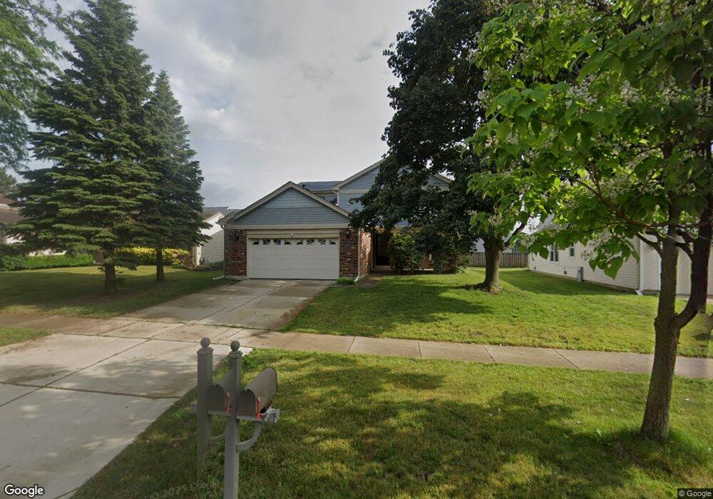
340 Thompson Blvd Buffalo Grove, IL 60089
Estimated Value: $563,000 - $566,000
3
Beds
3
Baths
2,398
Sq Ft
$235/Sq Ft
Est. Value
About This Home
This home is located at 340 Thompson Blvd, Buffalo Grove, IL 60089 and is currently estimated at $564,294, approximately $235 per square foot. 340 Thompson Blvd is a home located in Lake County with nearby schools including Prairie Elementary School, Twin Groves Middle School, and Adlai E Stevenson High School.
Ownership History
Date
Name
Owned For
Owner Type
Purchase Details
Closed on
Jan 12, 2012
Sold by
Burgher Lester R and Burgher Cyndi L
Bought by
Miriyala Manikeswari
Current Estimated Value
Home Financials for this Owner
Home Financials are based on the most recent Mortgage that was taken out on this home.
Original Mortgage
$184,000
Interest Rate
3.97%
Mortgage Type
New Conventional
Purchase Details
Closed on
Apr 25, 2003
Sold by
Dicianni Ronald A and Dicianni Patricia A
Bought by
Burgher Lester R and Burgher Cyndi L
Home Financials for this Owner
Home Financials are based on the most recent Mortgage that was taken out on this home.
Original Mortgage
$258,800
Interest Rate
5.31%
Mortgage Type
Stand Alone First
Purchase Details
Closed on
Apr 1, 1995
Sold by
Nbd Bank
Bought by
Dicianni Ronald A and Dicianni Patricia A
Create a Home Valuation Report for This Property
The Home Valuation Report is an in-depth analysis detailing your home's value as well as a comparison with similar homes in the area
Home Values in the Area
Average Home Value in this Area
Purchase History
| Date | Buyer | Sale Price | Title Company |
|---|---|---|---|
| Miriyala Manikeswari | $230,000 | First American Title | |
| Burgher Lester R | $323,500 | -- | |
| Dicianni Ronald A | -- | -- |
Source: Public Records
Mortgage History
| Date | Status | Borrower | Loan Amount |
|---|---|---|---|
| Closed | Miriyala Manikeswari | $184,000 | |
| Previous Owner | Burgher Lester R | $258,800 |
Source: Public Records
Tax History Compared to Growth
Tax History
| Year | Tax Paid | Tax Assessment Tax Assessment Total Assessment is a certain percentage of the fair market value that is determined by local assessors to be the total taxable value of land and additions on the property. | Land | Improvement |
|---|---|---|---|---|
| 2024 | $12,536 | $144,900 | $33,548 | $111,352 |
| 2023 | $11,559 | $130,214 | $30,148 | $100,066 |
| 2022 | $11,559 | $116,854 | $27,055 | $89,799 |
| 2021 | $11,120 | $115,594 | $26,763 | $88,831 |
| 2020 | $10,858 | $115,988 | $26,854 | $89,134 |
| 2019 | $12,193 | $130,744 | $26,755 | $103,989 |
| 2018 | $11,506 | $127,471 | $26,443 | $101,028 |
| 2017 | $11,288 | $124,496 | $25,826 | $98,670 |
| 2016 | $10,992 | $119,214 | $24,730 | $94,484 |
| 2015 | $10,700 | $111,488 | $23,127 | $88,361 |
| 2014 | $7,257 | $76,505 | $24,837 | $51,668 |
| 2012 | $10,007 | $104,118 | $24,887 | $79,231 |
Source: Public Records
Map
Nearby Homes
- 538 Lasalle Ct
- 531 Lasalle Ln
- 327 Lasalle Ln
- 1118 Larraway Dr
- 1272 Sandhurst Dr
- 15 Thompson Ct
- 1113 Lockwood Dr
- 1901 Brandywyn Ln
- 1265 Devonshire Rd
- 268 Hoffmann Dr
- 1903 Sheridan Rd
- 361 Hoffmann Dr
- 938 Hidden Lake Dr
- 333 Didier Ct
- 896 Chaucer Way Unit 2
- 1012 Hobson Dr
- 22118 N Prairie Rd
- 1141 Devonshire Rd
- 2033 Olive Hill Dr
- 148 White Branch Ct
- 330 Thompson Blvd
- 352 Thompson Blvd
- 320 Thompson Blvd
- 360 Thompson Blvd
- 310 Thompson Blvd
- 401 Caren Dr
- 302 Ronnie Dr
- 400 Thompson Blvd
- 300 Thompson Blvd
- 405 Caren Dr
- 306 Ronnie Dr
- 410 Thompson Blvd
- 495 Lasalle Ln
- 402 Caren Dr
- 301 Ronnie Dr
- 409 Caren Dr
- 497 Lasalle Ln
- 310 Ronnie Dr
- 420 Thompson Blvd
- 406 Caren Dr