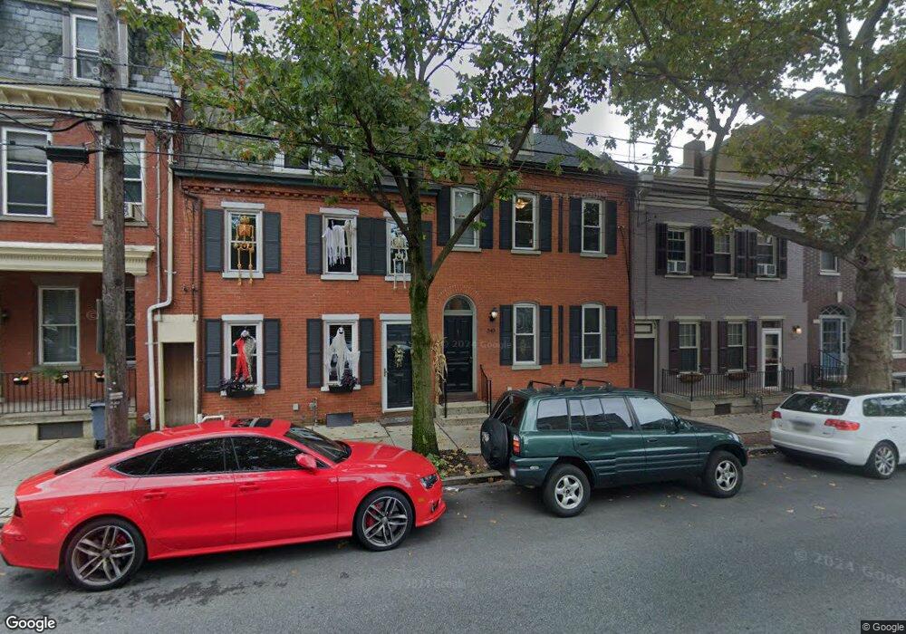
340 W Orange St Lancaster, PA 17603
Chestnut Hill NeighborhoodEstimated Value: $323,000 - $352,000
3
Beds
2
Baths
2,142
Sq Ft
$157/Sq Ft
Est. Value
About This Home
This home is located at 340 W Orange St, Lancaster, PA 17603 and is currently estimated at $336,350, approximately $157 per square foot. 340 W Orange St is a home located in Lancaster County with nearby schools including Fulton El School, Reynolds Middle School, and McCaskey High School.
Ownership History
Date
Name
Owned For
Owner Type
Purchase Details
Closed on
Apr 28, 2023
Sold by
Olney Bruce L and Olney Lois M
Bought by
Montgomery Frank and Montgomery Heather
Current Estimated Value
Home Financials for this Owner
Home Financials are based on the most recent Mortgage that was taken out on this home.
Original Mortgage
$235,000
Outstanding Balance
$228,501
Interest Rate
6.42%
Mortgage Type
Seller Take Back
Estimated Equity
$107,849
Purchase Details
Closed on
May 4, 2001
Sold by
Brehaut Jeffrey D and Brehaut Jeanne C
Bought by
Olney Bruce L and Olney Lois M
Home Financials for this Owner
Home Financials are based on the most recent Mortgage that was taken out on this home.
Original Mortgage
$52,224
Interest Rate
6.85%
Create a Home Valuation Report for This Property
The Home Valuation Report is an in-depth analysis detailing your home's value as well as a comparison with similar homes in the area
Home Values in the Area
Average Home Value in this Area
Purchase History
| Date | Buyer | Sale Price | Title Company |
|---|---|---|---|
| Montgomery Frank | $265,000 | None Listed On Document | |
| Olney Bruce L | $56,900 | -- |
Source: Public Records
Mortgage History
| Date | Status | Borrower | Loan Amount |
|---|---|---|---|
| Open | Montgomery Frank | $235,000 | |
| Previous Owner | Olney Bruce L | $52,224 |
Source: Public Records
Tax History Compared to Growth
Tax History
| Year | Tax Paid | Tax Assessment Tax Assessment Total Assessment is a certain percentage of the fair market value that is determined by local assessors to be the total taxable value of land and additions on the property. | Land | Improvement |
|---|---|---|---|---|
| 2025 | $5,749 | $145,300 | $35,800 | $109,500 |
| 2024 | $5,749 | $145,300 | $35,800 | $109,500 |
| 2023 | $5,417 | $145,300 | $35,800 | $109,500 |
| 2022 | $5,417 | $145,300 | $35,800 | $109,500 |
| 2021 | $5,301 | $145,300 | $35,800 | $109,500 |
| 2020 | $5,301 | $145,300 | $35,800 | $109,500 |
| 2019 | $5,222 | $145,300 | $35,800 | $109,500 |
| 2018 | $3,485 | $163,400 | $35,800 | $127,600 |
| 2017 | $3,560 | $77,500 | $23,600 | $53,900 |
| 2016 | $3,527 | $77,500 | $23,600 | $53,900 |
| 2015 | $1,376 | $77,500 | $23,600 | $53,900 |
| 2014 | $3,078 | $77,500 | $23,600 | $53,900 |
Source: Public Records
Map
Nearby Homes
- 28 N Charlotte St
- 118 N Charlotte St
- 257 W King St
- 321 W Mifflin St
- 443 Manor St
- 514 W Orange St
- 36 S Mulberry St
- 510 W Chestnut St
- 461 Lafayette St
- 120 W Strawberry St
- 212 W Chestnut St
- 464 Lafayette St
- 29 Old Dorwart St
- 228 N Mary St
- 471 High St
- 215 W Vine St
- 515 Lafayette St
- 113 Old Dorwart St
- 315 W Walnut St
- 125 Old Dorwart St
- 342 W Orange St
- 338 W Orange St
- 336 W Orange St
- 344 W Orange St
- 334 W Orange St
- 346 W Orange St
- 348 W Orange St
- 348 W Orange St
- 350 W Orange St
- 328 W Orange St
- 337 W Grant St
- 335 W Grant St
- 333 W Grant St
- 352 W Orange St
- 352 W Orange St Unit 1
- 331 W Grant St
- 345 W Grant St
- 39 N Charlotte St
- 347 W Grant St
- 322 W Orange St