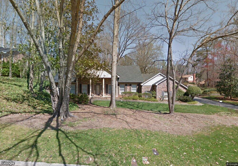
340 W Spalding Dr NE Unit 5 Atlanta, GA 30328
Estimated Value: $695,000 - $837,000
4
Beds
3
Baths
2,935
Sq Ft
$252/Sq Ft
Est. Value
About This Home
This home is located at 340 W Spalding Dr NE Unit 5, Atlanta, GA 30328 and is currently estimated at $739,467, approximately $251 per square foot. 340 W Spalding Dr NE Unit 5 is a home located in Fulton County with nearby schools including Spalding Drive Elementary School, Sandy Springs Middle School, and North Springs High School.
Ownership History
Date
Name
Owned For
Owner Type
Purchase Details
Closed on
Aug 28, 2002
Sold by
Dye Joseph S and Dye Marion
Bought by
Vale Michele H and Vale Adam N
Current Estimated Value
Home Financials for this Owner
Home Financials are based on the most recent Mortgage that was taken out on this home.
Original Mortgage
$283,500
Outstanding Balance
$119,032
Interest Rate
6.31%
Mortgage Type
New Conventional
Estimated Equity
$620,435
Purchase Details
Closed on
Mar 28, 1997
Sold by
Cherry Pamela P
Bought by
Dye Joseph and Marion Dye S
Home Financials for this Owner
Home Financials are based on the most recent Mortgage that was taken out on this home.
Original Mortgage
$100,000
Interest Rate
7.58%
Mortgage Type
New Conventional
Create a Home Valuation Report for This Property
The Home Valuation Report is an in-depth analysis detailing your home's value as well as a comparison with similar homes in the area
Home Values in the Area
Average Home Value in this Area
Purchase History
| Date | Buyer | Sale Price | Title Company |
|---|---|---|---|
| Vale Michele H | $320,000 | -- | |
| Dye Joseph | $184,000 | -- |
Source: Public Records
Mortgage History
| Date | Status | Borrower | Loan Amount |
|---|---|---|---|
| Open | Vale Michele H | $283,500 | |
| Previous Owner | Dye Joseph | $100,000 |
Source: Public Records
Tax History Compared to Growth
Tax History
| Year | Tax Paid | Tax Assessment Tax Assessment Total Assessment is a certain percentage of the fair market value that is determined by local assessors to be the total taxable value of land and additions on the property. | Land | Improvement |
|---|---|---|---|---|
| 2025 | $5,120 | $249,600 | $78,560 | $171,040 |
| 2023 | $6,174 | $218,720 | $41,480 | $177,240 |
| 2022 | $4,841 | $218,720 | $41,480 | $177,240 |
| 2021 | $4,809 | $214,560 | $53,800 | $160,760 |
| 2020 | $4,834 | $183,160 | $40,760 | $142,400 |
| 2019 | $4,757 | $179,920 | $40,040 | $139,880 |
| 2018 | $4,994 | $171,880 | $23,680 | $148,200 |
| 2017 | $4,709 | $151,240 | $17,240 | $134,000 |
| 2016 | $4,681 | $151,240 | $17,240 | $134,000 |
| 2015 | $4,695 | $151,240 | $17,240 | $134,000 |
| 2014 | $4,353 | $136,080 | $19,840 | $116,240 |
Source: Public Records
Map
Nearby Homes
- 7090 Stonington Dr NE
- 229 Devonwood Dr
- 7321 Cardigan Cir
- 6980 Roswell Rd NE Unit B3
- 6980 Roswell Rd NE Unit A8
- 6980 Roswell Rd NE Unit M1
- 6980 Roswell Rd NE Unit O2
- 6980 Roswell Rd Unit H1
- 7307 Cardigan Cir
- 380 Thornwood Dr NE
- 7155 Roswell Rd NE Unit 58
- 6940 Roswell Rd Unit B4
- 6940 Roswell Rd Unit 19C
- 6940 Roswell Rd Unit 15C
- 6940 Roswell Rd Unit 21A
- 6940 Roswell Rd Unit 16B
- 6900 Roswell Rd Unit G1
- 6900 Roswell Rd Unit F6
- 330 W Spalding Dr NE
- 7060 Duncourtney Dr NE
- 7045 Duncourtney Dr NE
- 320 W Spalding Dr NE
- 7070 Duncourtney Dr NE
- 335 W Spalding Dr NE
- 345 W Spalding Dr NE
- 325 W Spalding Dr NE
- 315 Westerhall Ct NE
- 7055 Duncourtney Dr NE
- 310 W Spalding Dr NE
- 325 Westerhall Ct NE
- 355 W Spalding Dr NE Unit 5
- 315 W Spalding Dr NE
- 7080 Duncourtney Dr NE
- 7065 Duncourtney Dr NE
- 7075 Duncourtney Dr NE
- 305 W Spalding Dr NE
- 309 Brixham Ct NE
- 300 Westerhall Ct NE