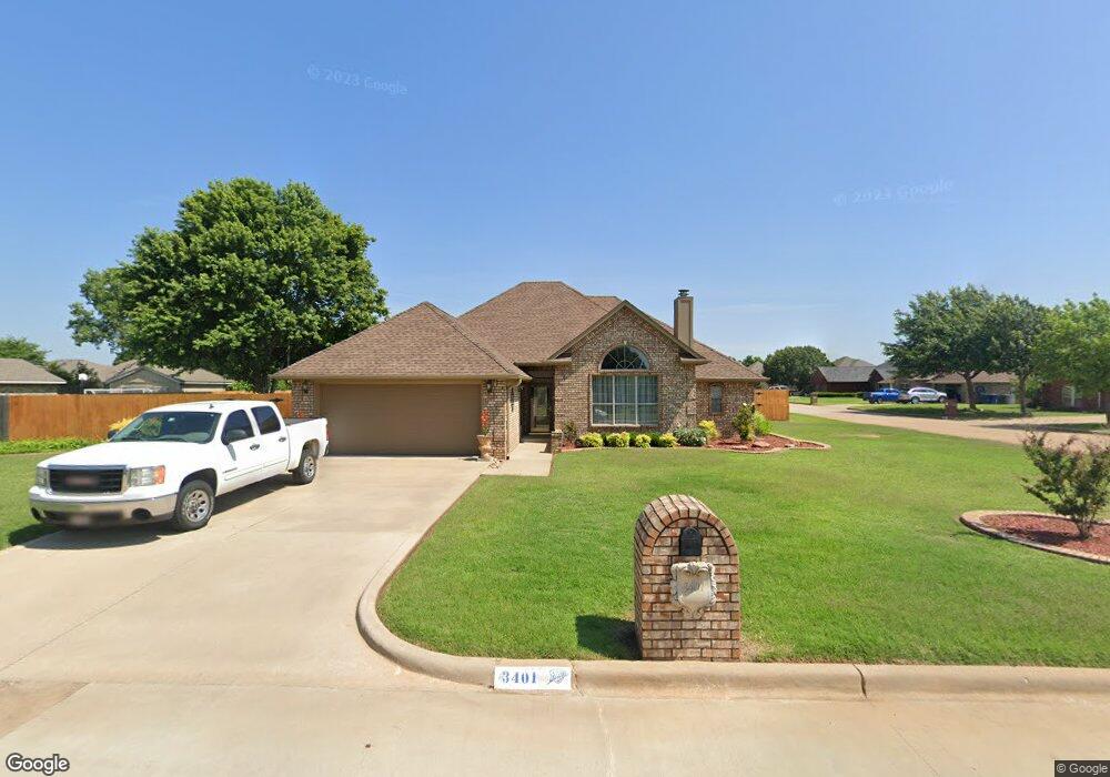
3401 Bates Dr Duncan, OK 73533
Estimated Value: $245,000 - $252,990
3
Beds
2
Baths
1,773
Sq Ft
$140/Sq Ft
Est. Value
About This Home
This home is located at 3401 Bates Dr, Duncan, OK 73533 and is currently estimated at $247,998, approximately $139 per square foot. 3401 Bates Dr is a home located in Stephens County with nearby schools including Horace Mann Elementary School, Duncan Middle School, and Duncan High School.
Ownership History
Date
Name
Owned For
Owner Type
Purchase Details
Closed on
Oct 22, 2008
Sold by
Shields Timothy Duane and Shields Mary E
Bought by
Simpson Alan E and Simpson Renee Linette
Current Estimated Value
Home Financials for this Owner
Home Financials are based on the most recent Mortgage that was taken out on this home.
Original Mortgage
$140,000
Outstanding Balance
$91,518
Interest Rate
6.08%
Mortgage Type
New Conventional
Estimated Equity
$156,480
Purchase Details
Closed on
Aug 22, 2006
Sold by
Beshirs Margie and Beshirs Margie Ann
Bought by
Shields Timothy Duane and Shields Mary E
Home Financials for this Owner
Home Financials are based on the most recent Mortgage that was taken out on this home.
Original Mortgage
$139,200
Interest Rate
6.75%
Mortgage Type
New Conventional
Purchase Details
Closed on
Mar 23, 2000
Sold by
Mowdy Johnny Dale
Purchase Details
Closed on
Aug 31, 1999
Sold by
Whisenant Joseph W
Create a Home Valuation Report for This Property
The Home Valuation Report is an in-depth analysis detailing your home's value as well as a comparison with similar homes in the area
Purchase History
We collect this data history from publicly available records. To have your information removed, we recommend requesting removal directly through your county’s website.
| Date | Buyer | Sale Price | Title Company |
|---|---|---|---|
| Simpson Alan E | $175,000 | None Available | |
| Shields Timothy Duane | $174,000 | Stewart Escrow & Title | |
| -- | $110,000 | -- | |
| -- | $6,500 | -- |
Source: Public Records
Mortgage History
We collect this data history from publicly available records. To have your information removed, we recommend requesting removal directly through your county’s website.
| Date | Status | Borrower | Loan Amount |
|---|---|---|---|
| Open | Simpson Alan E | $140,000 | |
| Previous Owner | Shields Timothy Duane | $139,200 |
Source: Public Records
Tax History
| Year | Tax Paid | Tax Assessment Tax Assessment Total Assessment is a certain percentage of the fair market value that is determined by local assessors to be the total taxable value of land and additions on the property. | Land | Improvement |
|---|---|---|---|---|
| 2025 | $2,013 | $24,862 | $1,997 | $22,865 |
| 2024 | $1,911 | $23,435 | $1,997 | $21,438 |
| 2023 | $1,911 | $23,435 | $1,997 | $21,438 |
| 2022 | $1,793 | $22,753 | $1,997 | $20,756 |
| 2021 | $1,741 | $21,447 | $1,997 | $19,450 |
| 2020 | $1,551 | $18,962 | $1,997 | $16,965 |
| 2019 | $1,506 | $18,410 | $1,997 | $16,413 |
| 2018 | $1,570 | $18,673 | $1,997 | $16,676 |
| 2017 | $1,469 | $18,089 | $1,997 | $16,092 |
| 2016 | $1,473 | $18,325 | $1,997 | $16,328 |
| 2015 | $1,438 | $18,304 | $1,997 | $16,307 |
| 2014 | $1,438 | $17,770 | $1,997 | $15,773 |
Source: Public Records
Map
Nearby Homes
- 3425 Kacey St
- 737 Drexal Place
- 1336 Smith Rd
- 3450 W Elk Ave
- 1239 Carriage Dr
- 805 N Harville Rd
- 903 N Harville Rd
- 0 N 44th St
- 0 W Beech Ave
- NO ADDRESS W Elk Ave
- 220 N 30th St
- 705 N Alice Dr
- 2610 Virginia St
- 0000 W Beech Ave Unit A
- 0002 W Beech Ave Unit C
- 0001 W Beech Ave Unit B
- 2206 W Spruce Ave
- 2086 N 44th St
- 502 N Alice Dr
- 2201 W Parkview Ave
- 3409 Bates Dr
- 3402 Salter St
- 1002 Drexal Place
- 3413 Bates Dr
- 1006 Drexal Place
- 3410 Salter St
- 922 Drexal Place
- 3406 Bates Dr
- 1010 Drexal Place
- 3410 Bates Dr
- 3414 Bates Dr
- 2018 Drexal Place
- 3414 Salter St
- 3417 Bates Dr
- 1014 Drexal Place
- 914 914 Drexal Place
- 2004 Drexal Place
- 3418 Salter St
- 3418 Bates Dr
- 3421 Bates Dr
Your Personal Tour Guide
Ask me questions while you tour the home.