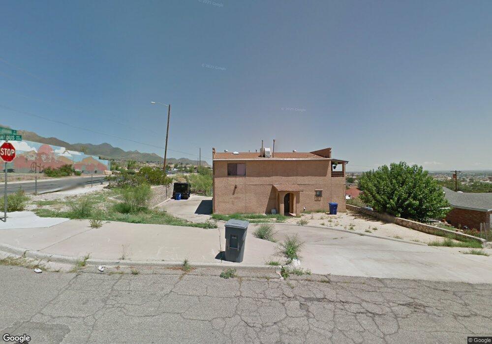
3401 Broaddus Ave Unit 3403 El Paso, TX 79904
Logan Heights NeighborhoodEstimated Value: $189,000 - $284,000
4
Beds
2
Baths
2,160
Sq Ft
$112/Sq Ft
Est. Value
About This Home
This home is located at 3401 Broaddus Ave Unit 3403, El Paso, TX 79904 and is currently estimated at $242,561, approximately $112 per square foot. 3401 Broaddus Ave Unit 3403 is a home located in El Paso County with nearby schools including Logan Elementary School, Canyon Hills Middle School, and Chapin High School.
Ownership History
Date
Name
Owned For
Owner Type
Purchase Details
Closed on
Aug 14, 2023
Sold by
Cano Natividad T
Bought by
Cano Natividad T
Current Estimated Value
Purchase Details
Closed on
Apr 28, 2011
Sold by
Sellers Timothy R and Sellers Robert James
Bought by
Old Blue Homes Llc
Purchase Details
Closed on
Jan 14, 2003
Sold by
Sellers Robert and Sellers Timothy
Bought by
Sellers Timothy R and Sellers Robert James
Home Financials for this Owner
Home Financials are based on the most recent Mortgage that was taken out on this home.
Original Mortgage
$90,819
Interest Rate
6.16%
Create a Home Valuation Report for This Property
The Home Valuation Report is an in-depth analysis detailing your home's value as well as a comparison with similar homes in the area
Home Values in the Area
Average Home Value in this Area
Purchase History
| Date | Buyer | Sale Price | Title Company |
|---|---|---|---|
| Cano Natividad T | -- | None Listed On Document | |
| Old Blue Homes Llc | -- | None Available | |
| Sellers Timothy R | -- | -- |
Source: Public Records
Mortgage History
| Date | Status | Borrower | Loan Amount |
|---|---|---|---|
| Previous Owner | Sellers Timothy R | $90,819 |
Source: Public Records
Tax History Compared to Growth
Tax History
| Year | Tax Paid | Tax Assessment Tax Assessment Total Assessment is a certain percentage of the fair market value that is determined by local assessors to be the total taxable value of land and additions on the property. | Land | Improvement |
|---|---|---|---|---|
| 2025 | $6,245 | $285,054 | $35,402 | $249,652 |
| 2024 | $6,245 | $285,054 | $35,402 | $249,652 |
| 2023 | $5,546 | $200,477 | $16,092 | $184,385 |
| 2022 | $5,934 | $200,477 | $16,092 | $184,385 |
| 2021 | $5,401 | $172,980 | $16,092 | $156,888 |
| 2020 | $3,035 | $98,734 | $13,410 | $85,324 |
| 2018 | $2,922 | $98,734 | $13,410 | $85,324 |
| 2017 | $3,122 | $110,835 | $13,410 | $97,425 |
| 2016 | $3,122 | $110,835 | $13,410 | $97,425 |
| 2015 | $3,033 | $110,835 | $13,410 | $97,425 |
| 2014 | $3,033 | $110,835 | $13,410 | $97,425 |
Source: Public Records
Map
Nearby Homes
- 3517 Thomason Ave
- 3609 Broaddus Ave
- 3630 Sheppard Ave
- 3737 Fred Wilson Ave
- 3817 Mcconnell Ave
- 3825 Keltner Ave
- 3445 Clearview Ln
- 3425 Clearview Ln
- 3416 Montridge Ct
- 3808 Johnson Ave
- 4219 Mcconnell Ave
- 6840 Ridge Top Dr
- 3408 Pierce Ave
- 5030 Alabama St Unit 9
- 3010 Pierce Ave
- 3501 Taylor Ave
- 4029 Lincoln Ave
- 3621 Taylor Ave Unit ABC
- 3616 Taylor Ave
- 7465 Stoney Hill Dr Unit 12D
- 3411 Broaddus Ave
- 3404 Thomason Ave
- 3415 Broaddus Ave Unit A
- 3415 Broaddus Ave Unit B
- 3408 Thomason Ave Unit 3410
- 3404 Broaddus Ave
- 3408 Broaddus Ave
- 3412 Thomason Ave
- 3423 Broaddus Ave
- 3412 Broaddus Ave
- 3416 Thomason Ave
- 3416 Broaddus Ave
- 3427 Broaddus Ave
- 3418 Thomason Ave
- 5801 Alabama St
- 3420 Broaddus Ave
- 3426 Thomason Ave
- 3401 Sheppard Ave
- 5801 Byron St
- 3409 Sheppard Ave