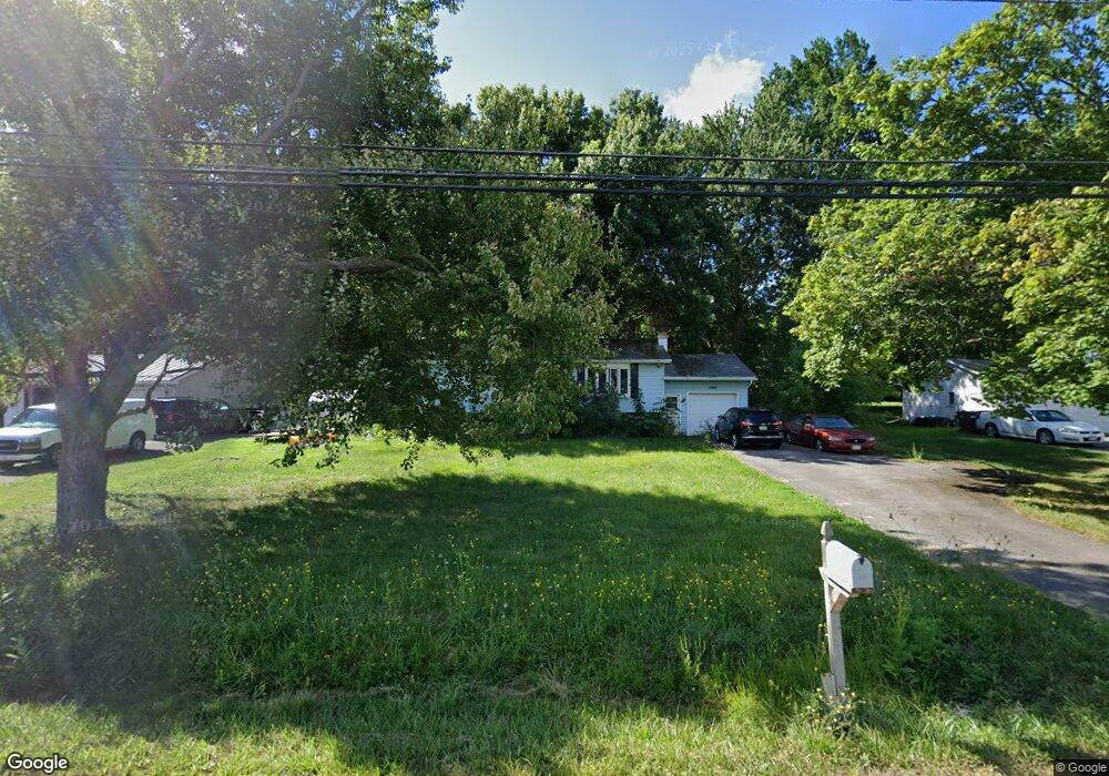
3401 Brockport Spencerport Rd Spencerport, NY 14559
Estimated Value: $219,000 - $301,000
3
Beds
2
Baths
1,591
Sq Ft
$163/Sq Ft
Est. Value
About This Home
This home is located at 3401 Brockport Spencerport Rd, Spencerport, NY 14559 and is currently estimated at $259,569, approximately $163 per square foot. 3401 Brockport Spencerport Rd is a home located in Monroe County with nearby schools including Ginther Elementary School, Barclay Elementary School, and Fred W. Hill Elementary School.
Ownership History
Date
Name
Owned For
Owner Type
Purchase Details
Closed on
Jun 16, 2010
Sold by
Corson Rachel and Corson Matthew
Bought by
Kleps Sandra F
Current Estimated Value
Home Financials for this Owner
Home Financials are based on the most recent Mortgage that was taken out on this home.
Original Mortgage
$69,900
Outstanding Balance
$46,985
Interest Rate
5.03%
Mortgage Type
New Conventional
Estimated Equity
$212,584
Purchase Details
Closed on
Jul 14, 2006
Sold by
Huntoon Rachel
Bought by
Huntoon Rachel
Purchase Details
Closed on
Jul 3, 2001
Sold by
Gerew Mary W
Bought by
Duncan Michael
Create a Home Valuation Report for This Property
The Home Valuation Report is an in-depth analysis detailing your home's value as well as a comparison with similar homes in the area
Home Values in the Area
Average Home Value in this Area
Purchase History
| Date | Buyer | Sale Price | Title Company |
|---|---|---|---|
| Kleps Sandra F | $99,900 | None Available | |
| Huntoon Rachel | -- | -- | |
| Duncan Michael | $93,000 | Christopher D Trotto | |
| Duncan Michael | $93,000 | Christopher D Trotto |
Source: Public Records
Mortgage History
| Date | Status | Borrower | Loan Amount |
|---|---|---|---|
| Open | Kleps Sandra F | $69,900 |
Source: Public Records
Tax History Compared to Growth
Tax History
| Year | Tax Paid | Tax Assessment Tax Assessment Total Assessment is a certain percentage of the fair market value that is determined by local assessors to be the total taxable value of land and additions on the property. | Land | Improvement |
|---|---|---|---|---|
| 2024 | $5,394 | $194,200 | $26,200 | $168,000 |
| 2023 | $5,703 | $127,400 | $26,200 | $101,200 |
| 2022 | $5,109 | $127,400 | $26,200 | $101,200 |
| 2021 | $4,996 | $127,400 | $26,200 | $101,200 |
| 2020 | $4,943 | $127,400 | $26,200 | $101,200 |
| 2019 | $3,881 | $127,400 | $26,200 | $101,200 |
| 2018 | $1,056 | $127,400 | $26,200 | $101,200 |
| 2017 | $3,051 | $115,800 | $26,200 | $89,600 |
| 2016 | $3,881 | $115,800 | $27,000 | $88,800 |
| 2015 | -- | $115,800 | $27,000 | $88,800 |
| 2014 | -- | $115,800 | $27,000 | $88,800 |
Source: Public Records
Map
Nearby Homes
- 3375 Brockport Spencerport Rd
- 4310 Canal Rd
- 389 Washington St
- vl Canal Rd
- 4028 Canal Rd
- 911 Washington St
- 909 Washington St
- 24 Birdsong Terrace
- 607 Trimmer Rd
- 1161 Ogden Parma Town Line Rd
- 76 Hawthorne Dr
- 6 Walnut Hill Dr
- 0000 Bay Leaf Cir Lot#119
- 000
- 00 Bay Leaf Circle Lot#117
- 0 Unit R1620030
- 585 Chambers St
- 326 Village Walk Cir
- 154 Amity St
- 87 Highview Dr
- 3399 Brockport Spencerport Rd
- 3403 Brockport Spencerport Rd
- 3397 Brockport Spencerport Rd
- 3405 Brockport Spencerport Rd
- 3400 Brockport Spencerport Rd
- 3395 Brockport Spencerport Rd
- 3427 Brockport Spencerport Rd
- 3425 Brockport Spencerport Rd
- 3429 Brockport Spencerport Rd
- 15 Rolling Acre Dr
- 3389 Brockport Spencerport Rd
- 3389 Brockport Spencerport Rd Unit R
- 3471 Brockport Spencerport Rd
- 3470 Brockport Spencerport Rd
- 3387 Brockport Spencerport Rd
- 3473 Brockport Spencerport Rd
- 3475 Brockport Spencerport Rd
- 3415 Brockport Spencerport Rd
- 3383 Brockport Spencerport Rd
- 3480 Brockport Spencerport Rd