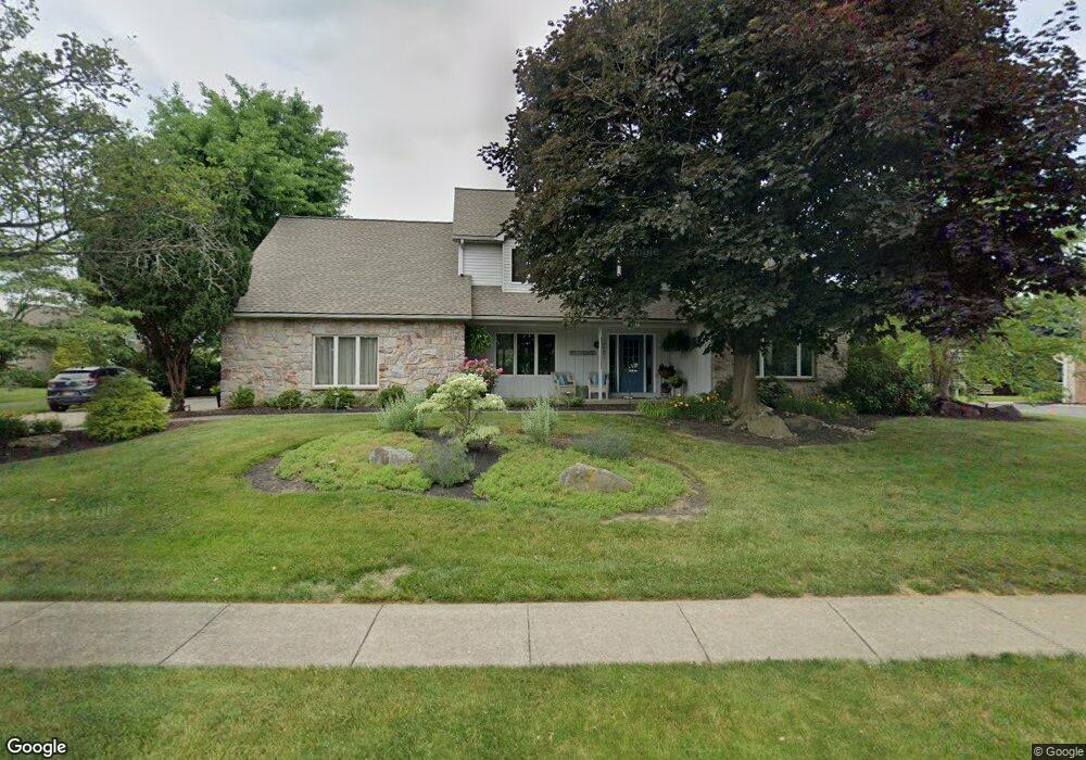
3401 Miriam Dr Emmaus, PA 18049
Estimated Value: $597,498 - $672,000
5
Beds
3
Baths
2,890
Sq Ft
$215/Sq Ft
Est. Value
About This Home
This home is located at 3401 Miriam Dr, Emmaus, PA 18049 and is currently estimated at $621,125, approximately $214 per square foot. 3401 Miriam Dr is a home located in Lehigh County with nearby schools including Jefferson Elementary School, Lower Macungie Middle School, and Emmaus High School.
Ownership History
Date
Name
Owned For
Owner Type
Purchase Details
Closed on
Apr 14, 2022
Sold by
Cipolle Mary J
Bought by
Mary J Cipolle Revocable Trust
Current Estimated Value
Purchase Details
Closed on
Apr 26, 1999
Sold by
Cipolle Mark D and Cipolle Mary J
Bought by
Cipolle Mary J
Purchase Details
Closed on
Jul 7, 1993
Sold by
Koneski Anthony T and Koneski Elizabeth F
Bought by
Cipolle Mark D and Cipolle Mary J
Purchase Details
Closed on
Jul 16, 1992
Sold by
Schantz Jr Glenn H
Bought by
Koneski Anthony T and Koneski Elizabeth F
Purchase Details
Closed on
Dec 9, 1989
Bought by
Schantz Glenn H
Create a Home Valuation Report for This Property
The Home Valuation Report is an in-depth analysis detailing your home's value as well as a comparison with similar homes in the area
Home Values in the Area
Average Home Value in this Area
Purchase History
| Date | Buyer | Sale Price | Title Company |
|---|---|---|---|
| Mary J Cipolle Revocable Trust | -- | Fitzpatrick Lentz & Bubba Pc | |
| Cipolle Mary J | -- | -- | |
| Cipolle Mark D | $265,000 | -- | |
| Koneski Anthony T | $60,000 | -- | |
| Schantz Glenn H | -- | -- |
Source: Public Records
Tax History Compared to Growth
Tax History
| Year | Tax Paid | Tax Assessment Tax Assessment Total Assessment is a certain percentage of the fair market value that is determined by local assessors to be the total taxable value of land and additions on the property. | Land | Improvement |
|---|---|---|---|---|
| 2025 | $8,943 | $350,300 | $42,400 | $307,900 |
| 2024 | $8,547 | $350,300 | $42,400 | $307,900 |
| 2023 | $8,374 | $350,300 | $42,400 | $307,900 |
| 2022 | $8,174 | $350,300 | $307,900 | $42,400 |
| 2021 | $7,998 | $350,300 | $42,400 | $307,900 |
| 2020 | $7,921 | $350,300 | $42,400 | $307,900 |
| 2019 | $7,872 | $350,300 | $42,400 | $307,900 |
| 2018 | $7,670 | $350,300 | $42,400 | $307,900 |
| 2017 | $7,534 | $350,300 | $42,400 | $307,900 |
| 2016 | -- | $350,300 | $42,400 | $307,900 |
| 2015 | -- | $350,300 | $42,400 | $307,900 |
| 2014 | -- | $350,300 | $42,400 | $307,900 |
Source: Public Records
Map
Nearby Homes
- 3430 Gentlewind Way Unit IC 109
- 4109 Eveningstar Rd
- 3420 Gentlewind Way Unit IC 110
- 4088 Eveningstar Rd
- 943 N 6th St
- 3514 Daylily Dr
- 3623 Daylily Dr
- 657 Walnut St
- 3810 Allen St
- 543 Long St
- 3149 Sheffield Dr
- 569 Chestnut St Unit 571
- 659 Broad St
- 4490 Canterbury Dr
- 4476 Stonebridge Dr
- 3703 Samantha Ln Unit Lot 70
- 3707 Samantha Ln Unit Lot 71
- 3736 Samantha Ln Unit Lot 7
- 3734 Samantha Ln Unit Lot 8
- 3748 Samantha Ln Unit Lot 3