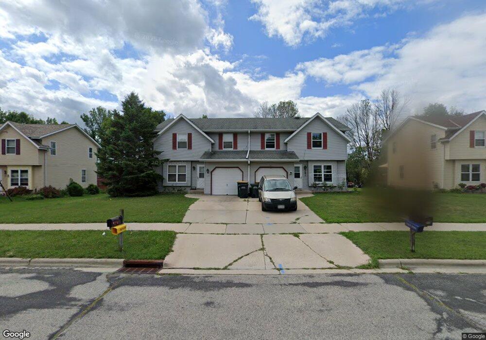
3401 Stanford Ln West Bend, WI 53090
Estimated Value: $402,000 - $478,000
6
Beds
2
Baths
3,635
Sq Ft
$117/Sq Ft
Est. Value
About This Home
This home is located at 3401 Stanford Ln, West Bend, WI 53090 and is currently estimated at $423,883, approximately $116 per square foot. 3401 Stanford Ln is a home located in Washington County with nearby schools including McLane Elementary School, Silverbrook Intermediate School, and East High School.
Ownership History
Date
Name
Owned For
Owner Type
Purchase Details
Closed on
Feb 15, 2007
Sold by
Wilant Matthew and Katzenberger Tracy
Bought by
Zhang Donguyuan and Li Jianghua
Current Estimated Value
Home Financials for this Owner
Home Financials are based on the most recent Mortgage that was taken out on this home.
Original Mortgage
$209,600
Outstanding Balance
$126,307
Interest Rate
6.27%
Mortgage Type
New Conventional
Estimated Equity
$297,576
Create a Home Valuation Report for This Property
The Home Valuation Report is an in-depth analysis detailing your home's value as well as a comparison with similar homes in the area
Home Values in the Area
Average Home Value in this Area
Purchase History
| Date | Buyer | Sale Price | Title Company |
|---|---|---|---|
| Zhang Donguyuan | $262,000 | None Available |
Source: Public Records
Mortgage History
| Date | Status | Borrower | Loan Amount |
|---|---|---|---|
| Open | Zhang Donguyuan | $209,600 |
Source: Public Records
Tax History Compared to Growth
Tax History
| Year | Tax Paid | Tax Assessment Tax Assessment Total Assessment is a certain percentage of the fair market value that is determined by local assessors to be the total taxable value of land and additions on the property. | Land | Improvement |
|---|---|---|---|---|
| 2024 | $4,360 | $323,900 | $56,500 | $267,400 |
| 2023 | $3,894 | $293,200 | $45,400 | $247,800 |
| 2022 | $5,362 | $293,200 | $45,400 | $247,800 |
| 2021 | $5,539 | $293,200 | $45,400 | $247,800 |
| 2020 | $5,363 | $293,200 | $45,400 | $247,800 |
| 2019 | $5,217 | $293,200 | $45,400 | $247,800 |
| 2018 | $5,043 | $293,200 | $45,400 | $247,800 |
| 2017 | $4,679 | $246,200 | $45,400 | $200,800 |
| 2016 | $4,722 | $246,200 | $45,400 | $200,800 |
| 2015 | $4,688 | $246,200 | $45,400 | $200,800 |
| 2014 | $4,688 | $246,200 | $45,400 | $200,800 |
| 2013 | $5,067 | $246,200 | $45,400 | $200,800 |
Source: Public Records
Map
Nearby Homes
- 3316 Mediterranean Ave
- 3315 Windsor Place
- 2820 Valley Ave
- 6837 Reuter Ln
- Lt3-5 Schuster Dr
- Lt3 Schuster Dr
- Lt5 Schuster Dr
- Lt4 Schuster Dr
- 805 Canterberry Ct Unit C
- 2606 Park Forest Dr
- 4262 N Woodcrest Ridge Dr
- 2346 W Washington St
- 4000 W Washington St
- 2124 Willowbrook Dr
- 2110 Hollow Cir
- 2214 Willowbrook Dr
- Lt2 Beaver Dam Rd
- 704 N 18th Ave
- 2106 Chestnut St
- 1925 Hilltop Dr
- 3405 Stanford Ln
- 3329 Stanford Ln
- 3327 Stanford Ln
- 806 Kings Ridge Ct W
- 3411 Stanford Ln
- 3411 Stanford Ln Unit 3413
- 3315 Stanford Ln
- 3316 Stanford Ln
- 3412 Stanford Ln
- 812 Kings Ridge Ct W
- 3307 Stanford Ln
- 3421 Stanford Ln
- 811 Kings Ridge Ct W
- 813 Squire Ln
- 818 Kings Ridge Ct W
- 3303 Stanford Ln
- 3306 Stanford Ln
- 817 Kings Ridge Ct W
- 808 Squire Ln
- 819 Squire Ln