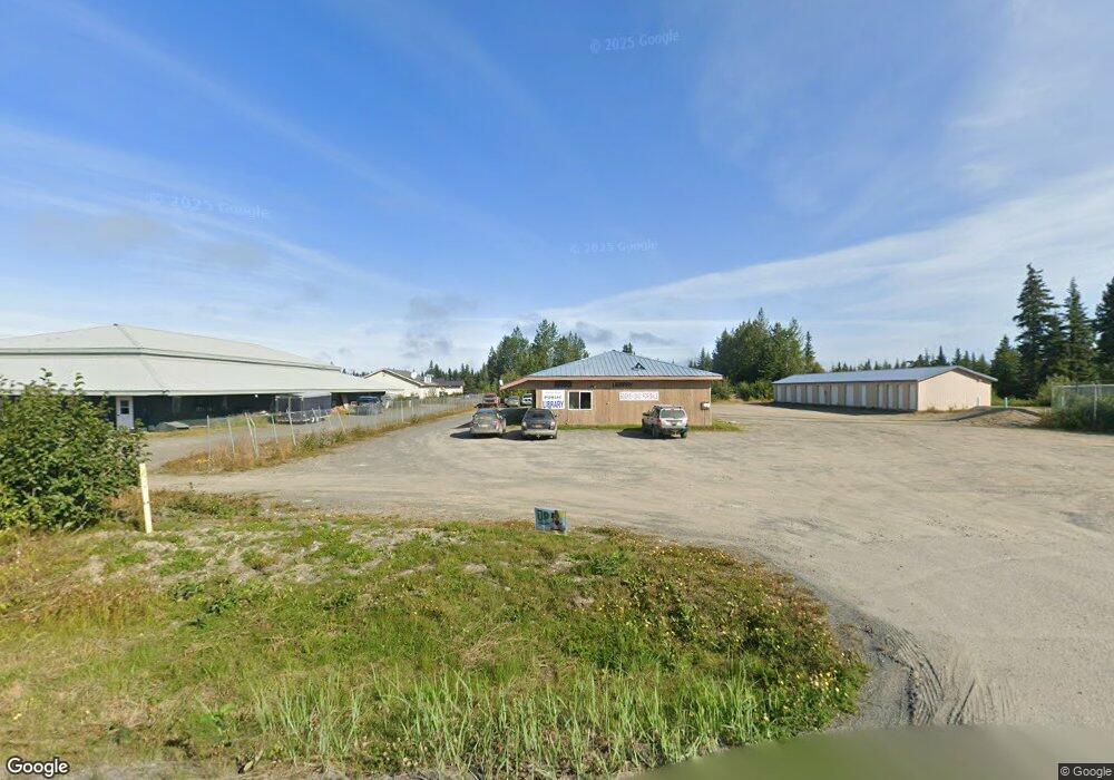
34020 N Fork Rd Anchor Point, AK 99556
--
Bed
--
Bath
6,472
Sq Ft
1.01
Acres
About This Home
This home is located at 34020 N Fork Rd, Anchor Point, AK 99556. 34020 N Fork Rd is a home located in Kenai Peninsula Borough with nearby schools including Chapman School and Homer High School.
Ownership History
Date
Name
Owned For
Owner Type
Purchase Details
Closed on
Aug 28, 2014
Sold by
Marquis Enterprises Llc
Bought by
Craig Enterprises Llc
Home Financials for this Owner
Home Financials are based on the most recent Mortgage that was taken out on this home.
Original Mortgage
$151,800
Outstanding Balance
$103,147
Interest Rate
4.11%
Mortgage Type
Commercial
Purchase Details
Closed on
Jun 21, 2011
Sold by
Marquis Ray
Bought by
Marquis Enterprises Llc
Home Financials for this Owner
Home Financials are based on the most recent Mortgage that was taken out on this home.
Original Mortgage
$205,000
Interest Rate
4.56%
Mortgage Type
Unknown
Purchase Details
Closed on
Jun 17, 2011
Sold by
Emmitt & Mary Trimble Joint Revocable Tr
Bought by
Marquis Ray
Home Financials for this Owner
Home Financials are based on the most recent Mortgage that was taken out on this home.
Original Mortgage
$205,000
Interest Rate
4.56%
Mortgage Type
Unknown
Create a Home Valuation Report for This Property
The Home Valuation Report is an in-depth analysis detailing your home's value as well as a comparison with similar homes in the area
Home Values in the Area
Average Home Value in this Area
Purchase History
| Date | Buyer | Sale Price | Title Company |
|---|---|---|---|
| Craig Enterprises Llc | -- | First American Title Ins Co | |
| Marquis Enterprises Llc | -- | Kachemak Bay Title Agency In | |
| Marquis Ray | -- | None Available |
Source: Public Records
Mortgage History
| Date | Status | Borrower | Loan Amount |
|---|---|---|---|
| Open | Craig Enterprises Llc | $151,800 | |
| Previous Owner | Marquis Enterprises Llc | $205,000 | |
| Previous Owner | Marquis Ray | $22,200 |
Source: Public Records
Tax History Compared to Growth
Tax History
| Year | Tax Paid | Tax Assessment Tax Assessment Total Assessment is a certain percentage of the fair market value that is determined by local assessors to be the total taxable value of land and additions on the property. | Land | Improvement |
|---|---|---|---|---|
| 2025 | $1,344 | $204,300 | $36,700 | $167,600 |
| 2024 | $672 | $195,700 | $33,700 | $162,000 |
| 2023 | $1,505 | $212,100 | $28,100 | $184,000 |
| 2022 | $1,404 | $189,900 | $17,700 | $172,200 |
| 2021 | $1,451 | $182,500 | $17,200 | $165,300 |
| 2020 | $1,345 | $180,800 | $17,200 | $163,600 |
| 2019 | $1,452 | $198,500 | $15,100 | $183,400 |
| 2018 | $1,451 | $197,200 | $15,100 | $182,100 |
| 2017 | $1,270 | $173,400 | $15,100 | $158,300 |
| 2016 | $2,043 | $186,600 | $15,100 | $171,500 |
| 2015 | $1,832 | $188,000 | $15,100 | $172,900 |
| 2014 | $1,832 | $202,400 | $15,100 | $187,300 |
Source: Public Records
Map
Nearby Homes
- 73340 School Ave
- 34191 Chapman St
- 000 Old Sterling Hwy
- L3 Aquila Wings Rd
- L1 Aquila Wings Rd
- L7 Brow Tine Rd
- L2 Aquila Wings Rd
- 33045 Sterling Hwy
- 73595 School Ave
- 34405 Birch St
- 34427 Birch St
- 33699 Granross St
- 72715 Kingair Ave
- 34143 Hms Resolution Rd
- 35625 Anchor River Air Park Ln
- 73487 Ann Ct
- 73790 Cuffel Ditton Rd
- 73549 Breakaway Rd
- 73481 Ann Rd
- 73528 Breakaway Rd
- 34020 N Fork Rd Unit 3
- 33930 Sterling Hwy
- 34100 Mumey Dr
- Mi 6.5 N Fork Rd
- 34049 North Fork Rd
- 33897 Bailey Dr
- 33925 Sterling Hwy
- 33940 Sterling Hwy
- 34053 North Fork Rd
- 34057 N Fork Rd
- 33850 Sterling Hwy
- 34045 North Fork Rd
- L3B Sterling Hwy
- Mi 156.5 Sterling Hwy
- 33840 Sterling Hwy
- 33880 Sterling Hwy
- L25A Anchor Point Rd
- 34019 N Fork Rd
- Mi 156 Sterling Hwy
- 34030 Sterling Hwy