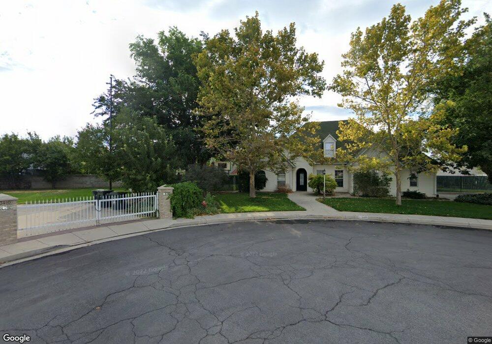
3405 El Cabrio Dr Salt Lake City, UT 84119
Granger NeighborhoodEstimated Value: $542,000 - $599,199
4
Beds
4
Baths
2,949
Sq Ft
$196/Sq Ft
Est. Value
About This Home
This home is located at 3405 El Cabrio Dr, Salt Lake City, UT 84119 and is currently estimated at $577,800, approximately $195 per square foot. 3405 El Cabrio Dr is a home located in Salt Lake County with nearby schools including Hillsdale Elementary School, West Lake Junior High School, and Granger High School.
Ownership History
Date
Name
Owned For
Owner Type
Purchase Details
Closed on
Oct 2, 2023
Sold by
Polonsky David A
Bought by
Ward Shantal and Ward Joshua
Current Estimated Value
Home Financials for this Owner
Home Financials are based on the most recent Mortgage that was taken out on this home.
Original Mortgage
$300,000
Outstanding Balance
$294,067
Interest Rate
7.09%
Mortgage Type
New Conventional
Estimated Equity
$283,733
Purchase Details
Closed on
Nov 16, 2015
Sold by
Thorup Michael D and Thorup Teresa M
Bought by
Polonsky David A
Home Financials for this Owner
Home Financials are based on the most recent Mortgage that was taken out on this home.
Original Mortgage
$223,200
Interest Rate
3.71%
Mortgage Type
New Conventional
Purchase Details
Closed on
Sep 1, 1992
Sold by
Thorup Brothers Construction Inc
Bought by
Thorup Michael D and Thorup Teresa M
Create a Home Valuation Report for This Property
The Home Valuation Report is an in-depth analysis detailing your home's value as well as a comparison with similar homes in the area
Home Values in the Area
Average Home Value in this Area
Purchase History
| Date | Buyer | Sale Price | Title Company |
|---|---|---|---|
| Ward Shantal | -- | Investors Title | |
| Polonsky David A | -- | Silver Leaf Title Ins Agcy | |
| Thorup Michael D | -- | -- |
Source: Public Records
Mortgage History
| Date | Status | Borrower | Loan Amount |
|---|---|---|---|
| Open | Ward Shantal | $300,000 | |
| Previous Owner | Polonsky David A | $223,200 |
Source: Public Records
Tax History Compared to Growth
Tax History
| Year | Tax Paid | Tax Assessment Tax Assessment Total Assessment is a certain percentage of the fair market value that is determined by local assessors to be the total taxable value of land and additions on the property. | Land | Improvement |
|---|---|---|---|---|
| 2025 | $3,823 | $584,700 | $141,700 | $443,000 |
| 2024 | $3,823 | $585,700 | $138,000 | $447,700 |
| 2023 | $4,147 | $608,300 | $132,700 | $475,600 |
| 2022 | $4,052 | $595,900 | $130,100 | $465,800 |
| 2021 | $3,676 | $485,900 | $100,100 | $385,800 |
| 2020 | $3,032 | $378,300 | $91,400 | $286,900 |
| 2019 | $2,996 | $360,500 | $86,300 | $274,200 |
| 2018 | $2,800 | $324,700 | $86,300 | $238,400 |
| 2017 | $2,562 | $302,200 | $86,300 | $215,900 |
| 2016 | $2,208 | $260,900 | $82,700 | $178,200 |
| 2015 | $2,427 | $273,100 | $88,500 | $184,600 |
| 2014 | $2,353 | $259,300 | $85,600 | $173,700 |
Source: Public Records
Map
Nearby Homes
- 3018 Asplund Cir
- 2831 S Snowdon Park Dr Unit 122
- 2841 Clearbrook Dr
- 3280 W Oxford Park Dr
- 2852 Hampton Park Dr
- 3188 S Jason Place
- 2774 S Downs Way Unit 3
- 3281 W Coventry Dr S Unit 184
- 3224 W Regency Park Dr
- 3224 W Regency Park Dr Unit 12
- 3321 Valcrest Dr Unit 3323
- 3007 W 2960 S
- 3111 S Beaver St
- 3315 Valcrest Cir Unit A
- 3315 W Valcrest Cir Unit B
- 2791 S 3050 W
- 2968 W 2920 S
- 3164 W Mark Ave
- 3869 Detevis Cir
- 3201 Barney St
- 3405 W El Cabrio Dr
- 3445 W El Cabrio Dr
- 2986 Asplund Cir
- 2994 Asplund Cir
- 2994 S Asplund Cir
- 2978 S Asplund Cir
- 2978 Asplund Cir
- 3410 El Cabrio Dr
- 3445 El Cabrio Dr
- 3002 Asplund Cir
- 2970 S Asplund Cir
- 2970 Asplund Cir
- 3048 Thorup Cir
- 3008 Asplund Cir
- 2962 S Asplund Cir
- 3008 S Asplund Cir
- 3450 El Cabrio Dr
- 2962 Asplund Cir
- 2991 S El Cajon Dr
- 3014 Asplund Cir