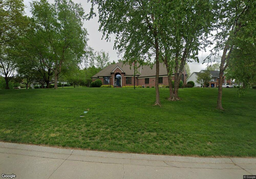
3405 N Pointe Dr Saint Joseph, MO 64506
East Saint Joseph NeighborhoodEstimated Value: $479,000 - $621,000
3
Beds
7
Baths
2,664
Sq Ft
$209/Sq Ft
Est. Value
About This Home
This home is located at 3405 N Pointe Dr, Saint Joseph, MO 64506 and is currently estimated at $557,710, approximately $209 per square foot. 3405 N Pointe Dr is a home located in Buchanan County with nearby schools including Oak Grove Elementary School, Bode Middle School, and Central High School.
Ownership History
Date
Name
Owned For
Owner Type
Purchase Details
Closed on
Jan 10, 2017
Sold by
Magee Trust
Bought by
Brickey Michael and Adams Lou Ann
Current Estimated Value
Home Financials for this Owner
Home Financials are based on the most recent Mortgage that was taken out on this home.
Original Mortgage
$55,000
Outstanding Balance
$27,435
Interest Rate
4.16%
Mortgage Type
New Conventional
Estimated Equity
$530,275
Create a Home Valuation Report for This Property
The Home Valuation Report is an in-depth analysis detailing your home's value as well as a comparison with similar homes in the area
Home Values in the Area
Average Home Value in this Area
Purchase History
| Date | Buyer | Sale Price | Title Company |
|---|---|---|---|
| Brickey Michael | -- | -- |
Source: Public Records
Mortgage History
| Date | Status | Borrower | Loan Amount |
|---|---|---|---|
| Open | Brickey Michael | $55,000 |
Source: Public Records
Tax History Compared to Growth
Tax History
| Year | Tax Paid | Tax Assessment Tax Assessment Total Assessment is a certain percentage of the fair market value that is determined by local assessors to be the total taxable value of land and additions on the property. | Land | Improvement |
|---|---|---|---|---|
| 2024 | $5,266 | $74,860 | $14,250 | $60,610 |
| 2023 | $5,266 | $74,860 | $14,250 | $60,610 |
| 2022 | $4,877 | $74,860 | $14,250 | $60,610 |
| 2021 | $4,898 | $74,860 | $14,250 | $60,610 |
| 2020 | $4,871 | $74,860 | $14,250 | $60,610 |
| 2019 | $4,701 | $74,860 | $14,250 | $60,610 |
| 2018 | $4,238 | $74,860 | $14,250 | $60,610 |
| 2017 | $4,198 | $74,860 | $0 | $0 |
| 2015 | $4,092 | $74,860 | $0 | $0 |
| 2014 | $4,092 | $74,860 | $0 | $0 |
Source: Public Records
Map
Nearby Homes
- 5418 N Pointe Dr
- 5408 N Pointe Dr
- 5415 N Pointe Dr
- 5411 N Pointe Dr
- 2 N Pointe Dr
- 0 N Pointe Dr
- 4809 N Lakewood Dr
- 4902 Corinth Dr
- 3201 Sheffield Ln
- 3804 Kingston Ct
- 4706 Donnelly Dr
- 4304 Kensington Dr
- 4703 Wilshire Dr N
- 4705 Huntsboro Ct
- 4404 Kensington Dr
- 3703 Durham Ct
- 4703 Woodland Shores Ct
- 4206 Stonegate Dr
- 4600 Valley Ridge Dr
- 4504 Valley Ridge Dr
- 3407 N Pointe Dr
- 3403 N Pointe Dr
- 3406 N Pointe Dr
- 3408 N Pointe Dr
- 3410 N Pointe Dr
- 4608 N Lakewood Dr
- 3401 N Pointe Dr
- 3404 N Pointe Dr
- 3409 N Pointe Dr
- 4704 N Lakewood Dr
- 4708 N Lakewood Dr
- 3402 N Pointe Dr
- 4606 N Lakewood Dr
- 4710 N Lakewood Dr
- 4706 N Lakewood Dr
- 3510 Harbor Pointe Dr
- 3508 Harbor Pointe Dr
- 4604 N Lakewood Dr
- 3506 Harbor Pointe Dr
- 4609 N Lakewood Dr