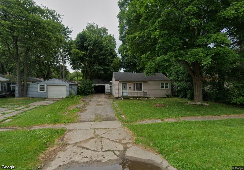
3406 Branch Rd Flint, MI 48506
Potter Longway NeighborhoodEstimated Value: $48,000 - $52,794
2
Beds
1
Bath
720
Sq Ft
$70/Sq Ft
Est. Value
About This Home
This home is located at 3406 Branch Rd, Flint, MI 48506 and is currently estimated at $50,449, approximately $70 per square foot. 3406 Branch Rd is a home located in Genesee County with nearby schools including Potter School, Richfield Public School Academy, and Richfield Early Learning Center.
Ownership History
Date
Name
Owned For
Owner Type
Purchase Details
Closed on
Nov 5, 2024
Sold by
Blevins Ella Mae and Blevins Ella M
Bought by
Simpson Robert A and Simpson Jean M
Current Estimated Value
Purchase Details
Closed on
Feb 26, 2009
Sold by
Secretary Of Housing & Urban Development
Bought by
Burnash Mark
Purchase Details
Closed on
Jul 14, 2008
Sold by
Wells Fargo Bank Na
Bought by
The Secretary Of Housing & Urban Develop
Purchase Details
Closed on
Jan 11, 2008
Sold by
Julian Loren C and Julian Larry E
Bought by
Wells Fargo Bank Na
Purchase Details
Closed on
Dec 29, 1998
Sold by
Harvey James R
Bought by
Harvey Rebecca L
Create a Home Valuation Report for This Property
The Home Valuation Report is an in-depth analysis detailing your home's value as well as a comparison with similar homes in the area
Home Values in the Area
Average Home Value in this Area
Purchase History
| Date | Buyer | Sale Price | Title Company |
|---|---|---|---|
| Simpson Robert A | $4,000 | Crossroads Title | |
| Burnash Mark | $7,000 | None Available | |
| The Secretary Of Housing & Urban Develop | -- | None Available | |
| Wells Fargo Bank Na | $35,423 | None Available | |
| Harvey Rebecca L | -- | Centennial Title & Abstract |
Source: Public Records
Tax History
| Year | Tax Paid | Tax Assessment Tax Assessment Total Assessment is a certain percentage of the fair market value that is determined by local assessors to be the total taxable value of land and additions on the property. | Land | Improvement |
|---|---|---|---|---|
| 2025 | $769 | $24,600 | $0 | $0 |
| 2024 | $704 | $20,800 | $0 | $0 |
| 2023 | $696 | $17,500 | $0 | $0 |
| 2022 | $0 | $14,500 | $0 | $0 |
| 2021 | $718 | $14,000 | $0 | $0 |
| 2020 | $656 | $11,500 | $0 | $0 |
| 2019 | $775 | $10,300 | $0 | $0 |
| 2018 | $627 | $9,000 | $0 | $0 |
| 2017 | $611 | $0 | $0 | $0 |
| 2016 | $608 | $0 | $0 | $0 |
| 2015 | -- | $0 | $0 | $0 |
| 2014 | -- | $0 | $0 | $0 |
| 2012 | -- | $10,400 | $0 | $0 |
Source: Public Records
Map
Nearby Homes
- 3118 Wyoming Ave
- 3010 Wyoming Ave
- 3210 Wyoming Ave
- 3006 Agree Ave
- 3018 Dakota Ave
- 2719 Branch Rd
- 3314 Dakota Ave
- 2701 Branch Rd
- 3413 Dakota Ave
- 2935 Richfield Rd
- 00 Richfield Rd
- 3602 Dakota Ave
- 3705 Aldon Ln
- 3149 Whittier Ave
- 2426 Hoff St
- 3734 Craig Dr
- 2217 Maryland Ave
- 3213 Holly Ave
- 2321 Levern St
- 2211 Torrance St
- 3402 Branch Rd
- 3111 Colorado Ave
- 3102 Wyoming Ave
- 3106 Wyoming Ave
- 3110 Wyoming Ave
- 3115 Colorado Ave
- 3114 Wyoming Ave
- 3119 Colorado Ave
- 3314 Branch Rd
- 3030 Wyoming Ave
- 3405 Branch Rd
- 3401 Branch Rd
- 3112 Colorado Ave
- 3123 Colorado Ave
- 3116 Colorado Ave
- 3022 Wyoming Ave
- 3026 Wyoming Ave
- 3025 Colorado Ave
- 3101 Wyoming Ave
- 3120 Colorado Ave
Your Personal Tour Guide
Ask me questions while you tour the home.