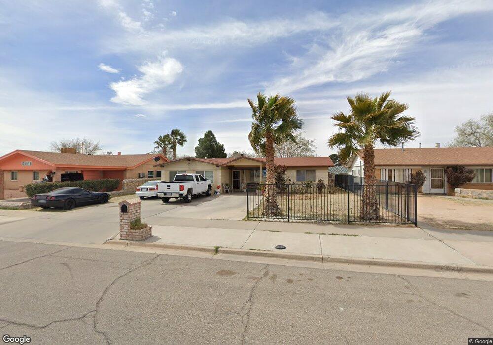
3407 Brookrock St Unit 1 El Paso, TX 79935
Pebble Hills NeighborhoodEstimated Value: $209,206 - $221,000
3
Beds
2
Baths
1,300
Sq Ft
$164/Sq Ft
Est. Value
About This Home
This home is located at 3407 Brookrock St Unit 1, El Paso, TX 79935 and is currently estimated at $213,302, approximately $164 per square foot. 3407 Brookrock St Unit 1 is a home located in El Paso County with nearby schools including Robbin E L Washington Elementary School, J M Hanks High School, and Jesus Chapel School.
Ownership History
Date
Name
Owned For
Owner Type
Purchase Details
Closed on
Sep 23, 2005
Sold by
Ochoa Hector R and Ochoa Flor M
Bought by
Amezquita Arturo and Amezquita Yolanda
Current Estimated Value
Home Financials for this Owner
Home Financials are based on the most recent Mortgage that was taken out on this home.
Original Mortgage
$40,000
Outstanding Balance
$21,238
Interest Rate
5.73%
Mortgage Type
Fannie Mae Freddie Mac
Estimated Equity
$192,064
Create a Home Valuation Report for This Property
The Home Valuation Report is an in-depth analysis detailing your home's value as well as a comparison with similar homes in the area
Home Values in the Area
Average Home Value in this Area
Purchase History
| Date | Buyer | Sale Price | Title Company |
|---|---|---|---|
| Amezquita Arturo | -- | -- |
Source: Public Records
Mortgage History
| Date | Status | Borrower | Loan Amount |
|---|---|---|---|
| Open | Amezquita Arturo | $40,000 |
Source: Public Records
Tax History Compared to Growth
Tax History
| Year | Tax Paid | Tax Assessment Tax Assessment Total Assessment is a certain percentage of the fair market value that is determined by local assessors to be the total taxable value of land and additions on the property. | Land | Improvement |
|---|---|---|---|---|
| 2025 | $1,744 | $161,385 | -- | -- |
| 2024 | $1,744 | $146,714 | -- | -- |
| 2023 | $1,658 | $133,376 | $0 | $0 |
| 2022 | $3,765 | $121,251 | $0 | $0 |
| 2021 | $3,583 | $126,069 | $20,361 | $105,708 |
| 2020 | $3,165 | $100,207 | $18,168 | $82,039 |
| 2018 | $3,093 | $99,449 | $18,168 | $81,281 |
| 2017 | $2,795 | $91,427 | $18,168 | $73,259 |
| 2016 | $2,795 | $91,427 | $18,168 | $73,259 |
| 2015 | $1,462 | $95,638 | $18,168 | $77,470 |
| 2014 | $1,462 | $96,397 | $18,168 | $78,229 |
Source: Public Records
Map
Nearby Homes
- 3400 Brookrock St
- 3425 Brookrock St
- 10602 Drillstone Dr
- 3369 Freeport Dr
- 3453 Guthrie St
- 10605 Kinross Ave Unit B
- 10649 Islerock Dr
- 10816 Cardigan Dr
- 3213 Isla Cocoa Ln
- 10405 Darin Rd
- 3332 Dungarvan Dr
- 3317 Dungarvan Dr
- 3150 N Yarbrough Dr Unit A1
- 3112 Eads Place
- 10216 Cardigan Dr
- 3345 Wexford Dr
- 3324 Kilgore Place
- 3318 Limerick Rd
- 3101 Vogue Dr
- 10905 Sagebrush Way Unit A & B
- 3407 Brookrock St
- 3409 Brookrock St
- 3405 Brookrock St
- 3413 Brookrock St
- 3401 Brookrock St
- 3406 Brookrock St
- 3408 Brookrock St
- 3404 Brookrock St
- 3417 Brookrock St
- 3412 Brookrock St
- 10640 Drillstone Dr
- 3416 Brookrock St
- 3421 Brookrock St
- 11504 Drillstone Dr
- 3409 Dial Rock Ln
- 3413 Dialrock Ln
- 3413 Dial Rock Ln
- 3405 Dialrock Ln
- 10636 Drillstone Dr
- 3405 Dial Rock Ln