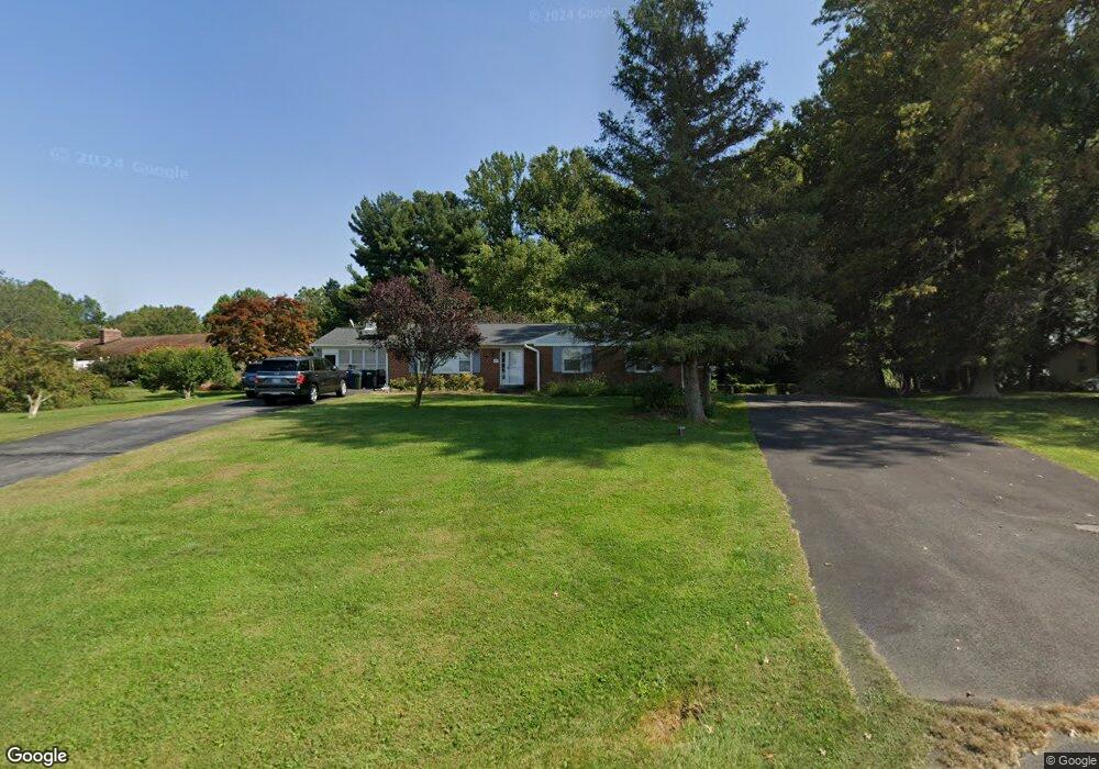
3409 Kemptown Church Rd Monrovia, MD 21770
Estimated Value: $505,733 - $671,000
--
Bed
2
Baths
2,037
Sq Ft
$295/Sq Ft
Est. Value
About This Home
This home is located at 3409 Kemptown Church Rd, Monrovia, MD 21770 and is currently estimated at $600,433, approximately $294 per square foot. 3409 Kemptown Church Rd is a home located in Frederick County with nearby schools including Kemptown Elementary School, Windsor Knolls Middle School, and Urbana High School.
Ownership History
Date
Name
Owned For
Owner Type
Purchase Details
Closed on
Jul 20, 2001
Sold by
Holmes Julie A
Bought by
Holmes Julie A and Warford Phyllis Jane
Current Estimated Value
Purchase Details
Closed on
Sep 30, 1988
Sold by
Holmes Julie A
Bought by
Holmes Julie A
Purchase Details
Closed on
May 26, 1988
Sold by
Stevens Carl E
Bought by
Holmes Julie A
Home Financials for this Owner
Home Financials are based on the most recent Mortgage that was taken out on this home.
Original Mortgage
$148,000
Interest Rate
10.52%
Create a Home Valuation Report for This Property
The Home Valuation Report is an in-depth analysis detailing your home's value as well as a comparison with similar homes in the area
Home Values in the Area
Average Home Value in this Area
Purchase History
| Date | Buyer | Sale Price | Title Company |
|---|---|---|---|
| Holmes Julie A | -- | -- | |
| Holmes Julie A | $185,000 | -- | |
| Holmes Julie A | $185,000 | -- |
Source: Public Records
Mortgage History
| Date | Status | Borrower | Loan Amount |
|---|---|---|---|
| Previous Owner | Holmes Julie A | $148,000 |
Source: Public Records
Tax History Compared to Growth
Tax History
| Year | Tax Paid | Tax Assessment Tax Assessment Total Assessment is a certain percentage of the fair market value that is determined by local assessors to be the total taxable value of land and additions on the property. | Land | Improvement |
|---|---|---|---|---|
| 2025 | $4,981 | $439,033 | -- | -- |
| 2024 | $4,981 | $399,100 | $126,000 | $273,100 |
| 2023 | $4,578 | $381,467 | $0 | $0 |
| 2022 | $4,374 | $363,833 | $0 | $0 |
| 2021 | $4,066 | $346,200 | $105,000 | $241,200 |
| 2020 | $4,066 | $337,333 | $0 | $0 |
| 2019 | $3,963 | $328,467 | $0 | $0 |
| 2018 | $3,894 | $319,600 | $105,000 | $214,600 |
| 2017 | $3,833 | $319,600 | $0 | $0 |
| 2016 | $3,833 | $315,000 | $0 | $0 |
| 2015 | $3,833 | $312,700 | $0 | $0 |
| 2014 | $3,833 | $312,700 | $0 | $0 |
Source: Public Records
Map
Nearby Homes
- 3607 Moline Ct
- 3553 Clarksburg Rd
- 10901 Moxley Rd
- 12353 Fingerboard Rd
- 3010 Burns Ct
- 3856 Saint Clair Ct
- 3887 Saint Clair Ct
- 3914 Millstone Cir
- 12034 Fingerboard Rd
- 12192 Overlook Dr
- 10200 Moxley Rd Unit PARCEL 328
- 10200 Moxley Rd Unit 350 & 191
- 11589A Nor Ray Cir
- 11201 Bethesda Church Rd
- 4105 Lynn Burke Rd
- 28411 Kemptown Rd
- 4801 Railway Cir
- 4807 Railway Cir
- 10960 Tavern Mews
- 11402 Meadowlark Dr
- 3403 Kemptown Church Rd
- 3417 Kemptown Church Rd
- 3451 Emys Place
- 3423 Kemptown Church Rd
- 3425 Kemptown Church Rd
- 3453 Emys Place
- 3427 Kemptown Church Rd
- 3429 Kemptown Church Rd
- 3450 Emys Place
- 3452 Emys Place
- 3433 Kemptown Church Rd
- 3455 Emys Place
- 3431 Kemptown Church Rd
- 3359 Kemptown Church Rd
- 3401 Kemptown Church Rd
- 3355 Kemptown Church Rd
- 3457 Emys Place
- 3456 Emys Place
- 3454 Emys Place
- 3458 Emys Place