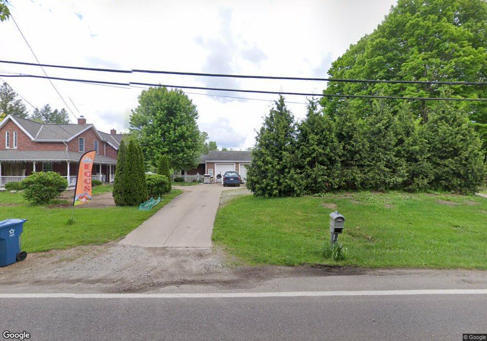
3409 Summit Rd Norton, OH 44203
Estimated Value: $206,243
4
Beds
3
Baths
2,298
Sq Ft
$90/Sq Ft
Est. Value
About This Home
This home is located at 3409 Summit Rd, Norton, OH 44203 and is currently estimated at $206,243, approximately $89 per square foot. 3409 Summit Rd is a home located in Summit County with nearby schools including Norton Primary Elementary School, Norton Middle School, and Norton High School.
Ownership History
Date
Name
Owned For
Owner Type
Purchase Details
Closed on
Mar 13, 2014
Sold by
Estright Paula J
Bought by
Estright William N and Estright Paula J
Current Estimated Value
Purchase Details
Closed on
Jun 15, 2004
Sold by
Estright William N
Bought by
Estright Paula J
Purchase Details
Closed on
Aug 25, 1999
Sold by
Golub James L
Bought by
Estright William N
Home Financials for this Owner
Home Financials are based on the most recent Mortgage that was taken out on this home.
Original Mortgage
$79,200
Outstanding Balance
$22,653
Interest Rate
7.59%
Estimated Equity
$183,590
Create a Home Valuation Report for This Property
The Home Valuation Report is an in-depth analysis detailing your home's value as well as a comparison with similar homes in the area
Home Values in the Area
Average Home Value in this Area
Purchase History
| Date | Buyer | Sale Price | Title Company |
|---|---|---|---|
| Estright William N | -- | None Available | |
| Estright Paula J | -- | -- | |
| Estright William N | $99,000 | Bond & Associates Title Agen |
Source: Public Records
Mortgage History
| Date | Status | Borrower | Loan Amount |
|---|---|---|---|
| Open | Estright William N | $79,200 |
Source: Public Records
Tax History
| Year | Tax Paid | Tax Assessment Tax Assessment Total Assessment is a certain percentage of the fair market value that is determined by local assessors to be the total taxable value of land and additions on the property. | Land | Improvement |
|---|---|---|---|---|
| 2024 | $2,937 | $71,516 | $12,670 | $58,846 |
| 2023 | $2,937 | $71,516 | $12,670 | $58,846 |
| 2022 | $3,123 | $62,447 | $11,466 | $50,981 |
| 2021 | $3,139 | $62,447 | $11,466 | $50,981 |
| 2020 | $2,933 | $62,450 | $11,470 | $50,980 |
| 2019 | $1,498 | $28,040 | $9,250 | $18,790 |
| 2018 | $1,473 | $28,040 | $9,250 | $18,790 |
| 2017 | $1,889 | $28,040 | $9,250 | $18,790 |
| 2016 | $1,889 | $32,940 | $11,180 | $21,760 |
| 2015 | $1,889 | $32,940 | $11,180 | $21,760 |
| 2014 | $1,871 | $32,940 | $11,180 | $21,760 |
| 2013 | $1,862 | $33,120 | $11,180 | $21,940 |
Source: Public Records
Map
Nearby Homes
- 2160 Ingersoll Dr
- 1974 Newton Ave
- 1772 Lakeland Ave
- 3649 Stradley Cir
- 2887 Greenridge Rd
- 3658 Knecht Rd
- 2958 Moyer Ave
- 3529 Clark Mill Rd
- 2902 S/L 16 Willow Way
- 3246 Stimson Rd
- 2943 S/L 5 Willow Way
- 1715-1731 Vernon Odom Blvd
- 2971 S/L 2 Willow Way
- 2891 S/L 10 Willow Way
- 2910 S/L 17 Willow Way
- 2038 Waycross Ave
- 714 Orchard Ave
- 197 W State St Unit 182
- 3885 Mount Vernon Blvd
- 26 W Hiram St
- 3408 Summit Rd
- 3394 Summit Rd
- 3424 Summit Rd
- 3382 Summit Rd
- 2341 Wadsworth Rd
- 3356 Summit Rd
- 2363 Wadsworth Rd
- 2371 Wadsworth Rd
- 3348 Summit Rd
- 2381 Wadsworth Rd
- 2391 Wadsworth Rd
- 2405 Wadsworth Rd
- 2316 Oak Point Dr
- 2300 Oak Point Dr
- 2292 Oak Point Dr
- 2415 Wadsworth Rd
- 2284 Oak Point Dr
- 2276 Oak Point Dr
- 9999 Summit County
- 3496 Summit Rd
Your Personal Tour Guide
Ask me questions while you tour the home.