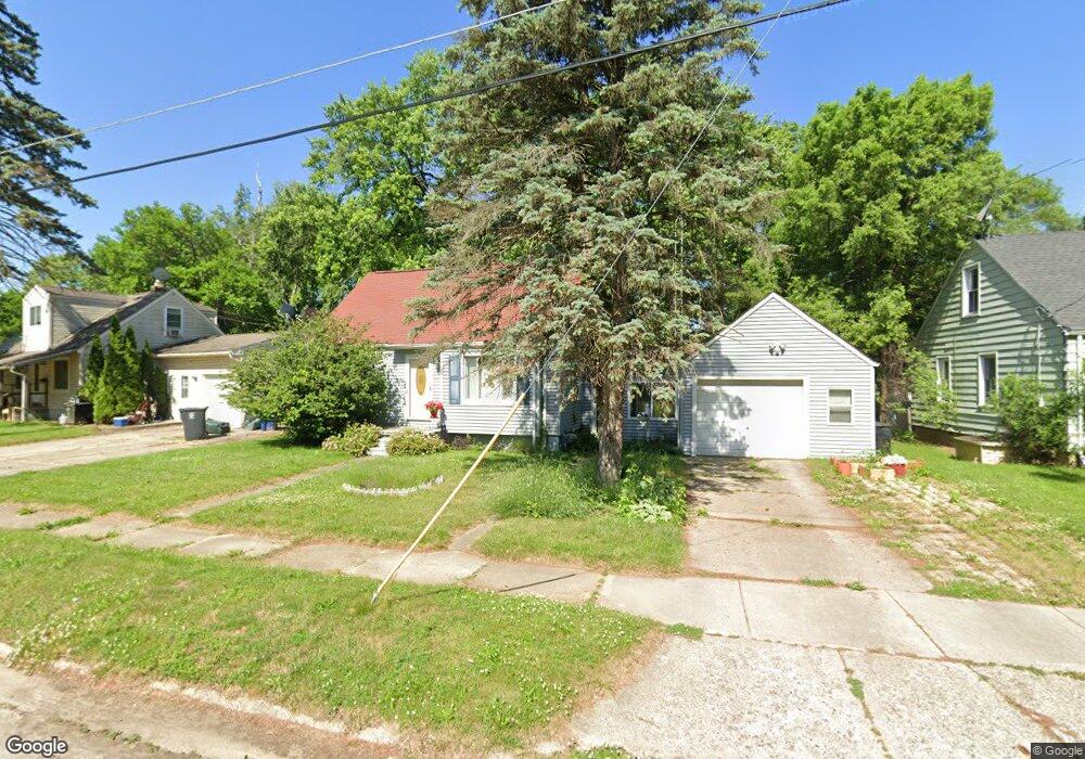
341 Browning Ave Flint, MI 48507
Circle Drive NeighborhoodEstimated Value: $68,675 - $94,000
3
Beds
1
Bath
948
Sq Ft
$86/Sq Ft
Est. Value
About This Home
This home is located at 341 Browning Ave, Flint, MI 48507 and is currently estimated at $81,419, approximately $85 per square foot. 341 Browning Ave is a home located in Genesee County with nearby schools including Freeman Elementary School, Flint Southwestern Classical Academy, and International Academy of Flint (K-12).
Ownership History
Date
Name
Owned For
Owner Type
Purchase Details
Closed on
May 16, 2024
Sold by
Labick Michael J and Labick Ines Marie
Bought by
Michael And Ines Labick Living Trust and Labick
Current Estimated Value
Purchase Details
Closed on
Apr 30, 1999
Sold by
Marie Hall I and Marie Ines Marie
Bought by
Labick Michael J and Labick Ines Marie
Home Financials for this Owner
Home Financials are based on the most recent Mortgage that was taken out on this home.
Original Mortgage
$40,000
Interest Rate
7.04%
Mortgage Type
Stand Alone Second
Create a Home Valuation Report for This Property
The Home Valuation Report is an in-depth analysis detailing your home's value as well as a comparison with similar homes in the area
Home Values in the Area
Average Home Value in this Area
Purchase History
| Date | Buyer | Sale Price | Title Company |
|---|---|---|---|
| Michael And Ines Labick Living Trust | -- | None Listed On Document | |
| Labick Michael J | -- | -- |
Source: Public Records
Mortgage History
| Date | Status | Borrower | Loan Amount |
|---|---|---|---|
| Previous Owner | Labick Michael J | $40,000 |
Source: Public Records
Tax History
| Year | Tax Paid | Tax Assessment Tax Assessment Total Assessment is a certain percentage of the fair market value that is determined by local assessors to be the total taxable value of land and additions on the property. | Land | Improvement |
|---|---|---|---|---|
| 2025 | $992 | $29,100 | $0 | $0 |
| 2024 | $899 | $28,900 | $0 | $0 |
| 2023 | $883 | $22,100 | $0 | $0 |
| 2022 | $0 | $17,800 | $0 | $0 |
| 2021 | $917 | $15,700 | $0 | $0 |
| 2020 | $827 | $14,000 | $0 | $0 |
| 2019 | $806 | $11,600 | $0 | $0 |
| 2018 | $806 | $11,600 | $0 | $0 |
| 2017 | $784 | $0 | $0 | $0 |
| 2016 | $779 | $0 | $0 | $0 |
| 2015 | -- | $0 | $0 | $0 |
| 2014 | -- | $0 | $0 | $0 |
| 2012 | -- | $14,900 | $0 | $0 |
Source: Public Records
Map
Nearby Homes
- 338 Browning Ave
- 4526 Milton Dr
- 4205 Red Arrow Rd
- 4127 Custer Ave
- 326 Burroughs Ave
- 416 Burroughs Ave
- 352 Buckingham Ave
- 530 McKeighan Ave
- 361 Buckingham Ave
- 617 McKeighan Ave
- 621 Lochhead Ave
- 1483 Carman St
- 3442 Griffith Ct
- 1453 Carman St
- 621 Burroughs Ave
- 1450 Carman St
- 630 Buckingham Ave
- 802 McKeighan Ave
- 818 Dell Ave
- 1388 Carman St
- 347 Browning Ave
- 329 Browning Ave
- 353 Browning Ave
- 323 Browning Ave
- 4606 Milton Dr
- 342 Browning Ave
- 4610 Milton Dr
- 346 Browning Ave
- 359 Browning Ave
- 334 Browning Ave
- 315 Browning Ave
- 4614 Milton Dr
- 354 Browning Ave
- 330 Browning Ave
- 365 Browning Ave
- 326 Browning Ave
- 4618 Milton Dr
- 405 Bede St
- 409 Bede St
- 401 Bede St
Your Personal Tour Guide
Ask me questions while you tour the home.