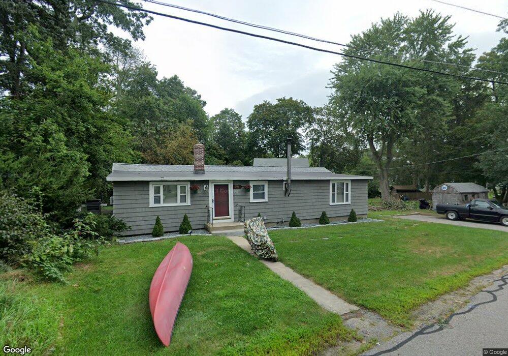
341 Forest Grove Ave Wrentham, MA 02093
Estimated Value: $409,000 - $500,159
2
Beds
1
Bath
1,072
Sq Ft
$418/Sq Ft
Est. Value
About This Home
This home is located at 341 Forest Grove Ave, Wrentham, MA 02093 and is currently estimated at $448,540, approximately $418 per square foot. 341 Forest Grove Ave is a home located in Norfolk County with nearby schools including Delaney Elementary School and Charles E Roderick.
Ownership History
Date
Name
Owned For
Owner Type
Purchase Details
Closed on
Apr 28, 1994
Sold by
Barron Leo and Barrons Patricia A
Bought by
Crossley James L
Current Estimated Value
Home Financials for this Owner
Home Financials are based on the most recent Mortgage that was taken out on this home.
Original Mortgage
$67,200
Interest Rate
7.7%
Mortgage Type
Purchase Money Mortgage
Purchase Details
Closed on
Dec 17, 1990
Sold by
Hayes Francis M
Bought by
Hayes Patricia A
Create a Home Valuation Report for This Property
The Home Valuation Report is an in-depth analysis detailing your home's value as well as a comparison with similar homes in the area
Home Values in the Area
Average Home Value in this Area
Purchase History
| Date | Buyer | Sale Price | Title Company |
|---|---|---|---|
| Crossley James L | $84,000 | -- | |
| Hayes Patricia A | $10,000 | -- |
Source: Public Records
Mortgage History
| Date | Status | Borrower | Loan Amount |
|---|---|---|---|
| Open | Hayes Patricia A | $64,000 | |
| Closed | Hayes Patricia A | $67,200 |
Source: Public Records
Tax History Compared to Growth
Tax History
| Year | Tax Paid | Tax Assessment Tax Assessment Total Assessment is a certain percentage of the fair market value that is determined by local assessors to be the total taxable value of land and additions on the property. | Land | Improvement |
|---|---|---|---|---|
| 2025 | $4,533 | $391,100 | $218,200 | $172,900 |
| 2024 | $4,166 | $347,200 | $218,200 | $129,000 |
| 2023 | $3,906 | $309,500 | $198,400 | $111,100 |
| 2022 | $4,057 | $296,800 | $193,000 | $103,800 |
| 2021 | $3,928 | $279,200 | $180,400 | $98,800 |
| 2020 | $3,303 | $231,800 | $137,700 | $94,100 |
| 2019 | $3,272 | $231,700 | $137,700 | $94,000 |
| 2018 | $3,114 | $218,700 | $138,300 | $80,400 |
| 2017 | $2,988 | $209,700 | $135,600 | $74,100 |
| 2016 | $2,935 | $205,500 | $131,700 | $73,800 |
| 2015 | $2,882 | $192,400 | $126,600 | $65,800 |
| 2014 | $2,849 | $186,100 | $121,800 | $64,300 |
Source: Public Records
Map
Nearby Homes
- 246 Forest Grove Ave
- 3 Oak Rd
- 0 W Birch Rd
- 10 W Birch Rd
- 45 King St
- 3 Sparrow Rd
- 38 Robin Rd
- 45 Joshua Rd
- 11 Quail Run Rd
- 2 Diamond St
- 3 Pheasanthill Rd
- 14 Essex St
- 50 Reed Fulton Ave Unit Lot 61
- 23 Fredrickson Rd
- 270 Dedham St
- 71 Pond St
- 1 Lorraine Metcalf Dr
- 6 Trailside Way
- 570 Franklin St
- 10 Nature View Dr
- 347 Forest Grove Ave
- 340 Forest Grove Ave
- 346 Forest Grove Ave
- 344 Forest Grove Ave
- 344 Forest Grove Ave Unit B
- 20 Spruce Rd
- 357 Forest Grove Ave
- 348 Forest Grove Ave
- 350 Forest Grove Ave
- 324 Forest Grove Ave
- 363 Forest Grove Ave
- 356 Forest Grove Ave
- 7 Spruce Rd
- 360 Forest Grove Ave
- 364 Forest Grove Ave
- 367 Forest Grove Ave
- 352 Forest Grove Ave
- 368 Forest Grove Ave
- 308 Forest Grove Ave
- 374 Forest Grove Ave