Estimated Value: $316,804 - $350,000
4
Beds
2
Baths
2,583
Sq Ft
$128/Sq Ft
Est. Value
About This Home
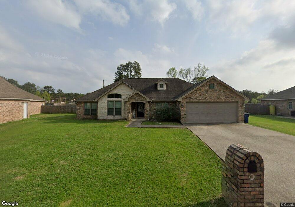
This home is located at 3410 Michelle Ave, Vidor, TX 77662 and is currently estimated at $331,201, approximately $128 per square foot. 3410 Michelle Ave is a home located in Orange County.
Ownership History
Date
Name
Owned For
Owner Type
Purchase Details
Closed on
Dec 10, 2012
Sold by
Wilson Thomas K and Wilson Melissa D
Bought by
Franks Jeremy Watson and Franks Ame Noel
Current Estimated Value
Home Financials for this Owner
Home Financials are based on the most recent Mortgage that was taken out on this home.
Original Mortgage
$199,405
Outstanding Balance
$137,923
Interest Rate
3.41%
Mortgage Type
New Conventional
Estimated Equity
$193,278
Purchase Details
Closed on
Jun 24, 2008
Sold by
P J Norman Of Pcsn Lp
Bought by
Wilson Thomas K and Wilson Melissa D
Purchase Details
Closed on
Feb 10, 2006
Sold by
T N J Corporation
Bought by
Franks Jeremy Watson and Ame Noel
Create a Home Valuation Report for This Property
The Home Valuation Report is an in-depth analysis detailing your home's value as well as a comparison with similar homes in the area
Home Values in the Area
Average Home Value in this Area
Purchase History
| Date | Buyer | Sale Price | Title Company |
|---|---|---|---|
| Franks Jeremy Watson | -- | None Available | |
| Wilson Thomas K | $17,500 | Thomas K & Melissa D Wilson | |
| Franks Jeremy Watson | -- | -- | |
| Franks Jeremy Watson | -- | -- |
Source: Public Records
Mortgage History
| Date | Status | Borrower | Loan Amount |
|---|---|---|---|
| Open | Franks Jeremy Watson | $199,405 |
Source: Public Records
Tax History Compared to Growth
Tax History
| Year | Tax Paid | Tax Assessment Tax Assessment Total Assessment is a certain percentage of the fair market value that is determined by local assessors to be the total taxable value of land and additions on the property. | Land | Improvement |
|---|---|---|---|---|
| 2025 | $5,096 | $329,326 | $19,900 | $309,426 |
| 2024 | $3,564 | $336,108 | $19,900 | $316,208 |
| 2023 | $4,808 | $327,575 | $19,900 | $307,675 |
| 2022 | $3,785 | $287,660 | $19,900 | $267,760 |
| 2021 | $4,732 | $254,408 | $19,900 | $243,420 |
| 2020 | $2,083 | $108,700 | $19,900 | $88,800 |
| 2019 | $4,471 | $231,280 | $19,900 | $211,380 |
| 2018 | $1,341 | $70,190 | $19,900 | $50,290 |
| 2017 | $3,378 | $221,090 | $19,900 | $201,190 |
| 2016 | $3,937 | $206,180 | $19,900 | $186,280 |
| 2015 | $3,025 | $195,893 | $19,900 | $175,993 |
| 2014 | $3,025 | $193,434 | $19,900 | $173,534 |
Source: Public Records
Map
Nearby Homes
- 3455 Michelle Ave
- 230 Christel
- 15600 Interstate 10
- 15600 Interstate 10
- 15660 Interstate 10
- 486 Parish Rd
- 346 Callie Ln
- 559 Doty Rd
- 13385 Interstate 10 E
- 1217 Liston Rd
- 9010 Terry Estates Dr
- 950 Millie St
- 4010 Shadowdale Ln
- 8594 Morgan Ln
- 0 Fm 1132 Unit 93970706
- 12575 Ih-10 E
- 9861 Fm 1442
- 0 Edgewood
- 4560 Townsend Dr
- 2651 Claire Dr
- 3420 Michelle Ave
- 3400 Michelle Ave
- 3430 Michelle Ave
- 3415 Michelle Ave
- 0 Michelle Ave
- 3405 Michelle Ave
- 3490 Michelle Ave
- 3500 Michelle Ave
- 3365 Michelle Ave
- 3445 Michelle Ave
- 3355 Michelle Ave
- 3340 Michelle Ave
- 215 Christel
- 3345 Michelle Ave
- 3470 Michelle Ave
- 210 Christel
- 14938 Interstate 10
- 3335 Michelle Ave
- 3320 Michelle Ave
- 3480 Michelle Ave