Estimated Value: $363,000 - $425,000
Studio
2
Baths
2,425
Sq Ft
$162/Sq Ft
Est. Value
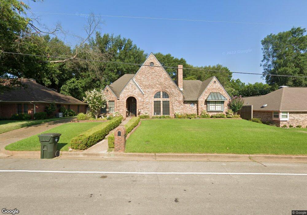
About This Home
This home is located at 3411 Brookside Dr, Tyler, TX 75701 and is currently estimated at $392,606, approximately $161 per square foot. 3411 Brookside Dr is a home located in Smith County with nearby schools including Woods Elementary School, Hubbard Middle School, and Tyler Legacy High School.
Ownership History
Date
Name
Owned For
Owner Type
Purchase Details
Closed on
Aug 15, 2005
Sold by
Fears Weaver Dowl Richard and Fears Weaver Carmen
Bought by
Wells Sam L and Wells Marsha R
Current Estimated Value
Home Financials for this Owner
Home Financials are based on the most recent Mortgage that was taken out on this home.
Original Mortgage
$182,986
Outstanding Balance
$93,988
Interest Rate
5.51%
Mortgage Type
Purchase Money Mortgage
Estimated Equity
$298,618
Create a Home Valuation Report for This Property
The Home Valuation Report is an in-depth analysis detailing your home's value as well as a comparison with similar homes in the area
Purchase History
| Date | Buyer | Sale Price | Title Company |
|---|---|---|---|
| Wells Sam L | -- | None Available | |
| Wells Sam L | -- | None Available |
Source: Public Records
Mortgage History
| Date | Status | Borrower | Loan Amount |
|---|---|---|---|
| Open | Wells Sam L | $182,986 | |
| Closed | Wells Sam L | $182,986 |
Source: Public Records
Tax History
| Year | Tax Paid | Tax Assessment Tax Assessment Total Assessment is a certain percentage of the fair market value that is determined by local assessors to be the total taxable value of land and additions on the property. | Land | Improvement |
|---|---|---|---|---|
| 2025 | $2,310 | $438,221 | $70,006 | $368,215 |
| 2024 | $2,310 | $298,640 | $23,390 | $390,717 |
| 2023 | $4,733 | $345,219 | $23,390 | $321,829 |
| 2022 | $4,835 | $319,696 | $23,390 | $296,306 |
| 2021 | $4,707 | $224,373 | $23,390 | $200,983 |
| 2020 | $4,729 | $220,994 | $23,390 | $197,604 |
| 2019 | $4,642 | $212,265 | $23,390 | $188,875 |
| 2018 | $4,581 | $210,615 | $23,390 | $187,225 |
| 2017 | $4,496 | $210,615 | $23,390 | $187,225 |
| 2016 | $4,412 | $206,668 | $23,390 | $183,278 |
| 2015 | $4,037 | $198,787 | $23,390 | $175,397 |
| 2014 | $4,037 | $189,991 | $23,390 | $166,601 |
Source: Public Records
Map
Nearby Homes
- 612 Rosemont Place II
- 3500 Silverwood Dr
- 604-606 Woodland Hills Dr
- 3308 Trafalgar Square
- 504 Hyde Park Dr
- 3501 Silverwood Dr
- 507 Hyde Park Dr
- 3613 Silverwood Dr
- 640 Beechwood Dr
- 3518 Cloverdale Dr
- 504 Woodland Hills Dr
- 509 Buckingham Place
- 505 Buckingham Place
- 614 Zelwood Dr
- 1111 Beechwood Dr
- 736 Fairmont Dr
- 745 Fairmont Dr
- 1218 Kingsbury Rd
- 410 Brighton Ct
- 406 Brighton Ct
- 3413 Brookside Dr
- 3409 Brookside Dr
- 3412 Teakwood Dr
- 3412 3412 Teakwood Dr
- 3410 Teakwood Dr
- 601 Rosemont Place
- 3407 Brookside Dr
- 3423 Harwood Dr
- 701 Gabriel Dr
- 638 Sherry Ln
- 3408 Teakwood Dr
- 703 Gabriel Dr
- 3405 Brookside Dr
- 603 603 Rosemont Place
- 603 Rosemont Place
- 3421 Harwood Dr
- 3406 Teakwood Dr
- 630 Sherry Ln
- 705 Gabriel Dr
- 705 705 Gabriel
Your Personal Tour Guide
Ask me questions while you tour the home.