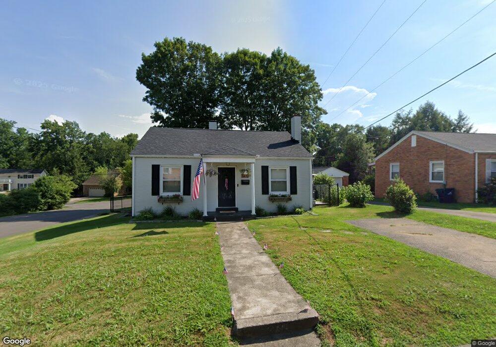
3412 Euclid Ave Ashland, KY 41102
13th Street-Boy Scout Road NeighborhoodEstimated Value: $143,000 - $175,000
2
Beds
2
Baths
1,520
Sq Ft
$103/Sq Ft
Est. Value
About This Home
This home is located at 3412 Euclid Ave, Ashland, KY 41102 and is currently estimated at $156,446, approximately $102 per square foot. 3412 Euclid Ave is a home located in Boyd County with nearby schools including Paul G. Blazer High School.
Ownership History
Date
Name
Owned For
Owner Type
Purchase Details
Closed on
Mar 3, 2021
Sold by
Boggs Melissa K and Cathers Melissa K
Bought by
Royalty Samantha J and Pruitt Justin
Current Estimated Value
Home Financials for this Owner
Home Financials are based on the most recent Mortgage that was taken out on this home.
Original Mortgage
$108,640
Outstanding Balance
$97,388
Interest Rate
2.7%
Mortgage Type
New Conventional
Estimated Equity
$59,058
Purchase Details
Closed on
May 14, 2014
Sold by
Meade Justin and Meade Kristina
Bought by
Boggs Melissa
Purchase Details
Closed on
Feb 23, 2011
Sold by
Smith Robert Lowry and Smith Charles
Bought by
Boggs Melissa
Home Financials for this Owner
Home Financials are based on the most recent Mortgage that was taken out on this home.
Original Mortgage
$80,000
Interest Rate
4.66%
Mortgage Type
Purchase Money Mortgage
Create a Home Valuation Report for This Property
The Home Valuation Report is an in-depth analysis detailing your home's value as well as a comparison with similar homes in the area
Home Values in the Area
Average Home Value in this Area
Purchase History
| Date | Buyer | Sale Price | Title Company |
|---|---|---|---|
| Royalty Samantha J | $112,000 | None Listed On Document | |
| Royalty Samantha J | $112,000 | None Available | |
| Boggs Melissa | -- | None Available | |
| Boggs Melissa | $75,000 | None Available |
Source: Public Records
Mortgage History
| Date | Status | Borrower | Loan Amount |
|---|---|---|---|
| Open | Royalty Samantha J | $108,640 | |
| Closed | Royalty Samantha J | $108,640 | |
| Previous Owner | Boggs Melissa | $80,000 |
Source: Public Records
Tax History Compared to Growth
Tax History
| Year | Tax Paid | Tax Assessment Tax Assessment Total Assessment is a certain percentage of the fair market value that is determined by local assessors to be the total taxable value of land and additions on the property. | Land | Improvement |
|---|---|---|---|---|
| 2024 | $701 | $112,000 | $10,000 | $102,000 |
| 2023 | $710 | $112,000 | $10,000 | $102,000 |
| 2022 | $718 | $112,000 | $10,000 | $102,000 |
| 2021 | $531 | $80,000 | $10,000 | $70,000 |
| 2020 | $541 | $80,000 | $10,000 | $70,000 |
| 2019 | $543 | $80,000 | $0 | $0 |
| 2018 | $517 | $75,000 | $0 | $0 |
| 2017 | $478 | $75,000 | $0 | $0 |
| 2016 | $451 | $75,000 | $10,000 | $65,000 |
| 2015 | $451 | $75,000 | $10,000 | $65,000 |
| 2012 | -- | $75,000 | $10,000 | $65,000 |
Source: Public Records
Map
Nearby Homes
- 0 County Road 103 Unit 25169836
- 3210 Ridgeway Dr
- 3232 Blackburn Ave
- 3239 Walters Hill Dr
- 3302 Walters Hill Dr
- 2801 Terrace Blvd
- 2741 Jackson Ave
- 2753 Jackson Ave
- 2701 S Belmont St
- 2616 Monroe St
- 2830 S Belmont St
- 3440 Randy Dr
- 2745 Adams St
- 2325 Smith St
- 2610 S 29th St
- 2930 Monroe St
- 4009 Ferguson Dr
- 2240 Barton Ct
- 4019 Ferguson Dr
- 2256 Crooks St
- 3406 Euclid Ave
- 3422 Euclid Ave
- 3400 Euclid Ave
- 2545 Auburn Ave
- 2545 W Euclid Ave
- 3401 Thompson Dr
- 2538 W Euclid Ave
- 3430 Euclid Ave
- 2700 Auburn Ave
- 3415 Thompson Dr
- 2528 W Euclid Ave
- 2535 Auburn Ave
- 2539 E Euclid Ave
- 2549 E Euclid Ave
- 2701 Auburn Ave
- 3431 Peacock Dr
- 2541 W Euclid Ave
- 2532 Auburn Ave
- 2524 W Euclid Ave