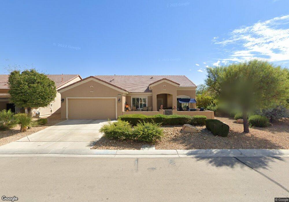
3413 Lapwing Dr Unit 2 North Las Vegas, NV 89084
Aliante NeighborhoodEstimated Value: $436,520 - $462,000
2
Beds
2
Baths
2,104
Sq Ft
$213/Sq Ft
Est. Value
About This Home
This home is located at 3413 Lapwing Dr Unit 2, North Las Vegas, NV 89084 and is currently estimated at $447,880, approximately $212 per square foot. 3413 Lapwing Dr Unit 2 is a home located in Clark County with nearby schools including Vincent L. Triggs Elementary School, Anthony Saville Middle School, and Shadow Ridge High School.
Ownership History
Date
Name
Owned For
Owner Type
Purchase Details
Closed on
Sep 15, 2022
Sold by
Minster Marshall N
Bought by
Minster Family Revocable Living Trust
Current Estimated Value
Purchase Details
Closed on
Jul 16, 2003
Sold by
Pn Ii Inc
Bought by
Minster Marshall N and Minster Phyllis R
Home Financials for this Owner
Home Financials are based on the most recent Mortgage that was taken out on this home.
Original Mortgage
$207,103
Interest Rate
5.18%
Mortgage Type
Unknown
Create a Home Valuation Report for This Property
The Home Valuation Report is an in-depth analysis detailing your home's value as well as a comparison with similar homes in the area
Home Values in the Area
Average Home Value in this Area
Purchase History
| Date | Buyer | Sale Price | Title Company |
|---|---|---|---|
| Minster Family Revocable Living Trust | -- | -- | |
| Minster Marshall N | $266,879 | Lawyers Title Of Nevada |
Source: Public Records
Mortgage History
| Date | Status | Borrower | Loan Amount |
|---|---|---|---|
| Previous Owner | Minster Marshall N | $207,103 |
Source: Public Records
Tax History Compared to Growth
Tax History
| Year | Tax Paid | Tax Assessment Tax Assessment Total Assessment is a certain percentage of the fair market value that is determined by local assessors to be the total taxable value of land and additions on the property. | Land | Improvement |
|---|---|---|---|---|
| 2025 | $2,482 | $116,417 | $29,400 | $87,017 |
| 2024 | $2,410 | $116,417 | $29,400 | $87,017 |
| 2023 | $2,410 | $113,660 | $31,605 | $82,055 |
| 2022 | $2,340 | $102,175 | $27,195 | $74,980 |
| 2021 | $2,272 | $95,510 | $24,255 | $71,255 |
| 2020 | $2,199 | $93,920 | $23,520 | $70,400 |
| 2019 | $2,135 | $90,451 | $21,315 | $69,136 |
| 2018 | $2,073 | $83,326 | $16,905 | $66,421 |
| 2017 | $2,769 | $81,702 | $15,400 | $66,302 |
| 2016 | $1,963 | $79,919 | $13,475 | $66,444 |
| 2015 | $1,959 | $64,474 | $10,780 | $53,694 |
| 2014 | $1,901 | $54,199 | $7,700 | $46,499 |
Source: Public Records
Map
Nearby Homes
- 3312 Lapwing Dr
- 3220 Flinthead Dr
- 3405 Kingbird Dr
- 7910 Kiskadee St
- 7839 Lyrebird Dr
- 7741 Fruit Dove St Unit 4
- 7927 Crested Starling Ct
- 7649 Broadwing Dr
- 3516 Herring Gull Ln Unit 3
- 7713 Lily Trotter St
- 7921 Fantail Dr
- 3124 Kookaburra Way
- 7937 Lily Trotter St
- 7804 Island Rail Dr
- 7905 Grey Teal St
- 7948 Fantail Dr Unit 3
- 3807 Andorian Ave
- 7633 Lily Trotter St
- 3109 Frigate Way
- 7617 Fieldfare Dr
- 3417 Lapwing Dr
- 3409 Lapwing Dr
- 3421 Lapwing Dr Unit 2
- 7805 Broadwing Dr
- 7809 Broadwing Dr
- 3412 Lapwing Dr
- 3321 Lapwing Dr
- 7749 Broadwing Dr
- 3408 Lapwing Dr Unit 2
- 3416 Lapwing Dr
- 3425 Lapwing Dr
- 7813 Broadwing Dr
- 3420 Lapwing Dr
- 7745 Broadwing Dr
- 3404 Lapwing Dr
- 3317 Lapwing Dr
- 3324 Lapwing Dr
- 3424 Lapwing Dr
- 3429 Lapwing Dr
- 7817 Broadwing Dr