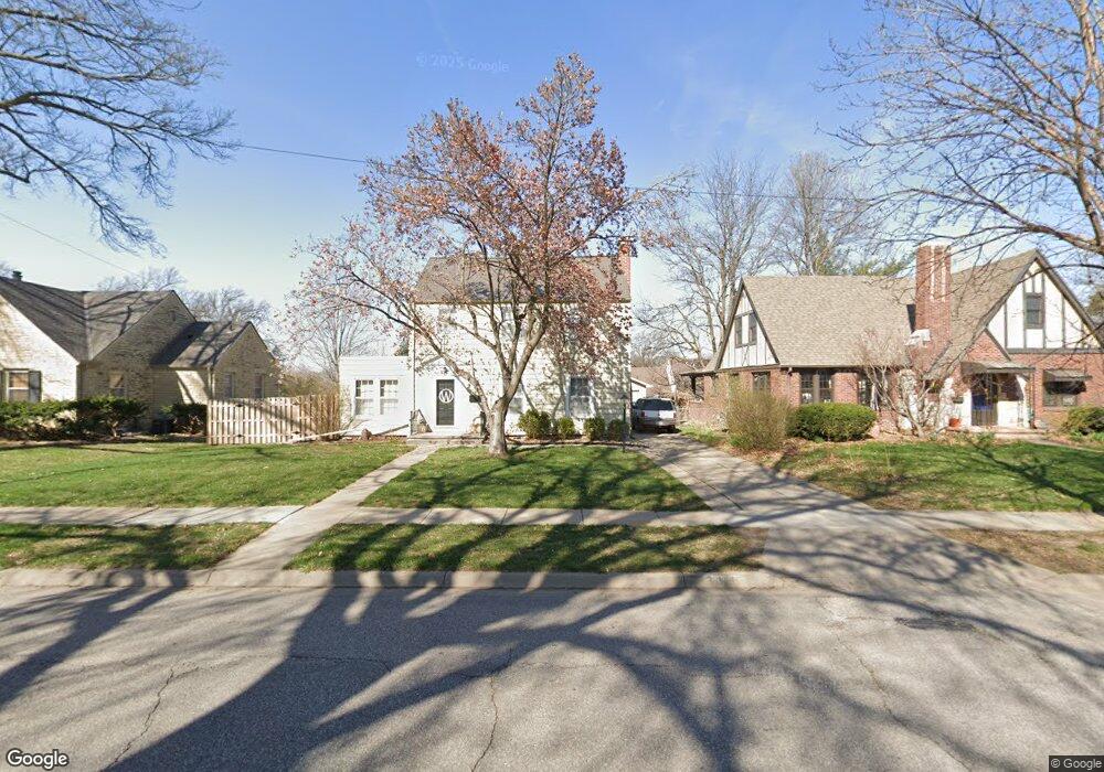
3415 S 17th St Lincoln, NE 68502
Indian Village NeighborhoodEstimated Value: $322,000 - $427,000
3
Beds
3
Baths
2,238
Sq Ft
$169/Sq Ft
Est. Value
About This Home
This home is located at 3415 S 17th St, Lincoln, NE 68502 and is currently estimated at $377,585, approximately $168 per square foot. 3415 S 17th St is a home located in Lancaster County with nearby schools including Beattie Elementary School, Irving Middle School, and Lincoln Southeast High School.
Ownership History
Date
Name
Owned For
Owner Type
Purchase Details
Closed on
Jul 28, 2014
Sold by
Wilson Brian P and Wilson Amanda L
Bought by
Wenstrand Keith D and Wenstrand Cari Lynn M
Current Estimated Value
Home Financials for this Owner
Home Financials are based on the most recent Mortgage that was taken out on this home.
Original Mortgage
$236,900
Outstanding Balance
$180,717
Interest Rate
4.2%
Mortgage Type
Unknown
Estimated Equity
$196,868
Purchase Details
Closed on
May 26, 2004
Sold by
Pursell Emily Josephine and Pursell Jo Reese
Bought by
Wilson Brian P and Botz Amanda L
Home Financials for this Owner
Home Financials are based on the most recent Mortgage that was taken out on this home.
Original Mortgage
$133,600
Interest Rate
5.97%
Mortgage Type
Unknown
Create a Home Valuation Report for This Property
The Home Valuation Report is an in-depth analysis detailing your home's value as well as a comparison with similar homes in the area
Home Values in the Area
Average Home Value in this Area
Purchase History
| Date | Buyer | Sale Price | Title Company |
|---|---|---|---|
| Wenstrand Keith D | $237,000 | Nebraska Land Title & Abstra | |
| Wilson Brian P | $167,000 | -- |
Source: Public Records
Mortgage History
| Date | Status | Borrower | Loan Amount |
|---|---|---|---|
| Open | Wenstrand Keith D | $236,900 | |
| Previous Owner | Wilson Brian P | $133,600 | |
| Closed | Wilson Brian P | $25,050 |
Source: Public Records
Tax History Compared to Growth
Tax History
| Year | Tax Paid | Tax Assessment Tax Assessment Total Assessment is a certain percentage of the fair market value that is determined by local assessors to be the total taxable value of land and additions on the property. | Land | Improvement |
|---|---|---|---|---|
| 2025 | $4,926 | $340,100 | $70,200 | $269,900 |
| 2024 | $4,926 | $350,900 | $58,500 | $292,400 |
| 2023 | $5,400 | $322,200 | $45,000 | $277,200 |
| 2022 | $4,963 | $249,000 | $35,000 | $214,000 |
| 2021 | $4,695 | $249,000 | $35,000 | $214,000 |
| 2020 | $4,580 | $239,700 | $35,000 | $204,700 |
| 2019 | $4,581 | $239,700 | $35,000 | $204,700 |
| 2018 | $4,420 | $230,300 | $35,000 | $195,300 |
| 2017 | $4,461 | $230,300 | $35,000 | $195,300 |
| 2016 | $4,393 | $225,600 | $30,000 | $195,600 |
| 2015 | $4,363 | $225,600 | $30,000 | $195,600 |
| 2014 | $3,511 | $180,500 | $30,000 | $150,500 |
| 2013 | -- | $180,500 | $30,000 | $150,500 |
Source: Public Records
Map
Nearby Homes
- 3609 S 18th St
- 3645 S 17th St
- 3345 Grimsby Ln
- 1444 Dakota St
- 1736 Sunny Hill Rd
- 1916 Pawnee St
- 1732 Rancho Rd
- 4101 S 17th St
- 1711 Rancho Rd
- 1605 Van Dorn St
- 2934 S 13th St
- 2810 S 14th St
- 1820 Brower Rd
- 2760 S 13th St
- 2950 S 11th St
- 1837 Harrison Ave
- 4160 Dunn Ave
- 2535 Saint Thomas Dr
- 2810 S 11th St
- 2601 Woodsdale Blvd
- 3425 S 17th St
- 3401 S 17th St
- 1669 Arapahoe St
- 3435 S 17th St
- 1666 Nemaha St
- 1661 Arapahoe St
- 1656 Nemaha St
- 3440 S 17th St
- 3450 S 17th St
- 3430 S 17th St
- 1655 Arapahoe St
- 3460 S 17th St
- 3335 S 17th St
- 1650 Nemaha St
- 3424 S 17th St
- 1672 Arapahoe St
- 1666 Arapahoe St
- 1645 Arapahoe St
- 3500 S 17th St
- 3412 S 17th St