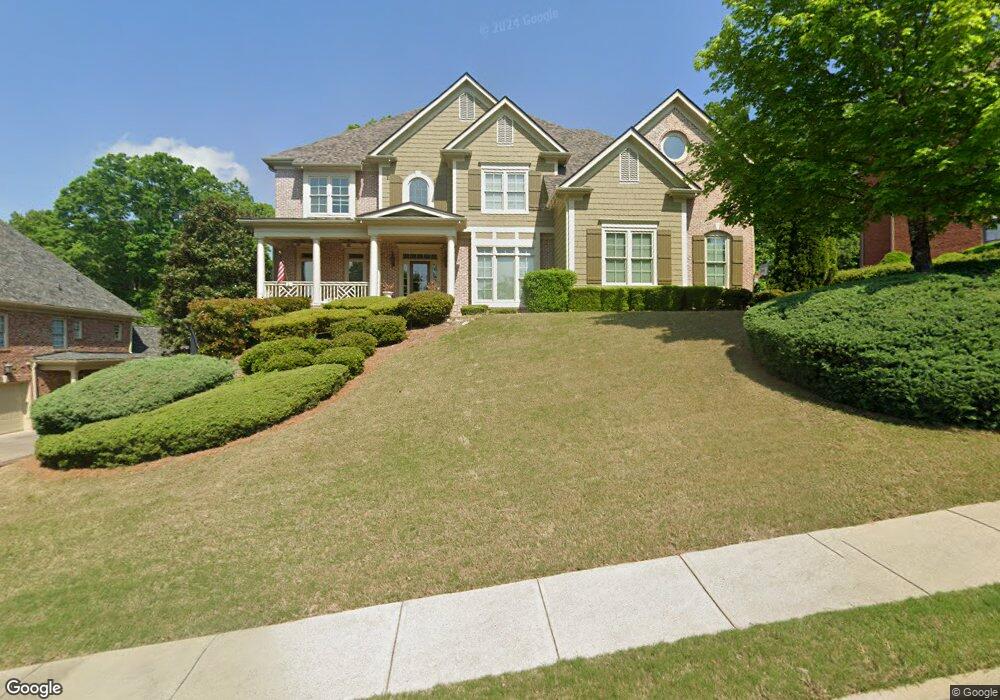
3418 Binghurst Rd Suwanee, GA 30024
Estimated Value: $1,214,544 - $1,400,000
6
Beds
6
Baths
5,173
Sq Ft
$254/Sq Ft
Est. Value
About This Home
This home is located at 3418 Binghurst Rd, Suwanee, GA 30024 and is currently estimated at $1,316,386, approximately $254 per square foot. 3418 Binghurst Rd is a home located in Gwinnett County with nearby schools including Riverside Elementary School, North Gwinnett Middle School, and North Gwinnett High School.
Ownership History
Date
Name
Owned For
Owner Type
Purchase Details
Closed on
Jan 30, 2004
Sold by
Stoneport Properties Inc
Bought by
Jones Gregory and Jones Michele
Current Estimated Value
Home Financials for this Owner
Home Financials are based on the most recent Mortgage that was taken out on this home.
Original Mortgage
$512,000
Interest Rate
5.72%
Mortgage Type
New Conventional
Create a Home Valuation Report for This Property
The Home Valuation Report is an in-depth analysis detailing your home's value as well as a comparison with similar homes in the area
Home Values in the Area
Average Home Value in this Area
Purchase History
| Date | Buyer | Sale Price | Title Company |
|---|---|---|---|
| Jones Gregory | $640,000 | -- |
Source: Public Records
Mortgage History
| Date | Status | Borrower | Loan Amount |
|---|---|---|---|
| Previous Owner | Jones Gregory | $512,000 |
Source: Public Records
Tax History
| Year | Tax Paid | Tax Assessment Tax Assessment Total Assessment is a certain percentage of the fair market value that is determined by local assessors to be the total taxable value of land and additions on the property. | Land | Improvement |
|---|---|---|---|---|
| 2025 | $4,809 | $528,120 | $84,000 | $444,120 |
| 2024 | $15,371 | $541,840 | $80,000 | $461,840 |
| 2023 | $15,371 | $499,960 | $74,000 | $425,960 |
| 2022 | $12,045 | $380,720 | $71,600 | $309,120 |
| 2021 | $11,488 | $343,000 | $61,200 | $281,800 |
| 2020 | $11,571 | $343,000 | $61,200 | $281,800 |
| 2019 | $11,201 | $343,000 | $61,200 | $281,800 |
| 2018 | $10,839 | $324,640 | $61,200 | $263,440 |
| 2016 | $10,368 | $302,320 | $58,000 | $244,320 |
| 2015 | $10,492 | $302,320 | $58,000 | $244,320 |
| 2014 | $9,486 | $261,800 | $54,000 | $207,800 |
Source: Public Records
Map
Nearby Homes
- 5173 Brendlynn Dr
- 600 Grimsby Ct
- 5224 Brendlynn Dr
- 4847 Basingstoke Dr
- 891 Woodvale Point
- 861 Woodvale Point
- 4920 Roaring Fork Pass
- 840 Woodvale Point
- 811 Woodvale Point
- 5683 Brendlynn Dr
- 3140 Glastonbury Ln
- 972 Harvest Park Ln
- 721 Woodvale Point
- 5566 Aviemore Ct
- 751 Woodvale Point
- 5385 Harbury Ln
- 5004 Gunnison Trace
- 989 Middle Fork Trail
- 1078 Crescent River Pass
- 731 Hexham Ct
- 3428 Binghurst Rd
- 3408 Binghurst Rd
- 5308 Binghurst Ct
- 3407 Binghurst Rd
- 3438 Binghurst Rd Unit 3438
- 3438 Binghurst Rd
- 3438 Binghurst Rd Unit V
- 3417 Binghurst Rd
- 3398 Binghurst Rd
- 3398 Binghurst Rd Unit 2
- 3398 Binghurst Rd Unit 5
- 3398 Binghurst Rd Unit 1
- 3427 Binghurst Rd
- 5318 Binghurst Ct
- 3387 Binghurst Rd
- 5319 Binghurst Ct
- 3437 Binghurst Rd
- 3458 Binghurst Rd
- 3388 Binghurst Rd
- 5328 Binghurst Ct
Your Personal Tour Guide
Ask me questions while you tour the home.