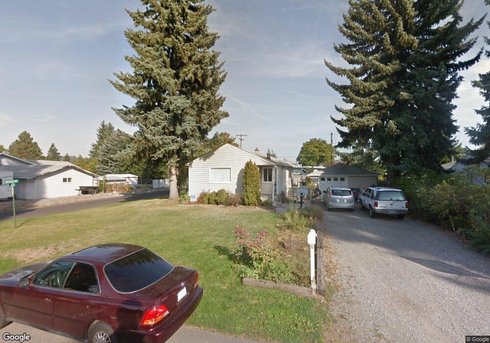
3418 N Dale Rd Spokane, WA 99212
Estimated Value: $283,000 - $348,000
2
Beds
1
Bath
880
Sq Ft
$370/Sq Ft
Est. Value
About This Home
This home is located at 3418 N Dale Rd, Spokane, WA 99212 and is currently estimated at $325,858, approximately $370 per square foot. 3418 N Dale Rd is a home located in Spokane County with nearby schools including Orchard Center Elementary, Centennial Middle School, and West Valley High School.
Ownership History
Date
Name
Owned For
Owner Type
Purchase Details
Closed on
Sep 8, 2005
Sold by
Sanborn Christina M and Mccormick Kyle M
Bought by
Mccormick Kyle M and Sanborn Christina M
Current Estimated Value
Home Financials for this Owner
Home Financials are based on the most recent Mortgage that was taken out on this home.
Original Mortgage
$112,000
Outstanding Balance
$61,306
Interest Rate
6.22%
Mortgage Type
Stand Alone First
Estimated Equity
$264,552
Purchase Details
Closed on
Apr 21, 1999
Sold by
Arrotta Joseph W and Arrotta Donna L
Bought by
Sanborn Christina M and Mccormick Kyle M
Home Financials for this Owner
Home Financials are based on the most recent Mortgage that was taken out on this home.
Original Mortgage
$92,331
Interest Rate
7.1%
Mortgage Type
FHA
Purchase Details
Closed on
Nov 10, 1981
Sold by
The Heirs & Devisees Of Luella A Keppner
Bought by
Arrotta Joseph W and Arrotta Donna L
Create a Home Valuation Report for This Property
The Home Valuation Report is an in-depth analysis detailing your home's value as well as a comparison with similar homes in the area
Home Values in the Area
Average Home Value in this Area
Purchase History
| Date | Buyer | Sale Price | Title Company |
|---|---|---|---|
| Mccormick Kyle M | -- | Pacific Nw Title | |
| Sanborn Christina M | $66,516 | Pacific Nw Title | |
| Arrotta Joseph W | -- | Transamerica Title Ins Svcs |
Source: Public Records
Mortgage History
| Date | Status | Borrower | Loan Amount |
|---|---|---|---|
| Open | Mccormick Kyle M | $112,000 | |
| Previous Owner | Sanborn Christina M | $92,331 |
Source: Public Records
Tax History Compared to Growth
Tax History
| Year | Tax Paid | Tax Assessment Tax Assessment Total Assessment is a certain percentage of the fair market value that is determined by local assessors to be the total taxable value of land and additions on the property. | Land | Improvement |
|---|---|---|---|---|
| 2025 | $2,842 | $280,400 | $105,000 | $175,400 |
| 2024 | $2,842 | $265,100 | $80,000 | $185,100 |
| 2023 | $2,705 | $265,100 | $80,000 | $185,100 |
| 2022 | $2,256 | $265,100 | $80,000 | $185,100 |
| 2021 | $2,181 | $166,250 | $36,150 | $130,100 |
| 2020 | $2,102 | $143,150 | $36,150 | $107,000 |
| 2019 | $1,770 | $133,450 | $36,150 | $97,300 |
| 2018 | $1,929 | $120,450 | $36,150 | $84,300 |
| 2017 | $1,769 | $112,200 | $30,000 | $82,200 |
| 2016 | $1,712 | $106,900 | $30,000 | $76,900 |
| 2015 | $1,721 | $105,400 | $30,000 | $75,400 |
| 2014 | -- | $99,400 | $30,000 | $69,400 |
| 2013 | -- | $0 | $0 | $0 |
Source: Public Records
Map
Nearby Homes
- 8928 E South Riverway Ave
- 9014 E Frederick Ave
- 8319 E Liberty Ave
- 2822 N Stout Rd
- 4107 N Bessie Rd
- 9116 E Lacrosse Ln
- 3417 N Elton Rd
- 2715 N Boeing Rd
- 4217 N Locust Rd
- 8020 E Marietta Ave
- 3704 N Center Rd
- 9609,9611,9615 E Upriver Dr
- 3924 N Sunderland Ct
- 8303 E Upriver Dr
- 9021 E Princeton Ln
- 9027 E Princeton Ln
- 7518 E Bridgeport Ave
- 4523 N Shiva Ln
- 4323 N Farr Rd
- 4303 N Ella Rd
- 3412 N Dale Rd
- 3502 N Dale Rd
- 8820 E Bridgeport Ave
- 8801 E Liberty Ave
- 8809 E Liberty Ave
- 3411 N Marguerite Rd
- 8819 E Bridgeport Ave
- 3425 N Dale Rd
- 3411 N Dale Rd
- 3504 N Dale Rd
- 3503 N Dale Rd
- 8821 E Bridgeport Ave
- 8827 E Liberty Ave
- 8717 E Liberty Ave
- 3505 N Dale Rd
- 3508 N Dale Ln
- 3508 N Dale Rd
- 8820 E South Riverway Ave
- 3318 N Dale Rd
- 8824 E South Riverway Ave