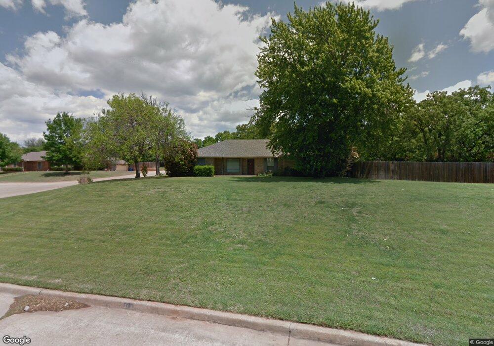
3418 Robert Dr Duncan, OK 73533
Estimated Value: $211,000 - $260,000
3
Beds
2
Baths
1,812
Sq Ft
$126/Sq Ft
Est. Value
About This Home
This home is located at 3418 Robert Dr, Duncan, OK 73533 and is currently estimated at $227,594, approximately $125 per square foot. 3418 Robert Dr is a home located in Stephens County with nearby schools including Plato Elementary School, Duncan Middle School, and Duncan High School.
Ownership History
Date
Name
Owned For
Owner Type
Purchase Details
Closed on
Dec 11, 2017
Sold by
Lang Doris Ann and Lang Herbert B
Bought by
York Dilrea Michelle
Current Estimated Value
Purchase Details
Closed on
Dec 18, 2000
Sold by
Kasper John J and Kasper Marie
Bought by
Lang Herbert B and Doris Ann
Purchase Details
Closed on
Mar 15, 1999
Sold by
Langston David L
Purchase Details
Closed on
Feb 13, 1997
Sold by
Tinsley Peggy J
Purchase Details
Closed on
Jan 4, 1994
Sold by
Brandvold David Edward
Create a Home Valuation Report for This Property
The Home Valuation Report is an in-depth analysis detailing your home's value as well as a comparison with similar homes in the area
Purchase History
| Date | Buyer | Sale Price | Title Company |
|---|---|---|---|
| York Dilrea Michelle | $149,500 | Stephens Co Abstract Co | |
| Lang Herbert B | $103,000 | -- | |
| -- | $106,000 | -- | |
| -- | $94,000 | -- | |
| -- | $83,500 | -- |
Source: Public Records
Tax History
| Year | Tax Paid | Tax Assessment Tax Assessment Total Assessment is a certain percentage of the fair market value that is determined by local assessors to be the total taxable value of land and additions on the property. | Land | Improvement |
|---|---|---|---|---|
| 2025 | $1,373 | $16,276 | $1,748 | $14,528 |
| 2024 | $1,343 | $15,769 | $1,748 | $14,021 |
| 2023 | $1,343 | $15,769 | $1,748 | $14,021 |
| 2022 | $0 | $15,018 | $1,748 | $13,270 |
| 2021 | $0 | $14,156 | $1,748 | $12,408 |
| 2020 | $0 | $16,831 | $1,748 | $15,083 |
| 2019 | $0 | $16,341 | $1,748 | $14,593 |
| 2018 | $1,472 | $16,531 | $1,748 | $14,783 |
| 2017 | $1,097 | $13,767 | $1,748 | $12,019 |
| 2016 | $1,077 | $13,674 | $1,748 | $11,926 |
| 2015 | $1,094 | $13,674 | $1,748 | $11,926 |
| 2014 | $1,094 | $13,557 | $1,748 | $11,809 |
Source: Public Records
Map
Nearby Homes
- 3505 Spencer Rd
- 805 Daryl Place
- 3202 Williamsburg St
- 1209 Bent Tree St
- 1205 Timbercreek Dr
- 3602 Woodknoll
- 3606 Woodknoll
- 2702 Wildwood Place
- 3710 Oakleaf Ct
- 1014 Oakview Dr
- 0 Clear Springs Dr
- 2518 Wildwood Place
- 1705 Foxboro Dr
- 2324 N 7th St
- 2306 Northridge Dr
- 1108 1108 W Plato Unit 40
- 1108 W Plato Rd Unit 10
- 1108 W Plato Rd Unit 29
- 2209 Sunset Dr
- 4590 N 5th St
- 3410 Robert Dr
- 3410 Dr
- 3413 Kristin Ln
- 3409 Kristin Ln
- 3417 Kristin Ln
- 3502 Robert Dr
- 3405 Kristin Ln
- 3406 Robert Dr
- 3409 Robert Dr
- 3501 Robert Dr
- 3505 Robert Dr
- 3401 Kristin Ln
- 296150 Old Highway 7
- 293245 E 1760 Rd
- 180550 N 3020 Rd
- 293423 E 1760 Rd
- 3405 Robert Dr
- 3501 Kristin Ln
- 3402 Robert Dr
- 3508 Robert Dr
Your Personal Tour Guide
Ask me questions while you tour the home.