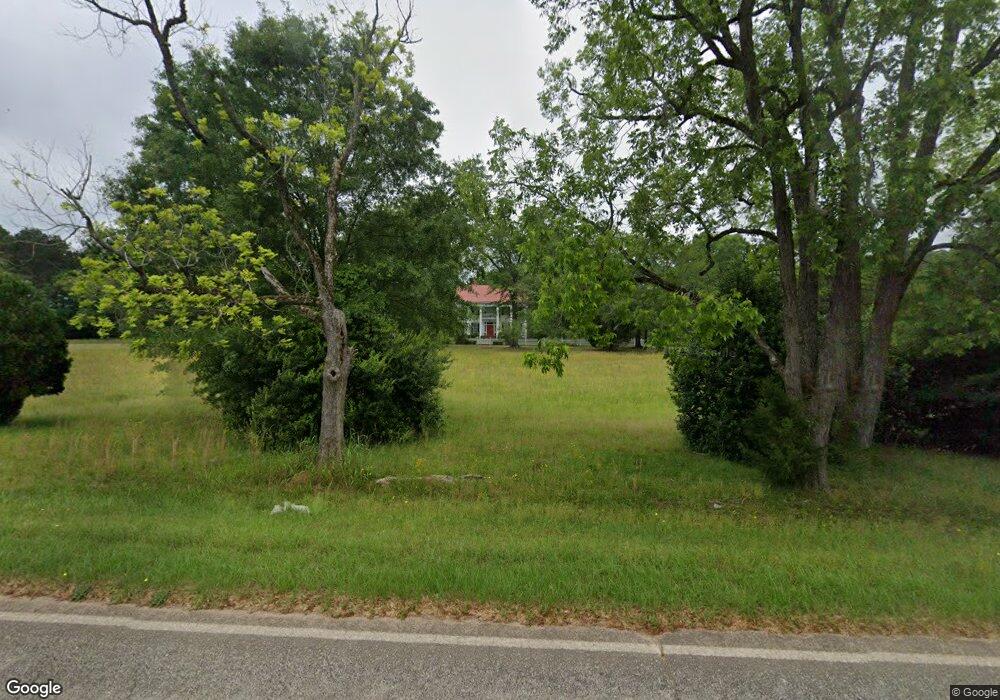
3419 Delhi Rd Tignall, GA 30668
Estimated Value: $416,000 - $838,000
5
Beds
3
Baths
4,697
Sq Ft
$126/Sq Ft
Est. Value
About This Home
This home is located at 3419 Delhi Rd, Tignall, GA 30668 and is currently estimated at $589,587, approximately $125 per square foot. 3419 Delhi Rd is a home with nearby schools including Washington-Wilkes Elementary School, Washington-Wilkes Primary School, and Washington-Wilkes Middle School.
Ownership History
Date
Name
Owned For
Owner Type
Purchase Details
Closed on
May 17, 2016
Sold by
Barnett John Patterson
Bought by
Patterson C Anne
Current Estimated Value
Purchase Details
Closed on
Jul 1, 1992
Bought by
Barnett Paul D
Purchase Details
Closed on
Dec 1, 1991
Purchase Details
Closed on
Sep 1, 1989
Purchase Details
Closed on
Dec 1, 1988
Purchase Details
Closed on
Jul 1, 1987
Create a Home Valuation Report for This Property
The Home Valuation Report is an in-depth analysis detailing your home's value as well as a comparison with similar homes in the area
Home Values in the Area
Average Home Value in this Area
Purchase History
| Date | Buyer | Sale Price | Title Company |
|---|---|---|---|
| Patterson C Anne | -- | -- | |
| Barnett Paul D | $129,000 | -- | |
| -- | $103,900 | -- | |
| -- | $110,000 | -- | |
| -- | $161,300 | -- | |
| -- | $200,000 | -- |
Source: Public Records
Tax History Compared to Growth
Tax History
| Year | Tax Paid | Tax Assessment Tax Assessment Total Assessment is a certain percentage of the fair market value that is determined by local assessors to be the total taxable value of land and additions on the property. | Land | Improvement |
|---|---|---|---|---|
| 2025 | $3,264 | $126,802 | $25,677 | $101,125 |
| 2024 | $3,309 | $126,802 | $25,677 | $101,125 |
| 2023 | $3,245 | $126,802 | $25,677 | $101,125 |
| 2022 | $3,236 | $126,802 | $25,677 | $101,125 |
| 2021 | $3,286 | $113,047 | $11,922 | $101,125 |
| 2020 | $3,337 | $113,097 | $11,922 | $101,175 |
| 2019 | $3,355 | $113,097 | $11,922 | $101,175 |
| 2018 | $3,284 | $113,097 | $11,922 | $101,175 |
| 2017 | $3,284 | $113,097 | $11,922 | $101,175 |
| 2016 | $2,997 | $105,661 | $13,426 | $92,235 |
| 2015 | -- | $13,426 | $13,426 | $92,235 |
| 2014 | -- | $105,661 | $13,426 | $92,235 |
| 2013 | -- | $106,774 | $13,426 | $93,348 |
Source: Public Records
Map
Nearby Homes
- 0 Oscar Walton Rd Unit 24714036
- 1105 Shore Dr
- Lot 14b Lbk Cir
- LOT 31C Lbk Rd
- 0 Lbk Rd Unit 545965
- 11 Doe Run
- 1695 Buckhead Dr
- 1151 Buckhead Dr
- 29 Eagle Pointe
- 0 Lincolnton Hwy Unit 10656813
- 1485 Broad River Scenic Dr
- 2132 Henry Hill Rd
- 1198 Sunset Cove
- 0 Cade Cir Unit 10610520
- 1108 Sunset Cove
- 1192 Sunset Cove
- 18 Lake View Dr
- 1126 Sunset Cove