Estimated Value: $471,000 - $527,424
3
Beds
2
Baths
1,810
Sq Ft
$281/Sq Ft
Est. Value
About This Home
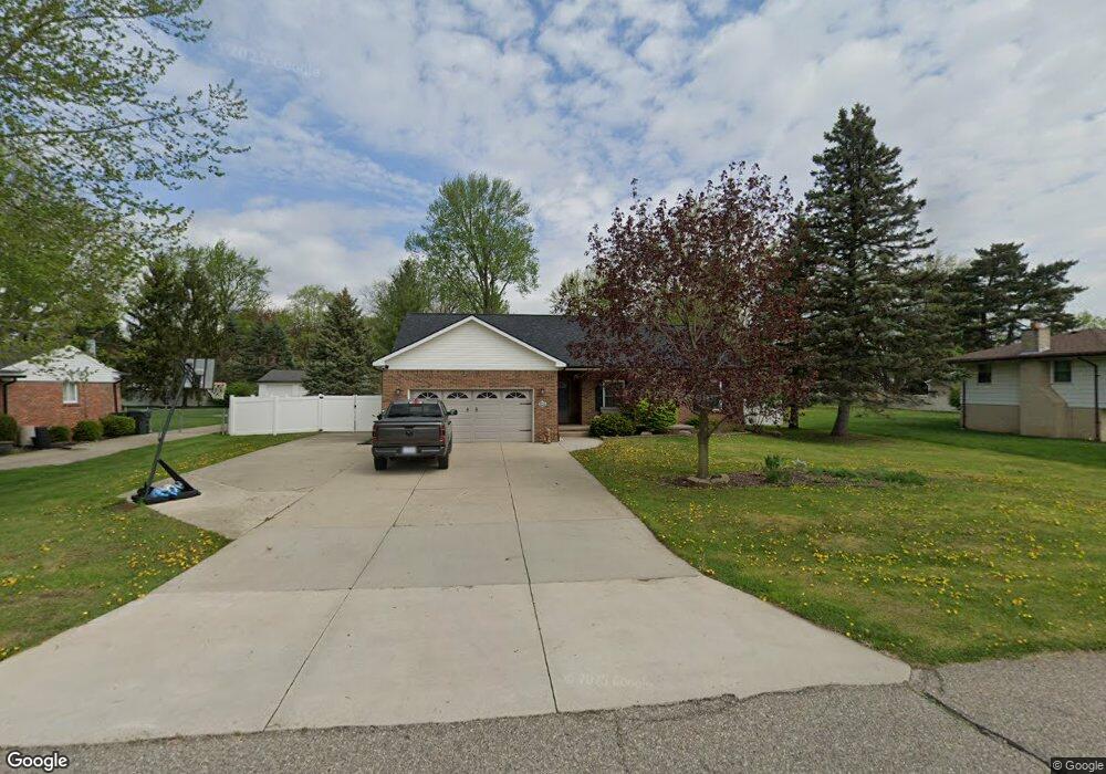
This home is located at 342 Carter Dr, Troy, MI 48098 and is currently estimated at $508,356, approximately $280 per square foot. 342 Carter Dr is a home located in Oakland County with nearby schools including Leonard Elementary School, Smith Middle School, and Troy High School.
Ownership History
Date
Name
Owned For
Owner Type
Purchase Details
Closed on
Jul 3, 2024
Sold by
Scott Cortney J and Scott Maria I
Bought by
Scott Family Protection Trust and Scott
Current Estimated Value
Purchase Details
Closed on
Jan 14, 2016
Sold by
Barnett John P and Barnett Susan
Bought by
Scott Cortney J and Scott Maria I
Home Financials for this Owner
Home Financials are based on the most recent Mortgage that was taken out on this home.
Original Mortgage
$268,000
Interest Rate
3.97%
Mortgage Type
New Conventional
Purchase Details
Closed on
Dec 5, 2003
Sold by
Brusen Carole Rosalee
Bought by
Barnett John P and Barnett Susan
Purchase Details
Closed on
Jun 17, 2003
Sold by
Brusen Carole Rosalee
Bought by
Mortgage Electronic Registration Systems
Purchase Details
Closed on
Jan 7, 2003
Sold by
Brusen Carole R
Bought by
Lender Homecomings Financial
Purchase Details
Closed on
May 10, 2001
Sold by
Lecuru Lucille
Bought by
Brusen Carole R
Create a Home Valuation Report for This Property
The Home Valuation Report is an in-depth analysis detailing your home's value as well as a comparison with similar homes in the area
Home Values in the Area
Average Home Value in this Area
Purchase History
| Date | Buyer | Sale Price | Title Company |
|---|---|---|---|
| Scott Family Protection Trust | -- | None Listed On Document | |
| Scott Cortney J | $288,000 | Attorney | |
| Barnett John P | $90,000 | -- | |
| Mortgage Electronic Registration Systems | $114,160 | -- | |
| Lender Homecomings Financial | $94,500 | -- | |
| Brusen Carole R | -- | -- |
Source: Public Records
Mortgage History
| Date | Status | Borrower | Loan Amount |
|---|---|---|---|
| Previous Owner | Scott Cortney J | $268,000 |
Source: Public Records
Tax History
| Year | Tax Paid | Tax Assessment Tax Assessment Total Assessment is a certain percentage of the fair market value that is determined by local assessors to be the total taxable value of land and additions on the property. | Land | Improvement |
|---|---|---|---|---|
| 2022 | $5,378 | $193,630 | $0 | $0 |
| 2015 | $5,642 | $143,890 | $0 | $0 |
| 2014 | -- | $116,410 | $0 | $0 |
| 2011 | -- | $117,770 | $0 | $0 |
Source: Public Records
Map
Nearby Homes
- 417 Carter Dr
- 3700 Old Creek Rd Unit 124
- 3733 Old Creek Rd
- 3711 Old Creek Rd Unit 72
- 4931 Treeside Ln
- 4953 Treeside Ln
- 4306 Tallman Dr
- 194 E Long Lake Rd
- 53 S Trail Ct
- 39 S Trail Ct
- 67 S Trail Ct
- 66 S Trail Ct
- 85 Stalwart Dr
- 556 Trombley Dr
- 3443 Ellenboro Dr
- 2755 W Wattles Rd
- 3122 Frankton Ave
- 365 Hartland Dr
- 4849 Parkside Ln
- 4840 Parkside Ln
- 322 Carter Dr
- 362 Carter Dr
- 306 Carter Dr
- 335 Paragon Dr
- 321 Paragon Dr Unit Bldg-Unit
- 321 Paragon Dr
- 361 Paragon Dr
- 376 Carter Dr
- 335 Carter Dr
- 345 Carter Dr
- 309 Paragon Dr
- 307 Carter Dr
- 379 Paragon Dr
- 390 Carter Dr
- 238 Carter Dr
- 377 Carter Dr
- 387 Paragon Dr
- 241 Paragon Dr Unit Bldg-Unit
- 241 Paragon Dr
- 237 Carter Dr
Your Personal Tour Guide
Ask me questions while you tour the home.