J
Seller's Agent in 2025
Julie Huebner
ERA Carroll Realty, Co., Inc.
(307) 461-1243
52 Total Sales
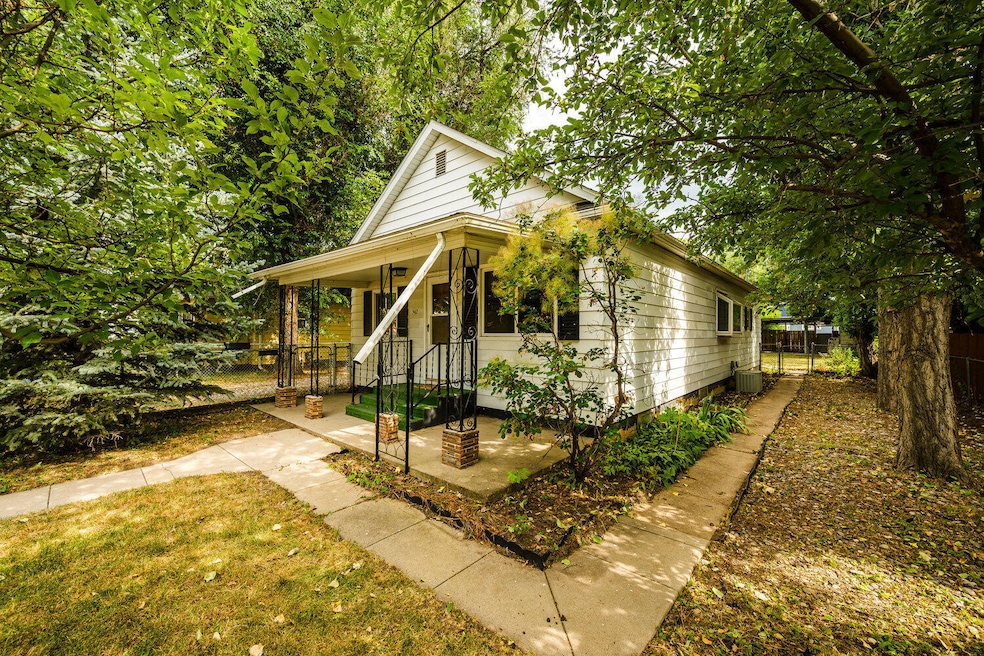
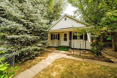
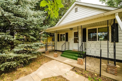
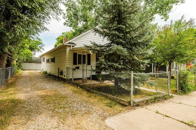


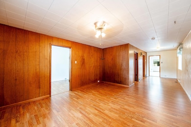
This 3 bed 1.5 bath home is located just a few blocks from Sheridan's Downtown Main St. The private fenced yard has alley access, a large garage, and a full basement that provides plenty of storage. There are front and back covered patios for entertainment as well as a large kitchen. This property is being sold in ''as is'' condition. All measurements are approximate.
Last Agent to Sell the Property
ERA Carroll Realty, Co., Inc. License #11935 Listed on: 07/10/2025
| Date | Type | Sale Price | Title Company |
|---|---|---|---|
| Warranty Deed | -- | None Listed On Document | |
| Warranty Deed | -- | None Listed On Document | |
| Warranty Deed | -- | None Available | |
| Quit Claim Deed | -- | None Available |
| Date | Status | Loan Amount | Loan Type |
|---|---|---|---|
| Open | $257,050 | New Conventional | |
| Previous Owner | $83,300 | New Conventional |
| Date | Event | Price | List to Sale | Price per Sq Ft |
|---|---|---|---|---|
| 09/15/2025 09/15/25 | Sold | -- | -- | -- |
| 08/06/2025 08/06/25 | Price Changed | $269,900 | -1.9% | $221 / Sq Ft |
| 07/10/2025 07/10/25 | For Sale | $275,000 | -- | $226 / Sq Ft |
| Year | Tax Paid | Tax Assessment Tax Assessment Total Assessment is a certain percentage of the fair market value that is determined by local assessors to be the total taxable value of land and additions on the property. | Land | Improvement |
|---|---|---|---|---|
| 2025 | $1,346 | $18,830 | $5,993 | $12,837 |
| 2024 | $17 | $24,395 | $7,923 | $16,472 |
| 2023 | $1,663 | $23,255 | $7,111 | $16,144 |
| 2022 | $1,462 | $20,441 | $5,566 | $14,875 |
| 2021 | $1,245 | $17,418 | $4,584 | $12,834 |
| 2020 | $1,130 | $15,804 | $4,266 | $11,538 |
| 2019 | $1,068 | $14,939 | $3,724 | $11,215 |
| 2018 | $983 | $13,753 | $4,030 | $9,723 |
| 2017 | $906 | $12,666 | $3,080 | $9,586 |
| 2015 | $879 | $12,289 | $2,958 | $9,331 |
| 2014 | $808 | $11,305 | $2,130 | $9,175 |
| 2013 | -- | $11,688 | $2,955 | $8,733 |
J
Seller's Agent in 2025
Julie Huebner
ERA Carroll Realty, Co., Inc.
(307) 461-1243
52 Total Sales
G
Buyer's Agent in 2025
Greg Hansen
ERA Carroll Realty, Co., Inc.
(307) 763-2466
71 Total Sales
Source: Sheridan County Board of REALTORS®
MLS Number: 25-673
APN: 03-5684-26-2-13-002-25
Ask me questions while you tour the home.
