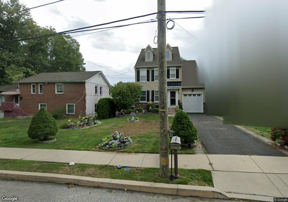
342 Logan Ave Glenside, PA 19038
Estimated Value: $482,937 - $603,000
3
Beds
3
Baths
1,800
Sq Ft
$295/Sq Ft
Est. Value
About This Home
This home is located at 342 Logan Ave, Glenside, PA 19038 and is currently estimated at $530,234, approximately $294 per square foot. 342 Logan Ave is a home located in Montgomery County with nearby schools including Thomas Fitzwater Elementary School, Sandy Run Middle School, and Upper Dublin High School.
Ownership History
Date
Name
Owned For
Owner Type
Purchase Details
Closed on
Jul 21, 2010
Sold by
Brandenburger Sheridan Inc
Bought by
Walley Matthew and Walley Nancy
Current Estimated Value
Purchase Details
Closed on
Aug 15, 2008
Sold by
Brandenburger Sheridan Inc
Bought by
Walley Matthew and Walley Nancy
Home Financials for this Owner
Home Financials are based on the most recent Mortgage that was taken out on this home.
Original Mortgage
$265,500
Interest Rate
6.29%
Purchase Details
Closed on
Dec 21, 2006
Sold by
Alon Eliahu
Bought by
Golf View Properties Lp
Purchase Details
Closed on
Jan 6, 2006
Sold by
Scott Clarissa
Bought by
Danel Llc
Create a Home Valuation Report for This Property
The Home Valuation Report is an in-depth analysis detailing your home's value as well as a comparison with similar homes in the area
Home Values in the Area
Average Home Value in this Area
Purchase History
| Date | Buyer | Sale Price | Title Company |
|---|---|---|---|
| Walley Matthew | -- | None Available | |
| Walley Matthew | $295,000 | None Available | |
| Golf View Properties Lp | $55,000 | None Available | |
| Danel Llc | $45,000 | None Available |
Source: Public Records
Mortgage History
| Date | Status | Borrower | Loan Amount |
|---|---|---|---|
| Previous Owner | Walley Matthew | $265,500 |
Source: Public Records
Tax History
| Year | Tax Paid | Tax Assessment Tax Assessment Total Assessment is a certain percentage of the fair market value that is determined by local assessors to be the total taxable value of land and additions on the property. | Land | Improvement |
|---|---|---|---|---|
| 2025 | $7,242 | $148,510 | -- | -- |
| 2024 | $7,242 | $148,510 | -- | -- |
| 2023 | $7,073 | $148,510 | $0 | $0 |
| 2022 | $6,919 | $148,510 | $0 | $0 |
| 2021 | $6,746 | $148,510 | $0 | $0 |
| 2020 | $6,552 | $148,510 | $0 | $0 |
| 2019 | $6,442 | $148,510 | $0 | $0 |
Source: Public Records
Map
Nearby Homes
- 332 Logan Ave
- 322 Logan Ave
- 0 Girard Ave
- 245 Linden Ave
- 140 Linden Ave
- 221 Central Ave
- 3113 Jenkintown Rd
- 0 Logan Ave Unit PAMC2163778
- 461 Hamel Ave
- 57 Chelfield Rd
- 624 Hamel Ave
- 2718 Hawthorne Rd
- 336 Elm Ave
- 2621 Hawthorne Rd
- 3012 Lincoln Ave
- 536 Cardinal Dr
- 906 Garfield Ave
- 215 Allison Rd
- 65 Limekiln Pike
- 0 Tyson Ave Unit PAMC2163766