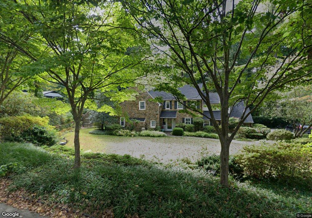
342 Millbank Rd Bryn Mawr, PA 19010
Lower Merion NeighborhoodEstimated Value: $1,149,000 - $1,508,000
4
Beds
5
Baths
2,672
Sq Ft
$520/Sq Ft
Est. Value
About This Home
This home is located at 342 Millbank Rd, Bryn Mawr, PA 19010 and is currently estimated at $1,388,957, approximately $519 per square foot. 342 Millbank Rd is a home located in Montgomery County with nearby schools including Welsh Valley Middle School, Harriton Senior High School, and The Baldwin School.
Ownership History
Date
Name
Owned For
Owner Type
Purchase Details
Closed on
Mar 29, 2017
Sold by
Berwind Sandra M
Bought by
Jarden Todd C and Jarden Jennifer F
Current Estimated Value
Home Financials for this Owner
Home Financials are based on the most recent Mortgage that was taken out on this home.
Original Mortgage
$740,000
Outstanding Balance
$617,302
Interest Rate
4.3%
Mortgage Type
Purchase Money Mortgage
Estimated Equity
$771,655
Purchase Details
Closed on
Jun 11, 1976
Bought by
Berwind Sandra M
Create a Home Valuation Report for This Property
The Home Valuation Report is an in-depth analysis detailing your home's value as well as a comparison with similar homes in the area
Home Values in the Area
Average Home Value in this Area
Purchase History
| Date | Buyer | Sale Price | Title Company |
|---|---|---|---|
| Jarden Todd C | $740,000 | None Available | |
| Berwind Sandra M | -- | -- |
Source: Public Records
Mortgage History
| Date | Status | Borrower | Loan Amount |
|---|---|---|---|
| Open | Jarden Todd C | $740,000 |
Source: Public Records
Tax History Compared to Growth
Tax History
| Year | Tax Paid | Tax Assessment Tax Assessment Total Assessment is a certain percentage of the fair market value that is determined by local assessors to be the total taxable value of land and additions on the property. | Land | Improvement |
|---|---|---|---|---|
| 2025 | $21,878 | $523,890 | $330,380 | $193,510 |
| 2024 | $21,878 | $523,890 | $330,380 | $193,510 |
| 2023 | $20,967 | $523,890 | $330,380 | $193,510 |
| 2022 | $20,578 | $523,890 | $330,380 | $193,510 |
| 2021 | $20,110 | $523,890 | $330,380 | $193,510 |
| 2020 | $19,619 | $523,890 | $330,380 | $193,510 |
| 2019 | $19,272 | $523,890 | $330,380 | $193,510 |
| 2018 | $19,272 | $523,890 | $330,380 | $193,510 |
| 2017 | $18,564 | $523,890 | $330,380 | $193,510 |
| 2016 | $18,360 | $523,890 | $330,380 | $193,510 |
| 2015 | $17,118 | $523,890 | $330,380 | $193,510 |
| 2014 | $17,118 | $523,890 | $330,380 | $193,510 |
Source: Public Records
Map
Nearby Homes
- 311 Millbank Rd
- 716 Old Gulph Rd
- 922 Montgomery Ave Unit B2
- 601 Montgomery Ave Unit 204
- 543 Avonwood Rd
- 27 S Merion Ave
- 530 New Gulph Rd
- 28 S Warner Ave
- 764 Mount Pleasant Rd
- 50 Prospect Ave
- 75 S Merion Ave
- 717 N Spring Mill Rd
- 741 County Line Rd
- 723 Dixon Ln Unit 31
- 726 John Barry Dr
- 449 Montgomery Ave Unit 112
- 1030 E Lancaster Ave Unit 216
- 1030 E Lancaster Ave Unit 702
- 1030 E Lancaster Ave Unit 923
- 815 Penn St
- 336 Millbank Rd
- 350 Millbank Rd
- 349 Millbank Rd
- 345 Millbank Rd
- 330 Millbank Rd
- 339 Millbank Rd
- 355 Millbank Rd
- 335 Millbank Rd
- 930 Old Gulph Rd
- 900 Old Gulph Rd
- 318 Millbank Rd
- 917 Old Gulph Rd
- 331 Millbank Rd
- 910 Potts Ln
- 923 Old Gulph Rd
- 900 Potts Ln
- 325 Millbank Rd
- 914 Potts Ln
- 911 Old Gulph Rd Unit 82
- 820 Potts Ln
