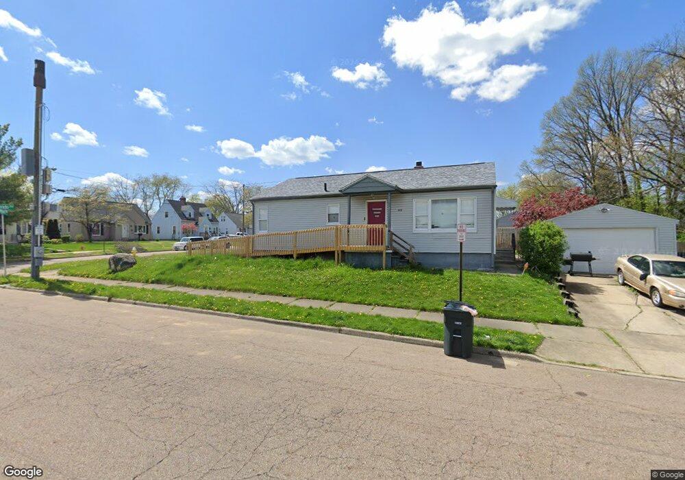
342 Rampart Ave Akron, OH 44313
Northwest Akron NeighborhoodEstimated Value: $154,000 - $167,000
3
Beds
1
Bath
1,014
Sq Ft
$158/Sq Ft
Est. Value
About This Home
This home is located at 342 Rampart Ave, Akron, OH 44313 and is currently estimated at $160,014, approximately $157 per square foot. 342 Rampart Ave is a home located in Summit County with nearby schools including Case Community Learning Center, Summit Academy School, and Our Lady Of The Elms Elementary School.
Ownership History
Date
Name
Owned For
Owner Type
Purchase Details
Closed on
Dec 17, 2007
Sold by
Price Julie and Price Robert W
Bought by
Price Robert W and Price Julie A
Current Estimated Value
Purchase Details
Closed on
May 28, 2003
Sold by
Wesann Enterprises Llc
Bought by
Price Julie
Purchase Details
Closed on
Aug 3, 1999
Sold by
Williams Robert M and Williams Carl G
Bought by
Wesann Enterprises Llc
Home Financials for this Owner
Home Financials are based on the most recent Mortgage that was taken out on this home.
Original Mortgage
$57,520
Interest Rate
7.68%
Purchase Details
Closed on
Nov 17, 1998
Sold by
Estate Of Helen Ruth Williams
Bought by
Williams Robert M and Williams Carl G
Create a Home Valuation Report for This Property
The Home Valuation Report is an in-depth analysis detailing your home's value as well as a comparison with similar homes in the area
Home Values in the Area
Average Home Value in this Area
Purchase History
| Date | Buyer | Sale Price | Title Company |
|---|---|---|---|
| Price Robert W | -- | Attorney | |
| Price Julie | $97,320 | -- | |
| Wesann Enterprises Llc | $71,900 | Tri County Title | |
| Williams Robert M | -- | -- |
Source: Public Records
Mortgage History
| Date | Status | Borrower | Loan Amount |
|---|---|---|---|
| Previous Owner | Wesann Enterprises Llc | $57,520 |
Source: Public Records
Tax History Compared to Growth
Tax History
| Year | Tax Paid | Tax Assessment Tax Assessment Total Assessment is a certain percentage of the fair market value that is determined by local assessors to be the total taxable value of land and additions on the property. | Land | Improvement |
|---|---|---|---|---|
| 2025 | $2,617 | $42,767 | $10,847 | $31,920 |
| 2024 | $2,617 | $42,767 | $10,847 | $31,920 |
| 2023 | $2,617 | $42,767 | $10,847 | $31,920 |
| 2022 | $2,402 | $30,412 | $7,585 | $22,827 |
| 2021 | $2,405 | $30,412 | $7,585 | $22,827 |
| 2020 | $2,373 | $30,420 | $7,590 | $22,830 |
| 2019 | $2,145 | $26,240 | $7,210 | $19,030 |
| 2018 | $2,119 | $26,240 | $7,210 | $19,030 |
| 2017 | $2,150 | $26,240 | $7,210 | $19,030 |
| 2016 | $2,152 | $26,240 | $7,210 | $19,030 |
| 2015 | $2,150 | $26,240 | $7,210 | $19,030 |
| 2014 | $2,135 | $26,240 | $7,210 | $19,030 |
| 2013 | $2,195 | $27,670 | $7,210 | $20,460 |
Source: Public Records
Map
Nearby Homes
- 1623 Liberty Dr Unit 1625
- 1633-1635 Liberty Dr
- 242 N Hawkins Ave
- 1688 Tanglewood Dr Unit 1690
- 297 Harcourt Dr
- 2040 Thurmont Rd
- 1725 Liberty Dr Unit 1727
- 101 N Hawkins Ave
- 100 N Hawkins Ave
- 254 Castle Blvd
- 590 N Hawkins Ave
- 284 Kenilworth Dr
- 607 Treeside Dr
- 1785 Fairlawn Knolls Dr
- 635 N Hawkins Ave
- 423 Foursome Ave
- 746 Newcastle Dr
- 637 Treeside Dr
- 432 Auburndale Ave
- 1159 Garman Rd
- 1547 Berendo Ave
- 1553 Berendo Ave
- 350 Rampart Ave
- 1557 Berendo Ave
- 1566 Bond St
- 1563 Berendo Ave
- 1544 Berendo Ave
- 1550 Berendo Ave
- 1570 Bond St
- 1554 Berendo Ave
- 1567 Berendo Ave
- 1560 Berendo Ave
- 1576 Bond St
- 1564 Berendo Ave
- 1580 Bond St
- 1573 Berendo Ave
- 1570 Berendo Ave
- 1577 Berendo Ave
- 1511 Shatto Ave
- 1574 Berendo Ave