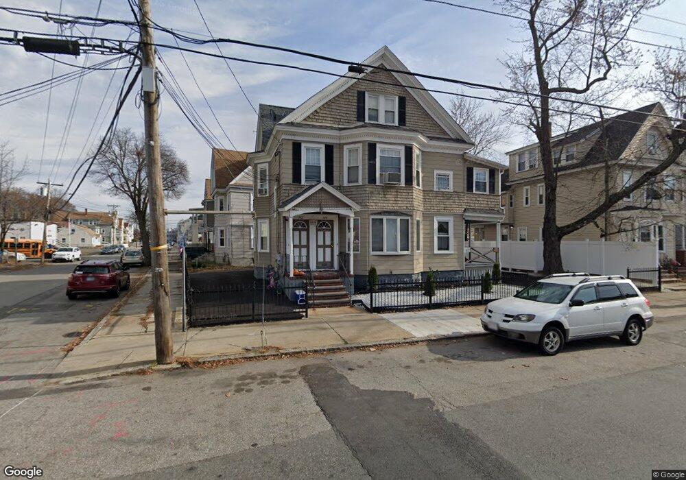
342 S Union St Unit 344 Lawrence, MA 01843
South Common NeighborhoodEstimated Value: $647,000 - $845,000
4
Beds
2
Baths
2,478
Sq Ft
$299/Sq Ft
Est. Value
About This Home
This home is located at 342 S Union St Unit 344, Lawrence, MA 01843 and is currently estimated at $741,308, approximately $299 per square foot. 342 S Union St Unit 344 is a home located in Essex County with nearby schools including Vardaman Elementary School, Olive Branch Elementary School, and Rowan Elementary School.
Ownership History
Date
Name
Owned For
Owner Type
Purchase Details
Closed on
Sep 28, 2018
Sold by
T & A Rt
Bought by
Claudio Luis and Camilo Elizabeth
Current Estimated Value
Home Financials for this Owner
Home Financials are based on the most recent Mortgage that was taken out on this home.
Original Mortgage
$371,153
Outstanding Balance
$324,493
Interest Rate
4.62%
Mortgage Type
FHA
Estimated Equity
$416,815
Create a Home Valuation Report for This Property
The Home Valuation Report is an in-depth analysis detailing your home's value as well as a comparison with similar homes in the area
Home Values in the Area
Average Home Value in this Area
Purchase History
| Date | Buyer | Sale Price | Title Company |
|---|---|---|---|
| Claudio Luis | $378,000 | -- |
Source: Public Records
Mortgage History
| Date | Status | Borrower | Loan Amount |
|---|---|---|---|
| Open | Claudio Luis | $371,153 |
Source: Public Records
Tax History Compared to Growth
Tax History
| Year | Tax Paid | Tax Assessment Tax Assessment Total Assessment is a certain percentage of the fair market value that is determined by local assessors to be the total taxable value of land and additions on the property. | Land | Improvement |
|---|---|---|---|---|
| 2025 | $6,036 | $685,900 | $99,100 | $586,800 |
| 2024 | $5,519 | $596,700 | $107,200 | $489,500 |
| 2023 | $5,920 | $582,700 | $99,500 | $483,200 |
| 2022 | $5,261 | $459,900 | $90,100 | $369,800 |
| 2021 | $5,109 | $416,400 | $90,100 | $326,300 |
| 2020 | $4,454 | $358,300 | $85,500 | $272,800 |
| 2019 | $6,056 | $442,700 | $94,900 | $347,800 |
| 2018 | $5,823 | $406,600 | $86,000 | $320,600 |
| 2017 | $5,203 | $339,200 | $78,500 | $260,700 |
| 2016 | $4,394 | $283,300 | $74,700 | $208,600 |
| 2015 | $4,222 | $279,200 | $74,700 | $204,500 |
Source: Public Records
Map
Nearby Homes
- 356-360 S Union St
- 27-29 Dorchester St
- 31 Garfield St
- 91 Farnham St
- 67-69 Osgood St
- 78-80 Osgood St
- 64 Salem St
- 77-79 Shawsheen Rd
- 5 Lafayette Ave
- 24 Inman St Unit 32
- 19 Front St
- 132-134 S Broadway
- 49 Bowdoin St Unit 51
- 46 Loring St
- 82 S Broadway
- 80 Market St
- 13 Kingston St
- 41 Durham St
- 5 W Kenneth St
- 57 Glenwood St
- 344 S Union St
- 344 S Union St Unit 1
- 342-344 S Union St
- 69/71 Cambridge
- 69 Cambridge St Unit 71
- 350 S Union St Unit 352
- 336 S Union St Unit 338
- 73 Cambridge St
- 332 S Union St Unit 334
- 332-334 S Union St
- 356 S Union St
- 70 Cambridge St
- 161 Foster St Unit 163
- 59 Cambridge St Unit 61
- 75 Cambridge St
- 75 Cambridge St Unit 3
- 324 S Union St Unit 326
- 157 Foster St Unit 159
- 46 Dorchester St Unit 46A
- 46-4 Dorchester St