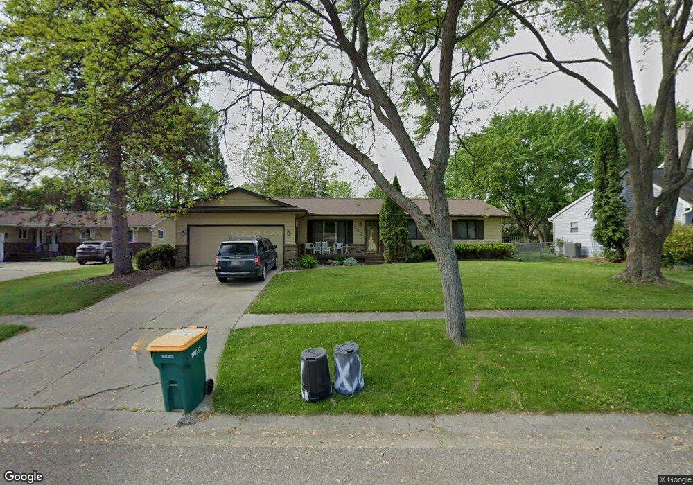
342 Sunrise Dr Unit Bldg-Unit Flushing, MI 48433
Estimated Value: $197,000 - $247,000
2
Beds
2
Baths
1,368
Sq Ft
$161/Sq Ft
Est. Value
About This Home
This home is located at 342 Sunrise Dr Unit Bldg-Unit, Flushing, MI 48433 and is currently estimated at $219,894, approximately $160 per square foot. 342 Sunrise Dr Unit Bldg-Unit is a home located in Genesee County with nearby schools including Seymour Elementary School, Flushing Middle School, and Flushing High School.
Ownership History
Date
Name
Owned For
Owner Type
Purchase Details
Closed on
Jul 9, 2018
Sold by
Isler Mark and Isler Thomas A
Bought by
Badini Christopher D and Badini Diana C
Current Estimated Value
Home Financials for this Owner
Home Financials are based on the most recent Mortgage that was taken out on this home.
Original Mortgage
$120,150
Outstanding Balance
$104,128
Interest Rate
4.5%
Mortgage Type
New Conventional
Estimated Equity
$115,766
Purchase Details
Closed on
Apr 7, 2014
Sold by
Isler Rudolf A and Isler Dorothy
Bought by
Isler Rudolf A and Isler Dorothy
Create a Home Valuation Report for This Property
The Home Valuation Report is an in-depth analysis detailing your home's value as well as a comparison with similar homes in the area
Home Values in the Area
Average Home Value in this Area
Purchase History
| Date | Buyer | Sale Price | Title Company |
|---|---|---|---|
| Badini Christopher D | $133,500 | First American Title Ins Co | |
| Isler Rudolf A | -- | None Available |
Source: Public Records
Mortgage History
| Date | Status | Borrower | Loan Amount |
|---|---|---|---|
| Open | Badini Christopher D | $120,150 |
Source: Public Records
Tax History
| Year | Tax Paid | Tax Assessment Tax Assessment Total Assessment is a certain percentage of the fair market value that is determined by local assessors to be the total taxable value of land and additions on the property. | Land | Improvement |
|---|---|---|---|---|
| 2025 | $3,510 | $102,000 | $0 | $0 |
| 2024 | $2,842 | $93,400 | $0 | $0 |
| 2023 | $2,733 | $84,300 | $0 | $0 |
| 2022 | $3,022 | $76,600 | $0 | $0 |
| 2021 | $3,022 | $69,800 | $0 | $0 |
| 2020 | $2,402 | $66,400 | $0 | $0 |
| 2019 | $2,370 | $62,300 | $0 | $0 |
| 2018 | $2,547 | $56,800 | $0 | $0 |
| 2017 | $2,385 | $62,800 | $0 | $0 |
| 2016 | $2,366 | $53,009 | $0 | $0 |
| 2015 | $2,355 | $0 | $0 | $0 |
| 2012 | -- | $51,200 | $51,200 | $0 |
Source: Public Records
Map
Nearby Homes
- 516 Sunnyslope Dr
- 6106 E River Rd
- 0 E River Rd Unit 50180952
- 433 Dutch Mill Dr
- 501 Spring Ln
- 748 Bending Ct
- 608 Autumn Dr
- 746 Bending Brook Dr
- 6289 W River Rd
- 0 Winters Eave Dr Unit 50117986
- 527 Oakbrook Cir Unit 14
- 321 Terrace Dr
- 113 N Mckinley Rd
- 200 Boman St
- 241 Aberdeen Ct Unit 11 bldg 6
- 100 Aberdeen Dr Unit 36
- 229 Aberdeen Ct
- 3155 Beech Tree Ln
- 7505 Falling Leaf Ct
- 0 Crooked Limb Ct
Your Personal Tour Guide
Ask me questions while you tour the home.