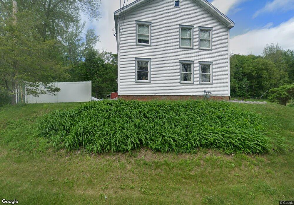
342 Union St Westfield, MA 01085
Estimated Value: $437,500
--
Bed
1
Bath
--
Sq Ft
7.3
Acres
About This Home
This home is located at 342 Union St, Westfield, MA 01085 and is currently priced at $437,500. 342 Union St is a home located in Hampden County with nearby schools including Westfield High School and Saint Mary High School.
Ownership History
Date
Name
Owned For
Owner Type
Purchase Details
Closed on
Aug 31, 2021
Sold by
Kielbasa Charles M
Bought by
Kielbasa Charles M and Kielbasa Melissa I
Current Estimated Value
Purchase Details
Closed on
Mar 5, 2015
Sold by
Kielbasa Jane A
Bought by
Kielbasa Jane A and Kielbasa Charles M
Purchase Details
Closed on
Apr 29, 1988
Sold by
Kielbasa Joseph
Bought by
Kielbasa Charles M
Create a Home Valuation Report for This Property
The Home Valuation Report is an in-depth analysis detailing your home's value as well as a comparison with similar homes in the area
Home Values in the Area
Average Home Value in this Area
Purchase History
| Date | Buyer | Sale Price | Title Company |
|---|---|---|---|
| Kielbasa Charles M | -- | None Available | |
| Kielbasa Charles M | -- | None Available | |
| Kielbasa Jane A | -- | -- | |
| Kielbasa Jane A | -- | -- | |
| Kielbasa Charles M | $30,000 | -- |
Source: Public Records
Mortgage History
| Date | Status | Borrower | Loan Amount |
|---|---|---|---|
| Previous Owner | Kielbasa Charles M | $75,000 | |
| Previous Owner | Kielbasa Charles M | $40,000 |
Source: Public Records
Tax History Compared to Growth
Tax History
| Year | Tax Paid | Tax Assessment Tax Assessment Total Assessment is a certain percentage of the fair market value that is determined by local assessors to be the total taxable value of land and additions on the property. | Land | Improvement |
|---|---|---|---|---|
| 2025 | -- | $412,052 | $89,652 | $322,400 |
| 2024 | -- | $380,219 | $81,719 | $298,500 |
| 2023 | $0 | $344,097 | $77,597 | $266,500 |
| 2022 | $0 | $306,606 | $69,306 | $237,300 |
| 2021 | $0 | $292,291 | $65,191 | $227,100 |
| 2020 | $0 | $283,291 | $65,191 | $218,100 |
| 2019 | $0 | $269,974 | $62,174 | $207,800 |
| 2018 | $0 | $268,712 | $62,212 | $206,500 |
| 2017 | $0 | $262,037 | $63,237 | $198,800 |
| 2016 | $4,525 | $261,772 | $62,972 | $198,800 |
| 2015 | $4,525 | $264,272 | $62,972 | $201,300 |
| 2014 | $4,525 | $264,272 | $62,972 | $201,300 |
Source: Public Records
Map
Nearby Homes
- 120 Woodcliff Dr
- 242 Eastwood Dr
- 0 Little River Road ( Rear )
- 346 E Mountain Rd
- 99 Hillcrest Cir
- 0 E Mountain Rd
- 119 Union St Unit 4
- 111 Union St Unit 6
- 0 Holyoke Rd
- 138 Main St Unit 13
- 138 Main St Unit 11
- 14 Lynnwood Dr
- 13 William St
- 103 Feeding Hills Rd
- 0 Feeding Hills Rd
- 26 Deepwoods Dr
- 33 George St
- 60 Shaker Rd
- 99 Woodmont St
- 19 Locust St