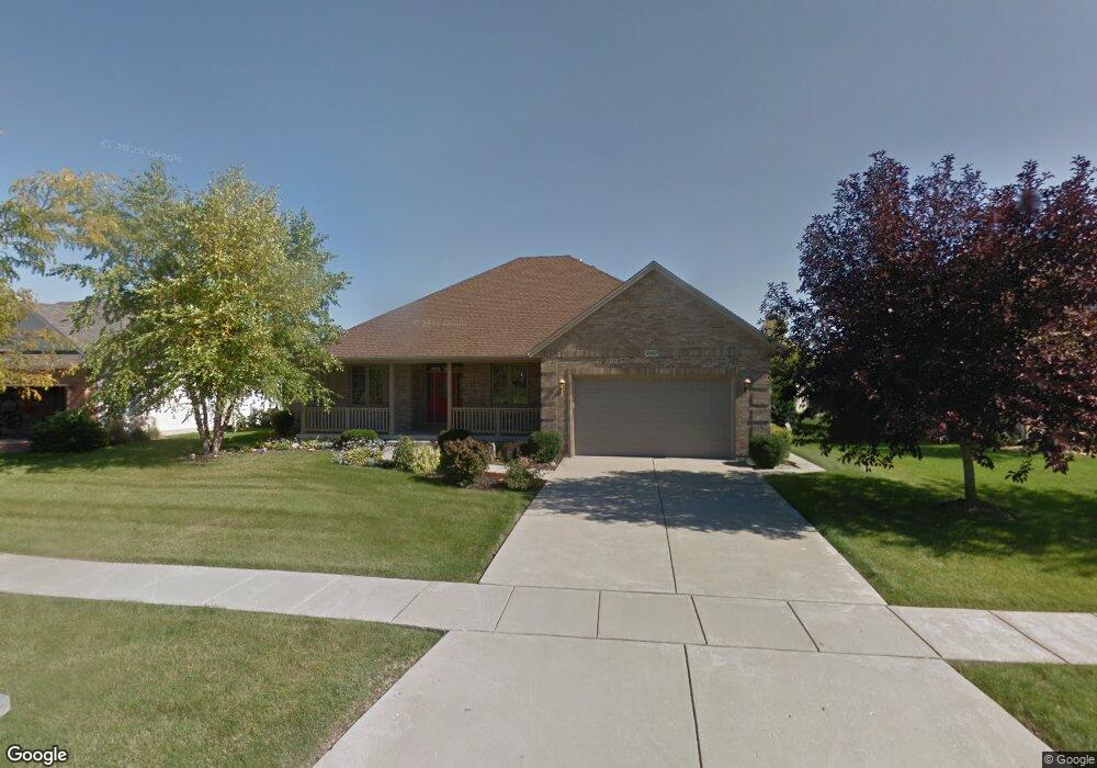
3422 Owens Ln Dekalb, IL 60115
Estimated Value: $389,723 - $441,000
3
Beds
3
Baths
2,274
Sq Ft
$182/Sq Ft
Est. Value
About This Home
This home is located at 3422 Owens Ln, Dekalb, IL 60115 and is currently estimated at $413,431, approximately $181 per square foot. 3422 Owens Ln is a home located in DeKalb County with nearby schools including Gwendolyn Brooks Elementary School, Clinton Rosette Middle School, and De Kalb High School.
Ownership History
Date
Name
Owned For
Owner Type
Purchase Details
Closed on
Jun 30, 2017
Sold by
Berning Robert F and Berning Evelyn C
Bought by
Johnson Ralph D and Ridgway Johnson Sandra L
Current Estimated Value
Home Financials for this Owner
Home Financials are based on the most recent Mortgage that was taken out on this home.
Original Mortgage
$264,000
Outstanding Balance
$216,946
Interest Rate
3.5%
Mortgage Type
VA
Estimated Equity
$196,485
Purchase Details
Closed on
Jun 21, 2008
Sold by
Berning Robert F
Bought by
Berning Trust
Create a Home Valuation Report for This Property
The Home Valuation Report is an in-depth analysis detailing your home's value as well as a comparison with similar homes in the area
Home Values in the Area
Average Home Value in this Area
Purchase History
| Date | Buyer | Sale Price | Title Company |
|---|---|---|---|
| Johnson Ralph D | $264,000 | None Available | |
| Berning Trust | -- | -- |
Source: Public Records
Mortgage History
| Date | Status | Borrower | Loan Amount |
|---|---|---|---|
| Open | Johnson Ralph D | $264,000 |
Source: Public Records
Tax History Compared to Growth
Tax History
| Year | Tax Paid | Tax Assessment Tax Assessment Total Assessment is a certain percentage of the fair market value that is determined by local assessors to be the total taxable value of land and additions on the property. | Land | Improvement |
|---|---|---|---|---|
| 2024 | $8,725 | $118,916 | $11,650 | $107,266 |
| 2023 | $8,725 | $103,685 | $10,158 | $93,527 |
| 2022 | $8,455 | $94,663 | $11,592 | $83,071 |
| 2021 | $8,608 | $88,785 | $10,872 | $77,913 |
| 2020 | $9,357 | $87,370 | $10,699 | $76,671 |
| 2019 | $9,146 | $83,937 | $10,279 | $73,658 |
| 2018 | $8,906 | $81,090 | $9,930 | $71,160 |
| 2017 | $8,339 | $77,948 | $9,545 | $68,403 |
| 2016 | $8,212 | $75,980 | $9,304 | $66,676 |
| 2015 | -- | $71,992 | $8,816 | $63,176 |
| 2014 | -- | $72,918 | $15,846 | $57,072 |
| 2013 | -- | $76,595 | $16,645 | $59,950 |
Source: Public Records
Map
Nearby Homes
- 102 Quinlan Ave
- The Samuel Plan at Bridges of Rivermist
- The Wesley Plan at Bridges of Rivermist
- 3467 Roseman Ln
- 151 Quinlan Ave
- 3051 Fairway Oaks Dr
- 3428 Comstock Ave
- 3323 Comstock Ave
- 3229 Meadow Trail E
- 10179 Rich Rd
- 3289 Comstock Ave
- 120 Stoney Creek Rd
- 2571 Lilac Ln
- 113 Andresen Ct
- 338 Greenwood N
- 701 Blackstone Ct
- 1606 E Stonehenge Dr
- TBD Greenwood Acres Dr
- 2123 Fairland Dr
- 2820 N 1st St
- 3430 Owens Ln
- 129 Larking Ave
- 121 Larking Ave
- 86 Owens Ln
- 3435 Owens Ln
- 3413 Owens Ln
- 117 Larking Ave
- 3447 Owens Ln
- 3401 Owens Ln
- 3458 Owens Ln
- 113 Larking Ave
- 3459 Owens Ln
- 138 Larking Ave
- 138 Larking Ave Unit A
- 3434 Roseman Ln
- 3456 Roseman Ln
- 3465 Owens Ln
- 3466 Owens Ln
- 5 Larking Ave
- 3420 Roseman Ln