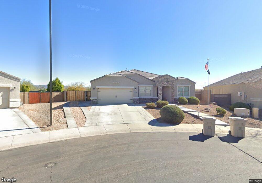
3425 N Brooklyn Dr Buckeye, AZ 85396
Estimated Value: $474,000 - $486,000
--
Bed
1
Bath
2,684
Sq Ft
$179/Sq Ft
Est. Value
About This Home
This home is located at 3425 N Brooklyn Dr, Buckeye, AZ 85396 and is currently estimated at $480,511, approximately $179 per square foot. 3425 N Brooklyn Dr is a home with nearby schools including Ruth Fisher Elementary School and Tonopah Valley High School.
Ownership History
Date
Name
Owned For
Owner Type
Purchase Details
Closed on
Dec 17, 2020
Sold by
Rezin John Stanley
Bought by
Rezin John Stanley and Bodrogi Suzanne M
Current Estimated Value
Purchase Details
Closed on
Aug 1, 2018
Sold by
D R Horton Inc
Bought by
Rezin John Stanley
Home Financials for this Owner
Home Financials are based on the most recent Mortgage that was taken out on this home.
Original Mortgage
$256,935
Outstanding Balance
$223,138
Interest Rate
4.5%
Mortgage Type
VA
Estimated Equity
$257,373
Purchase Details
Closed on
Oct 18, 2016
Sold by
Terrazzo Ii Llc
Bought by
D R Horton Inc
Purchase Details
Closed on
Dec 22, 2006
Sold by
Stardust Tartesso W12 Inc
Bought by
Pcg Tartesso Llc
Create a Home Valuation Report for This Property
The Home Valuation Report is an in-depth analysis detailing your home's value as well as a comparison with similar homes in the area
Home Values in the Area
Average Home Value in this Area
Purchase History
| Date | Buyer | Sale Price | Title Company |
|---|---|---|---|
| Rezin John Stanley | -- | None Available | |
| Rezin John Stanley | $256,935 | Dhi Title Agency | |
| D R Horton Inc | $1,555,400 | Dhi Title | |
| Pcg Tartesso Llc | $4,250,400 | First American Title |
Source: Public Records
Mortgage History
| Date | Status | Borrower | Loan Amount |
|---|---|---|---|
| Open | Rezin John Stanley | $256,935 |
Source: Public Records
Tax History Compared to Growth
Tax History
| Year | Tax Paid | Tax Assessment Tax Assessment Total Assessment is a certain percentage of the fair market value that is determined by local assessors to be the total taxable value of land and additions on the property. | Land | Improvement |
|---|---|---|---|---|
| 2025 | $2,664 | $21,053 | -- | -- |
| 2024 | $2,375 | $20,051 | -- | -- |
| 2023 | $2,375 | $35,160 | $7,030 | $28,130 |
| 2022 | $2,285 | $26,900 | $5,380 | $21,520 |
| 2021 | $2,105 | $23,970 | $4,790 | $19,180 |
| 2020 | $1,951 | $22,730 | $4,540 | $18,190 |
| 2019 | $1,893 | $21,820 | $4,360 | $17,460 |
| 2018 | $192 | $4,695 | $4,695 | $0 |
| 2017 | $192 | $3,975 | $3,975 | $0 |
| 2016 | $182 | $1,890 | $1,890 | $0 |
| 2015 | $195 | $1,216 | $1,216 | $0 |
Source: Public Records
Map
Nearby Homes
- 3375 N Brooklyn Dr
- 30618 W Osborn Rd
- 3164 N Lainey Ln
- 3407 N 307th Dr
- 3670 N 307th Dr
- 30777 W Whitton Ave
- 30773 W Cheery Lynn Rd
- 30560 W Weldon Ave
- 30700 W Weldon Ave
- 30794 W Whitton Ave
- 30546 W Celeborn Dr
- 3055 N Lainey Ln
- 3021 N 306th Ln
- 3791 N Brooklyn Dr
- 30851 W Columbus Ave
- 30864 W Whitton Ave
- 30323 W Sheila Ln
- 12467 N 305th Ave
- 12494 N 305th Ave
- 12462 N 305th Ave
- 3415 N Brooklyn Dr
- 3435 N Brooklyn Dr
- 3395 N Brooklyn Dr
- 30634 W Mulberry Dr
- 30633 W Mulberry Dr
- 30601 W Osborn Rd
- 3385 N Brooklyn Dr
- 30638 W Mulberry Dr
- 30637 W Mulberry Dr
- 30611 W Osborn Rd
- 30664 W Flower Ct
- 30621 W Osborn Rd
- 30642 W Mulberry Dr
- 30641 W Mulberry Dr
- 3501 N Brooklyn Dr
- 30674 W Flower Ct
- 30652 W Mulberry Dr
- 30651 W Mulberry Dr
- 3365 N Brooklyn Dr
- 30682 W Flower Ct