Estimated Value: $491,000 - $609,000
4
Beds
3
Baths
3,006
Sq Ft
$183/Sq Ft
Est. Value
About This Home
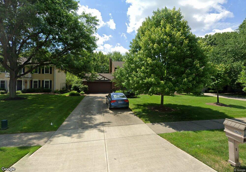
This home is located at 34250 Ada Dr, Solon, OH 44139 and is currently estimated at $549,438, approximately $182 per square foot. 34250 Ada Dr is a home located in Cuyahoga County with nearby schools including Orchard Middle School, Parkside Elementary School, and Solon Middle School.
Ownership History
Date
Name
Owned For
Owner Type
Purchase Details
Closed on
Jun 10, 2003
Sold by
Shelton Richard A and Shelton Margaret J
Bought by
Day Roger W and Day Wendy J
Current Estimated Value
Home Financials for this Owner
Home Financials are based on the most recent Mortgage that was taken out on this home.
Original Mortgage
$240,000
Outstanding Balance
$105,131
Interest Rate
5.78%
Mortgage Type
Purchase Money Mortgage
Estimated Equity
$444,307
Purchase Details
Closed on
Oct 24, 1986
Bought by
Shelton Richard A
Purchase Details
Closed on
Jan 1, 1985
Bought by
Constan Dev Co
Create a Home Valuation Report for This Property
The Home Valuation Report is an in-depth analysis detailing your home's value as well as a comparison with similar homes in the area
Home Values in the Area
Average Home Value in this Area
Purchase History
| Date | Buyer | Sale Price | Title Company |
|---|---|---|---|
| Day Roger W | $300,000 | Erie Title | |
| Shelton Richard A | $156,400 | -- | |
| Constan Dev Co | -- | -- |
Source: Public Records
Mortgage History
| Date | Status | Borrower | Loan Amount |
|---|---|---|---|
| Open | Day Roger W | $240,000 |
Source: Public Records
Tax History Compared to Growth
Tax History
| Year | Tax Paid | Tax Assessment Tax Assessment Total Assessment is a certain percentage of the fair market value that is determined by local assessors to be the total taxable value of land and additions on the property. | Land | Improvement |
|---|---|---|---|---|
| 2024 | $8,531 | $155,890 | $28,805 | $127,085 |
| 2023 | $8,300 | $124,050 | $25,450 | $98,600 |
| 2022 | $8,282 | $124,040 | $25,450 | $98,600 |
| 2021 | $8,188 | $124,040 | $25,450 | $98,600 |
| 2020 | $8,212 | $113,790 | $23,350 | $90,440 |
| 2019 | $7,954 | $325,100 | $66,700 | $258,400 |
| 2018 | $6,984 | $113,790 | $23,350 | $90,440 |
| 2017 | $6,913 | $104,440 | $20,230 | $84,210 |
| 2016 | $6,848 | $104,440 | $20,230 | $84,210 |
| 2015 | $6,575 | $104,440 | $20,230 | $84,210 |
| 2014 | $6,575 | $96,710 | $18,730 | $77,980 |
Source: Public Records
Map
Nearby Homes
- 7071 Navajo Trail
- 7032 Navajo Trail
- 7161 Som Center Rd
- 35160 Spatterdock Ln
- 36015 Spatterdock Ln
- 6676 Solon Blvd
- 32756 Washington Ct Unit 56
- 32469 Jefferson Dr Unit 3
- 6698 Glenallen Ave
- 7375 Som Center Rd
- 33203 Brackenbury Dr
- 7460 Hillside Ln
- 6454 Huntington Dr
- V/L (1.32 Acres) Aurora Rd
- 7471 Som Center Rd
- 7331 Cheshire Place
- 7260 Annadale Dr
- 7256 Dursley Ct
- 7372 Liberty Rd
- 32700 Pettibone Rd