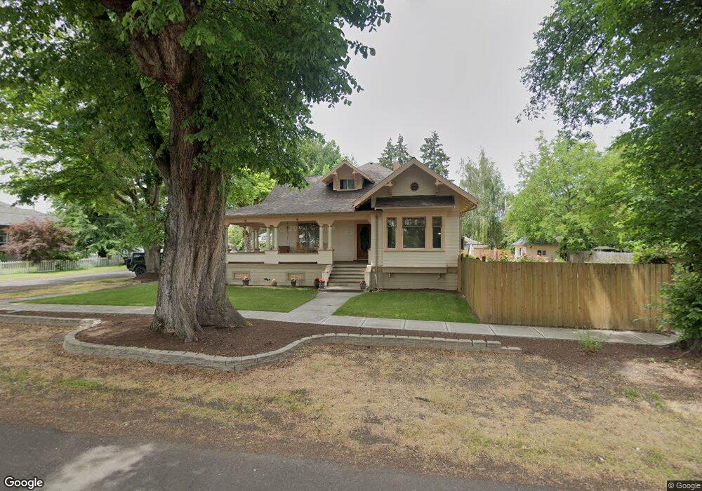
3427 4th St Hubbard, OR 97032
Estimated Value: $519,642 - $713,000
1
Bed
2
Baths
2,100
Sq Ft
$283/Sq Ft
Est. Value
About This Home
This home is located at 3427 4th St, Hubbard, OR 97032 and is currently estimated at $595,161, approximately $283 per square foot. 3427 4th St is a home located in Marion County with nearby schools including North Marion Primary School, North Marion Middle School, and North Marion High School.
Ownership History
Date
Name
Owned For
Owner Type
Purchase Details
Closed on
Jul 22, 2004
Sold by
Peterson Kathleen A
Bought by
Rostocil Charles E and Rostocil Crystal R
Current Estimated Value
Home Financials for this Owner
Home Financials are based on the most recent Mortgage that was taken out on this home.
Original Mortgage
$203,920
Outstanding Balance
$102,208
Interest Rate
6.27%
Mortgage Type
Purchase Money Mortgage
Estimated Equity
$492,953
Create a Home Valuation Report for This Property
The Home Valuation Report is an in-depth analysis detailing your home's value as well as a comparison with similar homes in the area
Home Values in the Area
Average Home Value in this Area
Purchase History
| Date | Buyer | Sale Price | Title Company |
|---|---|---|---|
| Rostocil Charles E | $254,900 | Fidelity Natl Title Co Of Or |
Source: Public Records
Mortgage History
| Date | Status | Borrower | Loan Amount |
|---|---|---|---|
| Open | Rostocil Charles E | $203,920 | |
| Closed | Rostocil Charles E | $50,980 |
Source: Public Records
Tax History Compared to Growth
Tax History
| Year | Tax Paid | Tax Assessment Tax Assessment Total Assessment is a certain percentage of the fair market value that is determined by local assessors to be the total taxable value of land and additions on the property. | Land | Improvement |
|---|---|---|---|---|
| 2025 | $3,457 | $232,530 | -- | -- |
| 2024 | $3,457 | $225,760 | -- | -- |
| 2023 | $3,337 | $219,190 | $0 | $0 |
| 2022 | $3,169 | $212,810 | $0 | $0 |
| 2021 | $3,056 | $206,620 | $0 | $0 |
| 2020 | $2,993 | $200,610 | $0 | $0 |
| 2019 | $2,740 | $194,770 | $0 | $0 |
| 2018 | $2,742 | $0 | $0 | $0 |
| 2017 | $2,595 | $0 | $0 | $0 |
| 2016 | $2,533 | $0 | $0 | $0 |
| 2015 | $2,476 | $0 | $0 | $0 |
| 2014 | $2,379 | $0 | $0 | $0 |
Source: Public Records
Map
Nearby Homes
- 2389 F St
- 3218 West Place
- 2356 B St
- 18767 Oregon 99e
- 3766 10th St
- 3472 Hoodview Dr
- 3197 Rainbow Loop Unit 10
- 2514 Baines Blvd
- 2663 Baines Bl
- 2143 Dorsey (-2145) Dr
- 2143 Dorsey Dr
- 2663 Baines Blvd
- 2157 Dorsey Dr
- 3370 Maple St
- 3370 Maple St Unit 44
- 2469 Dorsey Dr
- 18767 Highway 99e
- 19601 Boones Ferry Rd NE
- 11613 Pacific Ct NE
- 17765 Monnier Rd NE