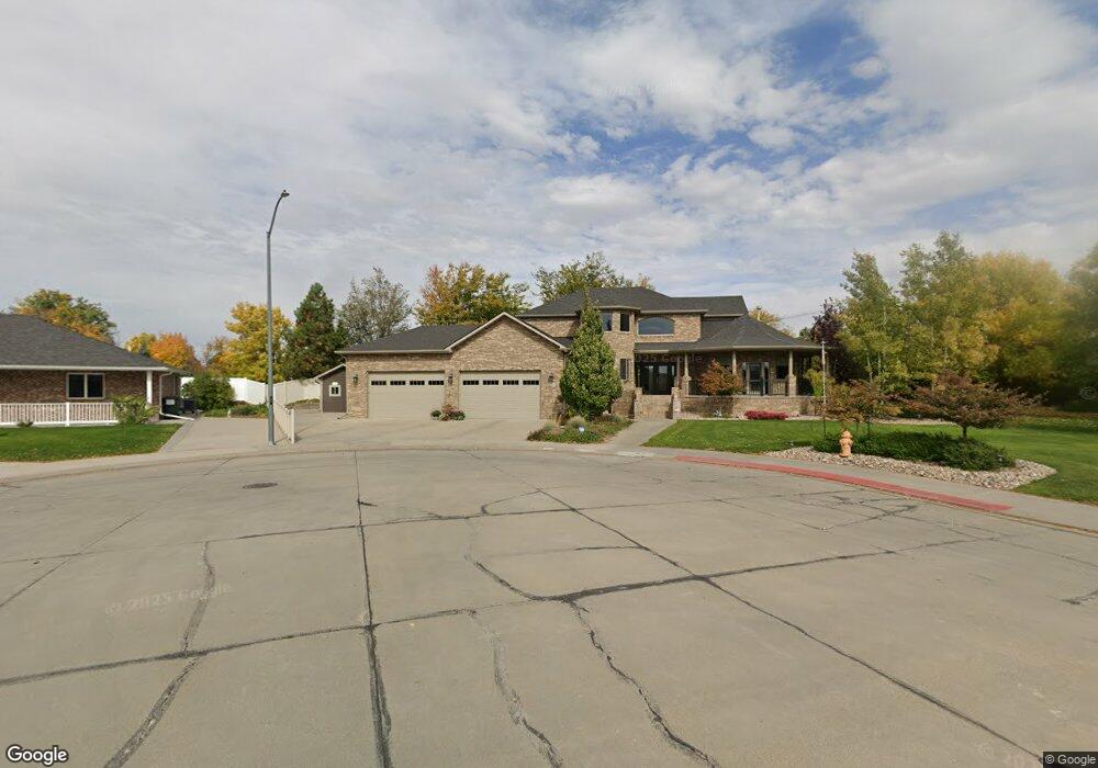
3427 Cary Ct Scottsbluff, NE 69361
Estimated Value: $521,000 - $621,752
5
Beds
5
Baths
2,851
Sq Ft
$206/Sq Ft
Est. Value
About This Home
This home is located at 3427 Cary Ct, Scottsbluff, NE 69361 and is currently estimated at $587,688, approximately $206 per square foot. 3427 Cary Ct is a home located in Scotts Bluff County with nearby schools including Longfellow Elementary School, Bluffs Middle School, and Scottsbluff Senior High School.
Ownership History
Date
Name
Owned For
Owner Type
Purchase Details
Closed on
Jul 23, 2014
Sold by
Anderson Marie and Dehaai Marie E
Bought by
Dehaai Marie E
Current Estimated Value
Purchase Details
Closed on
Jul 3, 2009
Sold by
Liebentritt Joseph L and Liebentritt Carol D
Bought by
Anderson Marie and Anderson Guy
Home Financials for this Owner
Home Financials are based on the most recent Mortgage that was taken out on this home.
Original Mortgage
$280,000
Interest Rate
5.39%
Mortgage Type
New Conventional
Create a Home Valuation Report for This Property
The Home Valuation Report is an in-depth analysis detailing your home's value as well as a comparison with similar homes in the area
Home Values in the Area
Average Home Value in this Area
Purchase History
| Date | Buyer | Sale Price | Title Company |
|---|---|---|---|
| Dehaai Marie E | -- | None Available | |
| Anderson Marie | $360,000 | -- |
Source: Public Records
Mortgage History
| Date | Status | Borrower | Loan Amount |
|---|---|---|---|
| Closed | Anderson Marie | $280,000 |
Source: Public Records
Tax History
| Year | Tax Paid | Tax Assessment Tax Assessment Total Assessment is a certain percentage of the fair market value that is determined by local assessors to be the total taxable value of land and additions on the property. | Land | Improvement |
|---|---|---|---|---|
| 2025 | $7,450 | $618,110 | $51,895 | $566,215 |
| 2024 | $7,184 | $578,727 | $39,475 | $539,252 |
| 2023 | $9,937 | $490,688 | $32,685 | $458,003 |
| 2022 | $9,937 | $490,688 | $32,685 | $458,003 |
| 2021 | $9,230 | $449,051 | $32,685 | $416,366 |
| 2020 | $8,955 | $433,037 | $32,685 | $400,352 |
| 2019 | $8,702 | $421,376 | $32,685 | $388,691 |
| 2018 | $8,756 | $421,376 | $32,685 | $388,691 |
| 2017 | $8,474 | $406,426 | $32,685 | $373,741 |
| 2016 | $8,483 | $406,426 | $32,685 | $373,741 |
| 2015 | $8,052 | $388,629 | $32,685 | $355,944 |
| 2014 | $7,531 | $388,629 | $32,685 | $355,944 |
| 2012 | -- | $388,629 | $32,685 | $355,944 |
Source: Public Records
Map
Nearby Homes
- 250455 Seip Rd
- TBD Hillcrest Dr
- 3209 8th Ave
- TBD U S Highway 26
- 3405 Ross Ave
- Lot 1 31st St
- 2805 5th Ave
- 613 E 28th St
- Lot 2 31st St
- 2618 4th Ave
- 3918 Hilltop Estate Place
- 3701 Juniper Dr
- 3319 Verbena Dr
- 522 E 26th St
- 908 E 42nd St
- TBD E 27th St
- 2426 5th Ave
- 410 Sandra Ct
- 1214 E 27th St
- 1523 Idlewylde Dr
- Unknown Cary Ct
- Unknown Cary Ct
- Unknown Cary Ct
- Unknown Cary Ct
- . Cary Ct
- 502 E 35th St
- 3217 5th Ave
- 3217 5th Ave
- 3421 Cary Ct
- 401 Hillcrest Dr
- 3414 Cary Ct
- 329 Hillcrest Dr
- 501 Hillcrest Dr
- 522 E 35th St
- 322 Hillcrest Dr
- 330 Hillcrest Dr
- 502 Hillcrest Dr
- 602 E 35th St
- 521 Hillcrest Dr
- 510 Hillcrest Dr
Your Personal Tour Guide
Ask me questions while you tour the home.