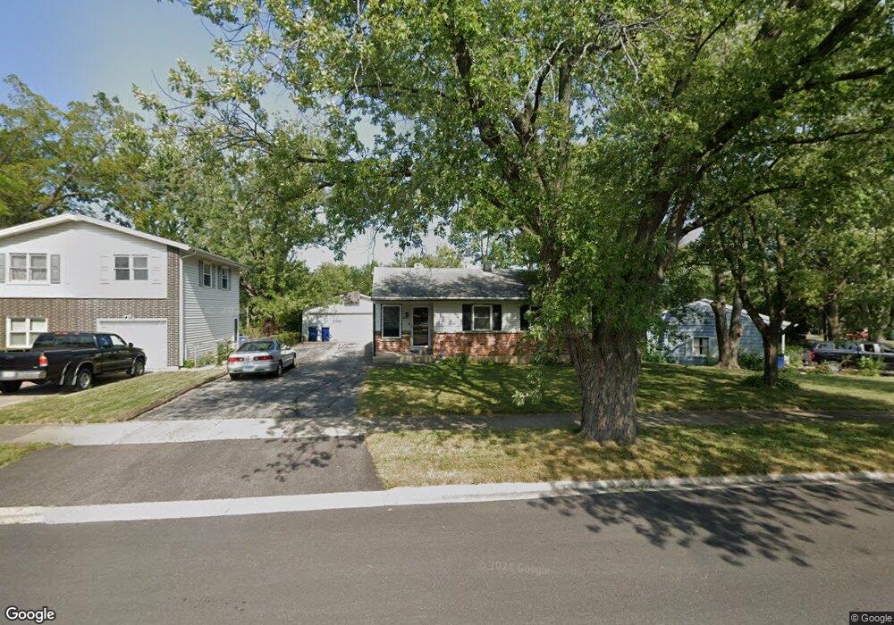
3427 Newcastle Rd Waukegan, IL 60087
Estimated Value: $240,000 - $281,000
3
Beds
2
Baths
1,056
Sq Ft
$246/Sq Ft
Est. Value
About This Home
This home is located at 3427 Newcastle Rd, Waukegan, IL 60087 and is currently estimated at $259,728, approximately $245 per square foot. 3427 Newcastle Rd is a home located in Lake County with nearby schools including H R McCall Elementary School, Jack Benny Middle School, and Waukegan High School.
Ownership History
Date
Name
Owned For
Owner Type
Purchase Details
Closed on
Jan 5, 2001
Sold by
Naber John M and Naber Betty J
Bought by
Dunn Derek R
Current Estimated Value
Home Financials for this Owner
Home Financials are based on the most recent Mortgage that was taken out on this home.
Original Mortgage
$93,600
Interest Rate
7.05%
Purchase Details
Closed on
Mar 2, 1999
Sold by
Koehmstedt Elizabeth M
Bought by
Naber John M and Naber Betty J
Purchase Details
Closed on
Jul 21, 1995
Sold by
Miller Evelyn H
Bought by
Koehmstedt Elizabeth M
Create a Home Valuation Report for This Property
The Home Valuation Report is an in-depth analysis detailing your home's value as well as a comparison with similar homes in the area
Home Values in the Area
Average Home Value in this Area
Purchase History
| Date | Buyer | Sale Price | Title Company |
|---|---|---|---|
| Dunn Derek R | $117,000 | First American Title | |
| Naber John M | -- | Chicago Title Insurance Co | |
| Koehmstedt Elizabeth M | -- | -- |
Source: Public Records
Mortgage History
| Date | Status | Borrower | Loan Amount |
|---|---|---|---|
| Previous Owner | Dunn Derek R | $93,600 | |
| Closed | Dunn Derek R | $17,550 |
Source: Public Records
Tax History Compared to Growth
Tax History
| Year | Tax Paid | Tax Assessment Tax Assessment Total Assessment is a certain percentage of the fair market value that is determined by local assessors to be the total taxable value of land and additions on the property. | Land | Improvement |
|---|---|---|---|---|
| 2024 | $4,956 | $69,499 | $6,751 | $62,748 |
| 2023 | $4,055 | $61,163 | $6,517 | $54,646 |
| 2022 | $4,055 | $47,977 | $6,376 | $41,601 |
| 2021 | $4,195 | $46,757 | $6,214 | $40,543 |
| 2020 | $4,318 | $44,620 | $5,930 | $38,690 |
| 2019 | $4,472 | $42,334 | $5,626 | $36,708 |
| 2018 | $3,943 | $36,240 | $6,756 | $29,484 |
| 2017 | $3,932 | $34,093 | $6,356 | $27,737 |
| 2016 | $4,017 | $32,457 | $6,051 | $26,406 |
| 2015 | $3,940 | $29,766 | $5,549 | $24,217 |
| 2014 | $5,000 | $37,215 | $9,134 | $28,081 |
| 2012 | $5,775 | $38,673 | $9,492 | $29,181 |
Source: Public Records
Map
Nearby Homes
- 3411 N Lewis Ave
- 3211 Rugby Ct
- 37966 N Cornell Rd
- 1730 W Beach Rd
- 3101 Country Club Ln
- 38683 N Lewis Ave
- 38127 N Shore Ave
- 1636 Rice St
- 38362 N Manor Ave
- 38697 N Cedar Ave
- 37905 N Loyola Ave
- 11345 W Carnahan Ave
- 12582 W Beach Rd
- 11342-11364 W Wadsworth Rd
- 1612 Whitney St
- 2613 N Lewis Ave
- 12312 W Audrey Ave
- 38859 N Green Bay Rd
- 2708 Dana Ave
- 12640 W Wadsworth Rd
- 3431 Newcastle Rd
- 2034 Herbert Dr
- 3435 Newcastle Rd
- 3434 Rock Pkwy
- 3430 Newcastle Rd
- 3430 Rock Pkwy
- 3438 Rock Pkwy
- 3439 Newcastle Rd
- 3500 Rock Pkwy
- 3424 Rock Pkwy
- 3436 Newcastle Rd
- 3415 Newcastle Rd
- 3410 Newcastle Rd
- 3443 Newcastle Rd
- 3504 Rock Pkwy
- 2033 Herbert Dr
- 2105 Herbert Dr
- 2116 Herbert Dr
- 3440 Newcastle Rd
- 2029 Herbert Dr