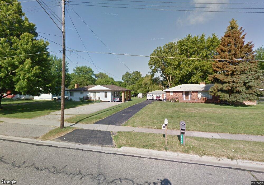
3428 Camden Ave Flint, MI 48507
South Side NeighborhoodEstimated Value: $170,000 - $185,219
2
Beds
2
Baths
1,796
Sq Ft
$98/Sq Ft
Est. Value
About This Home
This home is located at 3428 Camden Ave, Flint, MI 48507 and is currently estimated at $176,555, approximately $98 per square foot. 3428 Camden Ave is a home located in Genesee County with nearby schools including Carman-Ainsworth High School and International Academy of Flint (K-12).
Ownership History
Date
Name
Owned For
Owner Type
Purchase Details
Closed on
Feb 17, 2016
Sold by
Brooks Janet R
Bought by
Pierce Gary D and Pierce Diane M
Current Estimated Value
Purchase Details
Closed on
Nov 30, 2010
Sold by
Brooks Janet R and Bernard Janet R
Bought by
Pierce Gary and Pierce Diane
Purchase Details
Closed on
Sep 10, 1999
Sold by
Estate Of Mary J Recowski
Bought by
Bernard Janet R
Home Financials for this Owner
Home Financials are based on the most recent Mortgage that was taken out on this home.
Original Mortgage
$68,000
Interest Rate
7.93%
Mortgage Type
Purchase Money Mortgage
Create a Home Valuation Report for This Property
The Home Valuation Report is an in-depth analysis detailing your home's value as well as a comparison with similar homes in the area
Home Values in the Area
Average Home Value in this Area
Purchase History
| Date | Buyer | Sale Price | Title Company |
|---|---|---|---|
| Pierce Gary D | $72,000 | Attorney | |
| Pierce Gary | -- | None Available | |
| Bernard Janet R | $85,000 | First American Title Ins Co |
Source: Public Records
Mortgage History
| Date | Status | Borrower | Loan Amount |
|---|---|---|---|
| Previous Owner | Bernard Janet R | $68,000 |
Source: Public Records
Tax History
| Year | Tax Paid | Tax Assessment Tax Assessment Total Assessment is a certain percentage of the fair market value that is determined by local assessors to be the total taxable value of land and additions on the property. | Land | Improvement |
|---|---|---|---|---|
| 2025 | $2,249 | $80,200 | $0 | $0 |
| 2024 | $1,808 | $101,300 | $0 | $0 |
| 2023 | $1,774 | $57,100 | $0 | $0 |
| 2022 | $669 | $56,800 | $0 | $0 |
| 2021 | $328 | $59,400 | $0 | $0 |
| 2020 | $1,910 | $61,200 | $0 | $0 |
| 2019 | $1,565 | $56,100 | $0 | $0 |
| 2018 | $1,831 | $48,100 | $0 | $0 |
| 2017 | $1,785 | $48,100 | $0 | $0 |
| 2016 | $1,753 | $43,500 | $0 | $0 |
| 2015 | $1,878 | $0 | $0 | $0 |
| 2012 | -- | $35,600 | $35,600 | $0 |
Source: Public Records
Map
Nearby Homes
- 3433 Camden Ave
- 1019 E Bristol Rd
- 1219 Norton St
- 846 W Hemphill Rd
- 1216 E Hemphill Rd
- 912 Markham St
- 1034 W Bergin Ave
- 1335 Connell St
- 4418 Brunswick Ave
- 1122 Markham St
- 1388 Carman St
- 829 Clinton St
- 1210 Pinehurst Ave
- 1409 James St
- 1085 W Parkwood Ave
- 845 Alvord Ave
- 805 Alvord Ave
- 1015 Alvord Ave
- 806 Alvord Ave
- 1314 Pinehurst Ave
- 3418 Camden Ave
- 3434 Camden Ave
- 1113 E Mandeville St
- 1107 E Mandeville St
- 1101 E Mandeville St
- 3444 Camden Ave
- 1095 E Mandeville St
- 1121 E Mandeville St
- 1081 E Mandeville St
- 1127 E Mandeville St
- 3433 Camden Ave
- 3456 Camden Ave
- 3438 Camden Ave
- 3437 Camden Ave
- 3427 Camden Ave
- 3427 Camden Ave
- 3445 Camden Ave
- 1077 E Mandeville St
- 1071 E Mandeville St
- 1158 Carman St
Your Personal Tour Guide
Ask me questions while you tour the home.