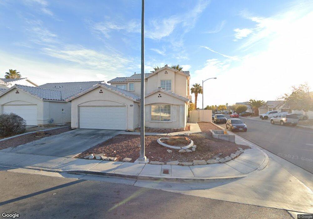
3428 Canter Dr North Las Vegas, NV 89032
Cheyenne NeighborhoodEstimated Value: $410,238 - $448,000
3
Beds
3
Baths
1,999
Sq Ft
$215/Sq Ft
Est. Value
About This Home
This home is located at 3428 Canter Dr, North Las Vegas, NV 89032 and is currently estimated at $429,310, approximately $214 per square foot. 3428 Canter Dr is a home located in Clark County with nearby schools including Claude & Stella Parson Elementary School, Theron L Swainston Middle School, and Cheyenne High School.
Ownership History
Date
Name
Owned For
Owner Type
Purchase Details
Closed on
Mar 28, 2002
Sold by
Culanag Robert M
Bought by
Culanag Alicia Paa
Current Estimated Value
Home Financials for this Owner
Home Financials are based on the most recent Mortgage that was taken out on this home.
Original Mortgage
$161,415
Outstanding Balance
$68,440
Interest Rate
7.13%
Mortgage Type
Seller Take Back
Estimated Equity
$360,870
Purchase Details
Closed on
Oct 18, 2001
Sold by
Warden Robert L
Bought by
Washington Mutual Home Loans Inc
Purchase Details
Closed on
Apr 4, 1995
Sold by
Warden Janet
Bought by
Warden Robert L
Home Financials for this Owner
Home Financials are based on the most recent Mortgage that was taken out on this home.
Original Mortgage
$128,509
Interest Rate
8.81%
Mortgage Type
Assumption
Create a Home Valuation Report for This Property
The Home Valuation Report is an in-depth analysis detailing your home's value as well as a comparison with similar homes in the area
Home Values in the Area
Average Home Value in this Area
Purchase History
| Date | Buyer | Sale Price | Title Company |
|---|---|---|---|
| Culanag Alicia Paa | -- | -- | |
| Culanag Alicia Paa | $169,911 | -- | |
| Washington Mutual Home Loans Inc | $133,077 | Fidelity National Title | |
| Va | -- | Fidelity National Title | |
| Warden Robert L | -- | United Title | |
| Warden Robert L | $126,000 | United Title |
Source: Public Records
Mortgage History
| Date | Status | Borrower | Loan Amount |
|---|---|---|---|
| Open | Culanag Alicia Paa | $161,415 | |
| Previous Owner | Warden Robert L | $128,509 |
Source: Public Records
Tax History Compared to Growth
Tax History
| Year | Tax Paid | Tax Assessment Tax Assessment Total Assessment is a certain percentage of the fair market value that is determined by local assessors to be the total taxable value of land and additions on the property. | Land | Improvement |
|---|---|---|---|---|
| 2025 | $1,817 | $90,577 | $28,350 | $62,227 |
| 2024 | $1,683 | $90,577 | $28,350 | $62,227 |
| 2023 | $1,120 | $88,055 | $28,700 | $59,355 |
| 2022 | $1,559 | $79,926 | $25,550 | $54,376 |
| 2021 | $1,443 | $74,345 | $22,400 | $51,945 |
| 2020 | $1,337 | $72,683 | $21,000 | $51,683 |
| 2019 | $1,253 | $68,339 | $17,500 | $50,839 |
| 2018 | $1,196 | $63,570 | $14,700 | $48,870 |
| 2017 | $1,942 | $57,882 | $12,250 | $45,632 |
| 2016 | $1,120 | $50,797 | $9,450 | $41,347 |
| 2015 | $1,117 | $36,268 | $5,250 | $31,018 |
| 2014 | $1,082 | $32,255 | $5,250 | $27,005 |
Source: Public Records
Map
Nearby Homes
- 4707 Chestnut Blaze Dr
- 4542 Silver Bit Ct
- 3318 N Decatur Blvd Unit 2143
- 3318 N Decatur Blvd Unit 2112
- 3318 N Decatur Blvd Unit 1088
- 3318 N Decatur Blvd Unit 2072
- 3318 N Decatur Blvd Unit 1092
- 3318 N Decatur Blvd Unit 1043
- 3318 N Decatur Blvd Unit 2007
- 3318 N Decatur Blvd Unit 2057
- 3318 N Decatur Blvd Unit 2083
- 3318 N Decatur Blvd Unit 1013
- 3318 N Decatur Blvd Unit 2103
- 3318 N Decatur Blvd Unit 2077
- 3318 N Decatur Blvd Unit 1035
- 3318 N Decatur Blvd Unit 2110
- 3318 N Decatur Blvd Unit 1002
- 3318 N Decatur Blvd Unit 1044
- 3318 N Decatur Blvd Unit 1056
- 4525 Ranch Foreman Rd
- 3432 Canter Dr Unit 1
- 3436 Canter Dr
- 3436 Canter Dr Unit Yours
- 3425 Golden Sage Dr
- 3429 Golden Sage Dr
- 4639 Chestnut Blaze Dr
- 4635 Chestnut Blaze Dr
- 3433 Golden Sage Dr
- 3440 Canter Dr
- 4643 Chestnut Blaze Dr
- 4631 Chestnut Blaze Dr
- 4631 Chestnut Blaze Dr
- 4631 Chestnut Blaze Dr
- 4631 Chestnut Blaze Dr
- 4631 Chestnut Blaze Dr
- 4631 Chestnut Blaze Dr
- 3429 Canter Dr
- 4703 Chestnut Blaze Dr
- 3433 Canter Dr
- 3437 Golden Sage Dr