Estimated Value: $109,574 - $358,000
--
Bed
1
Bath
1,350
Sq Ft
$169/Sq Ft
Est. Value
About This Home
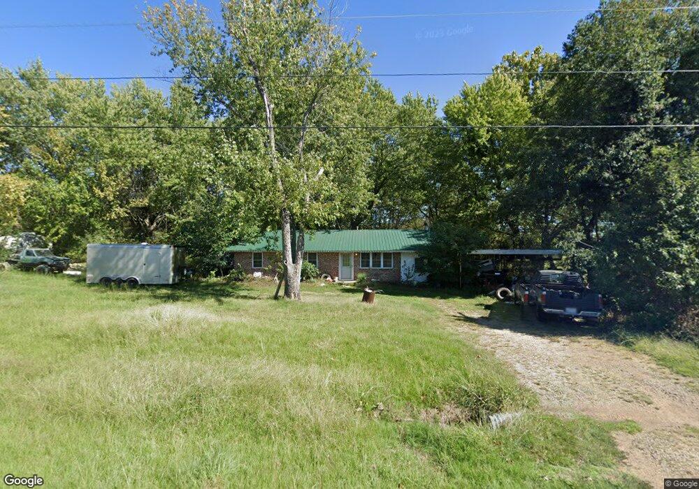
This home is located at 3428 Highway 41, Cecil, AR 72930 and is currently estimated at $228,394, approximately $169 per square foot. 3428 Highway 41 is a home located in Franklin County with nearby schools including County Line Elementary School and County Line High School.
Ownership History
Date
Name
Owned For
Owner Type
Purchase Details
Closed on
Feb 20, 2025
Sold by
Post Dustin E
Bought by
Wilson Jordan and Wilson Hannah
Current Estimated Value
Purchase Details
Closed on
Feb 14, 2025
Sold by
Wilson Jordan and Wilson Hannah
Bought by
Post Dustin E
Purchase Details
Closed on
May 12, 2010
Sold by
Post Heather D and Tune Robin
Bought by
Post Dustin E
Purchase Details
Closed on
Mar 19, 2002
Bought by
Lowrey and Post
Purchase Details
Closed on
Jul 25, 1997
Bought by
Franklin and Lowrey
Purchase Details
Closed on
Jun 23, 1997
Bought by
Franklin Heirs and Franklin Franklin
Purchase Details
Closed on
Dec 4, 1995
Bought by
Franklin and Franklin
Purchase Details
Closed on
Jun 19, 1995
Bought by
Julie Franklin and Ronald Franklin
Purchase Details
Closed on
Sep 1, 1992
Bought by
Franklin and Franklin
Create a Home Valuation Report for This Property
The Home Valuation Report is an in-depth analysis detailing your home's value as well as a comparison with similar homes in the area
Home Values in the Area
Average Home Value in this Area
Purchase History
| Date | Buyer | Sale Price | Title Company |
|---|---|---|---|
| Wilson Jordan | -- | None Listed On Document | |
| Post Dustin E | -- | None Listed On Document | |
| Post Dustin E | -- | -- | |
| Lowrey | $65,000 | -- | |
| Franklin | $40,000 | -- | |
| Franklin Heirs | -- | -- | |
| Franklin | -- | -- | |
| Julie Franklin | -- | -- | |
| Franklin | $32,000 | -- |
Source: Public Records
Tax History Compared to Growth
Tax History
| Year | Tax Paid | Tax Assessment Tax Assessment Total Assessment is a certain percentage of the fair market value that is determined by local assessors to be the total taxable value of land and additions on the property. | Land | Improvement |
|---|---|---|---|---|
| 2025 | $119 | $15,810 | $770 | $15,040 |
| 2024 | $227 | $17,830 | $2,790 | $15,040 |
| 2023 | $271 | $16,440 | $1,400 | $15,040 |
| 2022 | $320 | $16,440 | $1,400 | $15,040 |
| 2021 | $289 | $16,440 | $1,400 | $15,040 |
| 2020 | $258 | $13,890 | $1,200 | $12,690 |
| 2019 | $257 | $13,890 | $1,200 | $12,690 |
| 2018 | $282 | $13,890 | $1,200 | $12,690 |
| 2017 | $282 | $13,890 | $1,200 | $12,690 |
| 2016 | $282 | $13,890 | $1,200 | $12,690 |
| 2015 | $265 | $13,520 | $1,400 | $12,120 |
| 2014 | -- | $13,520 | $1,400 | $12,120 |
| 2013 | -- | $13,520 | $1,400 | $12,120 |
Source: Public Records
Map
Nearby Homes
- 105 W Hwy 96
- 000 N Highway 41
- 000 Arkansas 41
- 0 Citadel Bluff Trail
- 918 Citadel Bluff Trail
- 0 Oak Bend Ln
- 5B TBD Spring Creek Trail
- TBD 7A Spring Creek Trail
- 2405 Shelby Ln
- 0 Oak Bend Rd
- TBD Oak Bend Rd
- 5300 Oak Bend Rd
- 5100 Oak Bend Rd
- 923 Sandstone Ridge Rd
- 5644 Oak Bend Rd
- 4943 Anice Rd
- 8071 Red Oak Dr
- 5631 Anice Rd
- 3046 Smiths Creek Rd
- 5448 E Highway 96
- 7 E Highway 96
- 3443 Highway 41
- 11 W Highway 96
- 3501 Highway 41
- 10 Arkansas 96
- 207 W Highway 96
- 207 W Highway 96
- 12 W Highway 96
- 3526 Highway 41
- 3526 Arkansas 41
- 5757 Oak Bend Rd
- 34 E Highway 96
- 105 W Highway 96
- 3329 Highway 41
- 102 W Highway 96
- 3314 Highway 41
- 108 W Highway 96
- 110 E Highway 96
- 127 E Highway 96
- 124 E Highway 96