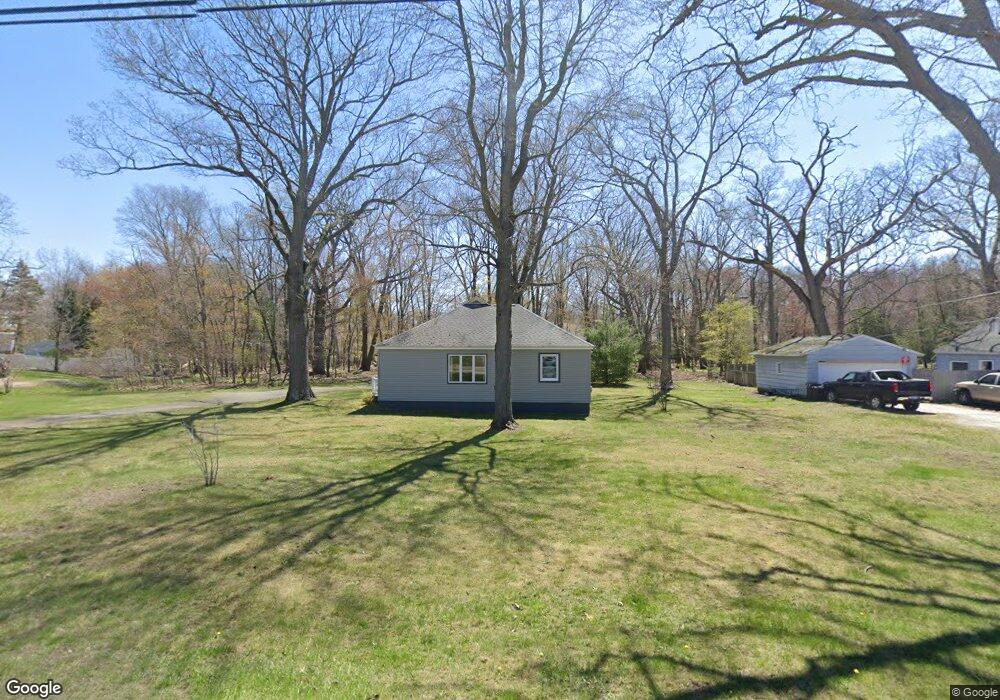
3428 Roosevelt Rd Norton Shores, MI 49441
Estimated Value: $225,700 - $291,000
--
Bed
1
Bath
1,705
Sq Ft
$158/Sq Ft
Est. Value
About This Home
This home is located at 3428 Roosevelt Rd, Norton Shores, MI 49441 and is currently estimated at $269,675, approximately $158 per square foot. 3428 Roosevelt Rd is a home located in Muskegon County with nearby schools including Mona Shores High School, Dr. Martin Luther King Academy, and West Shore Lutheran School.
Ownership History
Date
Name
Owned For
Owner Type
Purchase Details
Closed on
Sep 9, 2021
Sold by
Strieder Marilyn E
Bought by
Strieder Marilyn E and Tardani Christi
Current Estimated Value
Purchase Details
Closed on
Jan 23, 2019
Sold by
Strieder Marilyn E
Bought by
Strieder Marilyn E
Purchase Details
Closed on
Oct 11, 2013
Sold by
Strieder Marilyn E
Bought by
Strieder Marilyn E and Tardani Cristi
Purchase Details
Closed on
Apr 18, 2013
Sold by
Strieder Marilyn E
Bought by
Strieder Marilyn E and Hemond Frances S
Create a Home Valuation Report for This Property
The Home Valuation Report is an in-depth analysis detailing your home's value as well as a comparison with similar homes in the area
Home Values in the Area
Average Home Value in this Area
Purchase History
| Date | Buyer | Sale Price | Title Company |
|---|---|---|---|
| Strieder Marilyn E | -- | None Available | |
| Strieder Marilyn E | -- | None Available | |
| Strieder Marilyn E | -- | None Available | |
| Strieder Marilyn E | -- | None Available |
Source: Public Records
Tax History Compared to Growth
Tax History
| Year | Tax Paid | Tax Assessment Tax Assessment Total Assessment is a certain percentage of the fair market value that is determined by local assessors to be the total taxable value of land and additions on the property. | Land | Improvement |
|---|---|---|---|---|
| 2025 | $1,945 | $104,800 | $0 | $0 |
| 2024 | $1,525 | $95,100 | $0 | $0 |
| 2023 | $1,456 | $84,000 | $0 | $0 |
| 2022 | $1,775 | $72,700 | $0 | $0 |
| 2021 | $1,725 | $66,400 | $0 | $0 |
| 2020 | $1,706 | $62,200 | $0 | $0 |
| 2019 | $1,674 | $54,200 | $0 | $0 |
| 2018 | $1,635 | $50,400 | $0 | $0 |
| 2017 | $1,597 | $48,200 | $0 | $0 |
| 2016 | $1,237 | $44,800 | $0 | $0 |
| 2015 | -- | $42,300 | $0 | $0 |
| 2014 | $1,484 | $41,700 | $0 | $0 |
| 2013 | -- | $38,400 | $0 | $0 |
Source: Public Records
Map
Nearby Homes
- 1744 W Norton Ave
- 1733 Woodside Rd
- 3658 Lake Harbor Rd
- 3246 Royal Oak Rd
- 1480 Marlboro Rd
- 1582 Haverhill Rd
- 1448 Marlboro Rd
- 3684 Harris Dr
- 1936 Lawnel Ave
- 1243 Crandall Ave
- 3283 Mccracken St
- 3320 Davis Rd
- 1947 Spencer Dr
- 1689 Bonneville Dr
- 3891 Wickham Dr
- 1650 Bonneville Dr
- 1752 Bonneville Dr
- 2059 Garland Dr
- 3920 Braeburn Dr
- 1377 Princeton Rd
- 3418 Roosevelt Rd
- 3442 Roosevelt Rd
- 3455 Norton Woods Dr
- 1575 W Norton Ave
- 3460 Roosevelt Rd
- 1655 W Norton Ave
- 3463 Norton Woods Dr
- 1620 W Norton Ave
- 3489 Wickham Dr
- 1565 W Norton Ave
- 1632 W Norton Ave
- 3479 Norton Woods Dr Unit 15
- 3470 Roosevelt Rd
- 1642 W Norton Ave
- 3464 Norton Woods Dr Unit 30
- 1611 Leif Ave
- 1665 W Norton Ave
- 1623 Leif Ave
- 1654 W Norton Ave
- 1539 W Norton Ave