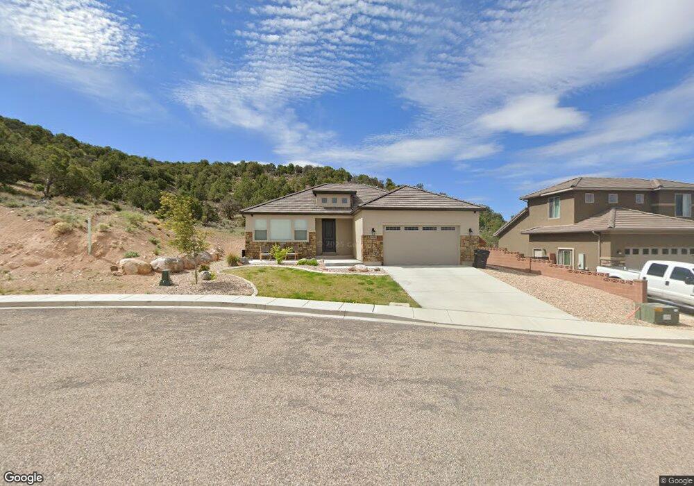
3429 W 375 S Unit 2 Cedar City, UT 84720
Estimated Value: $489,000 - $533,000
--
Bed
--
Bath
--
Sq Ft
6,970
Sq Ft Lot
About This Home
This home is located at 3429 W 375 S Unit 2, Cedar City, UT 84720 and is currently estimated at $504,214. 3429 W 375 S Unit 2 is a home located in Iron County with nearby schools including Iron Springs School, Cedar Middle School, and Cedar City High School.
Ownership History
Date
Name
Owned For
Owner Type
Purchase Details
Closed on
Jan 13, 2022
Sold by
Son Builders Inc
Bought by
Spurlock Matthew and Spurlock Melissa
Current Estimated Value
Home Financials for this Owner
Home Financials are based on the most recent Mortgage that was taken out on this home.
Original Mortgage
$440,910
Outstanding Balance
$406,033
Interest Rate
3.05%
Mortgage Type
New Conventional
Estimated Equity
$98,181
Purchase Details
Closed on
Jan 12, 2022
Sold by
Son Builders Inc
Bought by
Spurlock Matthew and Spurlock Melissa
Home Financials for this Owner
Home Financials are based on the most recent Mortgage that was taken out on this home.
Original Mortgage
$440,910
Outstanding Balance
$406,033
Interest Rate
3.05%
Mortgage Type
New Conventional
Estimated Equity
$98,181
Purchase Details
Closed on
Mar 1, 2010
Sold by
Diversified Properties Lc
Bought by
Son Builders Inc
Create a Home Valuation Report for This Property
The Home Valuation Report is an in-depth analysis detailing your home's value as well as a comparison with similar homes in the area
Home Values in the Area
Average Home Value in this Area
Purchase History
| Date | Buyer | Sale Price | Title Company |
|---|---|---|---|
| Spurlock Matthew | -- | Security Escrow & Title | |
| Spurlock Matthew | -- | Security Escrow & Title | |
| Son Builders Inc | -- | -- |
Source: Public Records
Mortgage History
| Date | Status | Borrower | Loan Amount |
|---|---|---|---|
| Open | Spurlock Matthew | $440,910 | |
| Closed | Spurlock Matthew | $440,910 |
Source: Public Records
Tax History Compared to Growth
Tax History
| Year | Tax Paid | Tax Assessment Tax Assessment Total Assessment is a certain percentage of the fair market value that is determined by local assessors to be the total taxable value of land and additions on the property. | Land | Improvement |
|---|---|---|---|---|
| 2025 | $1,617 | $207,911 | $22,520 | $185,391 |
| 2023 | $1,697 | $228,555 | $25,485 | $203,070 |
| 2022 | $1,674 | $182,095 | $23,815 | $158,280 |
| 2021 | $318 | $34,635 | $34,635 | $0 |
| 2020 | $326 | $31,490 | $31,490 | $0 |
| 2019 | $311 | $28,740 | $28,740 | $0 |
| 2018 | $304 | $27,140 | $27,140 | $0 |
| 2017 | $170 | $14,925 | $14,925 | $0 |
| 2016 | $143 | $11,670 | $11,670 | $0 |
| 2015 | $150 | $11,670 | $0 | $0 |
| 2014 | $136 | $9,850 | $0 | $0 |
Source: Public Records
Map
Nearby Homes
- 345 S 3450 W
- 3435 W 375 S
- 371 S 3525 W
- 503 S Renze Adams St
- 606 S Foundation Trail
- 535 S Foundation Trail
- 533 S Renze Adams St
- 533 S Renze Adams St Unit Lot 146 Ph 5
- 611 S Renze Adams St
- 611 S Renze Adams St Unit Lot 151 Ph 5
- 3577 W Bladen St Unit Lot 141 Ph 5
- 3577 W Bladen St
- Sydney Plan at Old Sorrel Ranch
- Topaz Plan at Old Sorrel Ranch
- Monroe Plan at Old Sorrel Ranch
- 170 S Kingsbury Dr
- 522 S Renze Adams St
- 522 S Renze Adams St Unit Lot 142 Ph 5
- 584 S Foundation Trail
- 549 S Bryant St Unit 129
- 3429 W 375 S
- 3441 W 375 S Unit 2
- 3441 W 375 S
- 366 S 3425 W
- 366 S 3425 W Unit 2
- 379 S 3425 W Unit 2
- 379 S 3425 W
- 371 S 3425 W Unit 2
- 365 S 3450 W Unit 2
- 365 S 3450 W Unit Lot 7 Ph 2
- 365 S 3450 W
- 3449 W 375 S
- 3449 W 375 S Unit Lot 19
- 356 S 3425 W Unit 2
- 361 S 3425 W Unit 2
- 355 S 3450 W
- 355 S 3450 W Unit 2
- 355 S 3450 W Unit Lot 8 Ph 2
- 3473 W 375 S
- 351 S 3425 W