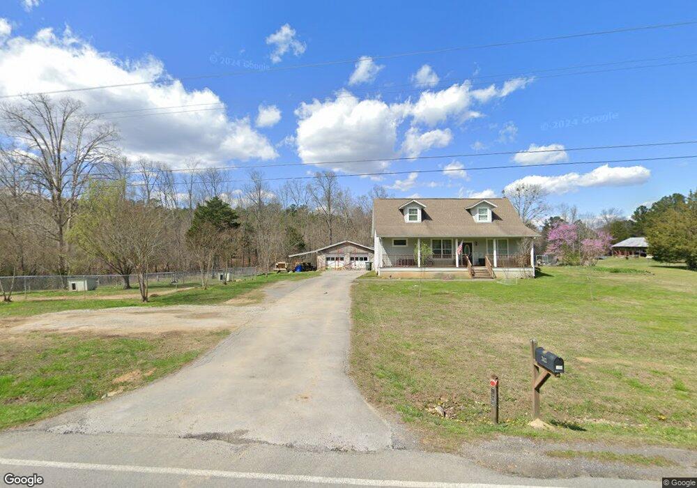
343 Beaumont Rd Rock Spring, GA 30739
Rock Spring NeighborhoodEstimated Value: $236,000 - $409,000
--
Bed
1
Bath
1,686
Sq Ft
$193/Sq Ft
Est. Value
About This Home
This home is located at 343 Beaumont Rd, Rock Spring, GA 30739 and is currently estimated at $325,081, approximately $192 per square foot. 343 Beaumont Rd is a home located in Walker County with nearby schools including Rock Spring Elementary School, Lafayette High School, and Alice M Daley Adventist School.
Ownership History
Date
Name
Owned For
Owner Type
Purchase Details
Closed on
Mar 11, 2010
Sold by
Williams Charles Harold
Bought by
Williams Charles Harold
Current Estimated Value
Home Financials for this Owner
Home Financials are based on the most recent Mortgage that was taken out on this home.
Original Mortgage
$101,500
Outstanding Balance
$66,495
Interest Rate
4.75%
Mortgage Type
New Conventional
Estimated Equity
$258,586
Purchase Details
Closed on
Mar 9, 2009
Sold by
Williams Sandra B
Bought by
Williams Charles Harold
Purchase Details
Closed on
Oct 6, 2005
Sold by
Not Provided
Bought by
Williams Charles Harold and Leann Williams
Purchase Details
Closed on
Nov 30, 1993
Bought by
Williams Charles H and Williams Sandra
Create a Home Valuation Report for This Property
The Home Valuation Report is an in-depth analysis detailing your home's value as well as a comparison with similar homes in the area
Home Values in the Area
Average Home Value in this Area
Purchase History
| Date | Buyer | Sale Price | Title Company |
|---|---|---|---|
| Williams Charles Harold | -- | -- | |
| Williams Charles Harold | -- | -- | |
| Williams Charles Harold | -- | -- | |
| Williams Charles Harold | -- | -- | |
| Williams Charles H | -- | -- |
Source: Public Records
Mortgage History
| Date | Status | Borrower | Loan Amount |
|---|---|---|---|
| Open | Williams Charles Harold | $101,500 |
Source: Public Records
Tax History Compared to Growth
Tax History
| Year | Tax Paid | Tax Assessment Tax Assessment Total Assessment is a certain percentage of the fair market value that is determined by local assessors to be the total taxable value of land and additions on the property. | Land | Improvement |
|---|---|---|---|---|
| 2024 | $1,883 | $83,091 | $10,033 | $73,058 |
| 2023 | $1,792 | $77,096 | $7,962 | $69,134 |
| 2022 | $1,597 | $63,452 | $6,702 | $56,750 |
| 2021 | $1,511 | $54,164 | $6,702 | $47,462 |
| 2020 | $1,261 | $42,924 | $6,702 | $36,222 |
| 2019 | $1,282 | $42,924 | $6,702 | $36,222 |
| 2018 | $1,136 | $42,924 | $6,702 | $36,222 |
| 2017 | $1,116 | $42,924 | $6,702 | $36,222 |
| 2016 | $1,131 | $42,924 | $6,702 | $36,222 |
| 2015 | $1,335 | $48,247 | $12,676 | $35,571 |
| 2014 | $1,232 | $48,247 | $12,676 | $35,571 |
| 2013 | $1,136 | $48,247 | $12,676 | $35,571 |
Source: Public Records
Map
Nearby Homes
- 0 Cheshire Crossing Dr Unit 1387793
- 0 E Teems Rd Unit 7573954
- 449 W Watts Rd
- 287 E Teems Rd
- 5602 Georgia 95
- 00 Georgia 95
- 265 Rodeo Dr
- 0 Tarvin Rd Unit 1523862
- 76 Side Kick Ln
- 10180 Us Highway 27
- 62 Lerch Ln
- 1003 Highway N Old 27
- 1370 Old Highway 27
- 13 Crosswinds Dr
- 819 Waters Dr
- 0 Colbert Hollow Rd Unit 1513202
- 701 Bicentennial Trail
- 59 Honeysuckle Dr
- 15 Willow Cir
- 1902 Long Hollow Rd
- 380 Beaumont Rd
- 312 Beaumont Rd
- 427 Beaumont Rd
- 393 Beaumont Rd
- 0 Cureton Ln Unit 7324574
- 0 Cureton Ln
- 30 Hwy 95
- 0 Fieldstone Commons Unit 1151448
- 0 Fieldstone Commons Unit 1151444
- 0 Fieldstone Commons Unit 1151450
- 0 Fieldstone Commons Unit 1151449
- 0 Fieldstone Commons Unit 1151447
- 0 Fieldstone Commons Unit 1151451
- 0 Fieldstone Commons Unit 1151446
- 0 Colbert Hollow Acre Unit 1145076
- 0 Colbert Hollow Acre Unit 1126960
- 0 Hwy 95 Unit 1083050
- 69 Summerfield Ln Unit 1
- 45 Summerfield Rd Unit 1
- 115 Summerfield Rd Unit 1